Congres in Bruxelles, Brussels, Belgium — Northwestern Europe
La Courtine / De Courtine / The Curtain Wall
Inscription.
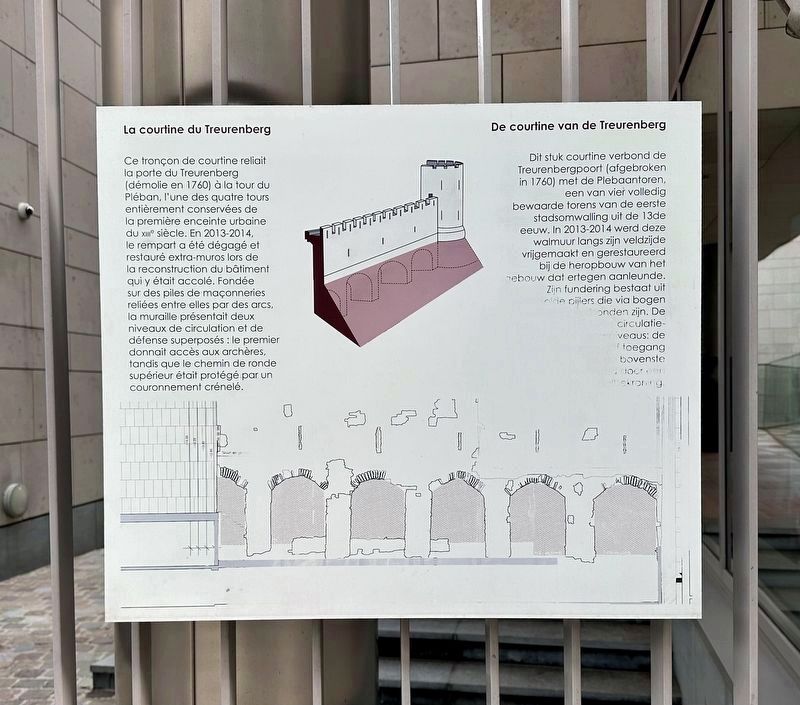
La courtine du Treurenberg
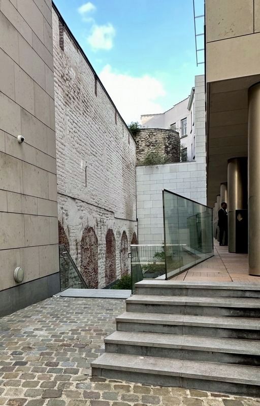
Ce tronçon de courtine reliait la porte du Treurenberg (démolie en 1760) à la tour du Pléban, l'une des quatre tours entièrement conservées de la première enceinte urbaine du XIIe siècle. En 2013-2014, le rempart a été dégagé et restauré extra-muros lors de la reconstruction du bâtiment qui y était accolé. Fondée sur des piles de maçonneries reliées entre elles par des arcs, la muraille présentait deux niveaux de circulation et de défense superposés : le premier donnait accès aux archères, tandis que le chemin de ronde supérieur était protégé par un couronnement crénelé.
Dit stuk courtine verbond de Treurenbergpoort (afgebroken in 1760) met de Plebaantoren, een van vier volledig bewaarde torens van de eerste stadsomwalling uit de 13de eeuw. In 2013-2014 werd deze walmuur langs zijn veldzijde vrijgemaakt en gerestaureerd bij de heropbouw van het gebouw dat ertegen aanleunde. Zijn fundering bestaat uit elde pijlers die via bogen
(English translation:)
The Treurenberg Curtain Wall
This section of curtain wall connected the Porte du Treurenberg (demolished in 1760) to the Tour du Pléban, one of the four fully preserved towers of the first urban wall of the 12th century. In 2013-2014, the rampart was cleared and restored outside the walls during the reconstruction of the building which was attached to it. Founded on piles of masonry linked together by arches, the wall had two superimposed circulation and defense levels: the first gave access to the arrow slits, while the upper walkway was protected by a crenellated crowning.
Topics. This historical marker is listed in this topic list: Forts and Castles.
Location. 50° 50.863′ N, 4° 21.711′ E. Marker is in Bruxelles, Brussels. It is in Congres. Marker is on Treurenberg, on the left when traveling east. Touch for map. Marker is at or near this postal address: Treurenberg 16, Bruxelles, Brussels 1000, Belgium. Touch for directions.
Other nearby markers. At least 8 other markers are within walking distance of this marker. The Museum of the National Bank of Belgium / Das Museum der Belgischen Nationalbank (about 150 meters away, measured in a direct line); Charlotte and Emily Brontë (approx. 0.4 kilometers away); Universite Libre de Bruxelles (1834 - 1984) (approx. 0.4 kilometers away); a different marker also named Charlotte and Emily Brontë

Photographed By Andrew Ruppenstein, May 16, 2023
2. La Courtine / De Courtine / The Curtain Wall Marker - wide view
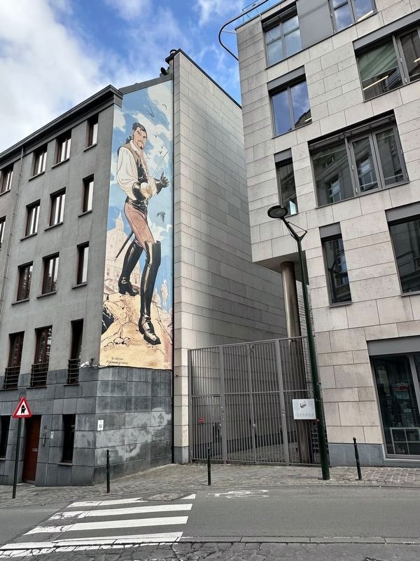
The marker is visible here attached to the gate.
The mural visible here is of Le Scorpion, a Franco-Belgian comic book character. There are more than 50 such murals in the Brussels area, celebrating Belgian comic book art.
Also see . . .
1. Première enceinte de Bruxelles (Wikipedia, in French). English title: The first walls of Brussels.
Overview (in translation): Thanks to the plans and other old documents, as well as the preserved vestiges, the layout of the ramparts of the first enclosure of Brussels is perfectly known. With a length of four kilometers, the enclosure includes on the one hand the first place of development of the city, the Saint-Géry island and the first port on the banks of the Senne and on the other hand the hills of Treurenberg with the first Romanesque collegiate church of Saints-Michel-et-Gudule (11th century) and Coudenberg with the ducal castle.(Submitted on June 6, 2023.)
The enclosure, built using stones and earth, is composed of square section pillars spaced about four meters apart and linked together by arcades buried in an embankment and surmounted by a wall pierced with loopholes. A second series of arcades supports the walkway protected by a crenellated parapet. The defense of the wall is completed by about forty towers and by a wide moat which could be flooded in certain parts of the city. Access to the city was provided by seven main gates and five secondary counters.
2. Courtine Treurenberg-Pléban (Reflex City). Several pictures of the site. (Submitted on June 6, 2023.)
Credits. This page was last revised on December 31, 2023. It was originally submitted on June 6, 2023, by Andrew Ruppenstein of Lamorinda, California. This page has been viewed 67 times since then and 23 times this year. Photos: 1, 2, 3. submitted on June 6, 2023, by Andrew Ruppenstein of Lamorinda, California.

