Antwerpen, Flanders, Belgium — Northwestern Europe
Antwerpen anno 1750 / Antwerp in 1750
— Paleis op de Meir —
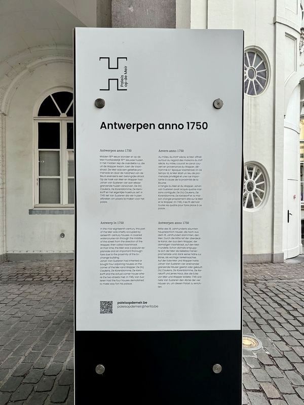
Antwerpen Anno 1750
Meir hoofdzakelijk 16de-eeuwse huizen. In het midden liep de overdekte rui, die uit de Wapper kwam, toen de Vaartstraat. De Meir was een geliefde promenade en door de nabijheid van de Beurs eveneens een belangrijke straat. Op de hoek van Meir en Wapper had Johan van Susteren vier aan elkaar grenzende huizen verworven. De Drij Caukens, De Korenblomme, De Keirskorff en het eigenlijke hoekhuis zelf. In 1745 liet Van Susteren die vier huizen. afbreken om plaats te maken voor het paleis.
In the mid-eighteenth century, this part of the Meir was chiefly occupied by sixteenth-century houses. A covered watercourse ran through the middle of the street from the direction of the Wapper, then called Vaartstraat. At that time, the Meir was a popular esplanade and an important thoroughfare due to the proximity of the Exchange building. Johan Van Susteren had inherited or bought four adjoining houses on the corner of the Meir and Wapper. De Drij Caukens, De Korenblomme, De Keirskorff and the actual corner house where the two streets met. In 1745, Van Susteren had the four houses demolished to make way for this palace.
Au milieu du XVIII° siècle, le Meir offrait surtout au regard des maisons du XVI° siècle. Au milieu courait le canal couvert en provenance du Wapper, dénommé à l'époque Vaartstraat. En ce temps-là, le Meir était un lieu de promenade privilégié et une rue impor- tante à cause de la proximité de la Bourse. A l'angle du Meir et du Wapper, Johan van Susteren avait acquis quatre mai- sons contigues: De Drij Caukens, De Korenblomme, De Keirskorff et la maison d'angle proprement dite sur le Meir et le Wapper. En 1745, il les fit démolir toutes les quatre pour faire place à ce palais.
Mitte des 18. Jahrhunderts säumten hauptsächlich Hauser, die noch aus dem 16. Jahrhundert stammten, den Meir. Durch die Mitte lief der überdeckte kanal, der aus dem Wapper, der damaligen Vaartstraat, auf den Meir mündete. Schon damals entpuppte sich der Meir als beliebte Flanierpromenade und, dank seiner Nähe zur Börse, als wichtige Verkehrsachse. Auf der Ecke Meir und Wapper hatte Johan Van Susteren vier aneinander grenzende Häuser geerbt oder gekauft: Drij Caukens, De Korenblomme, De Keirskorff und jenes Haus, das die Ecke von Meir und Wapper bildete. 1745 ordnete Van Susteren den Abriss der vier Häuser an,
um diesen Palast zu errichten.
Topics. This historical marker is listed in this topic list: Notable Buildings. A significant historical year for this entry is 1750.
Location. 51° 13.076′ N, 4° 24.51′ E. Marker is in Antwerpen, Vlaams Gewest (Flanders). Marker is on Meir, on the right when traveling east. Touch for map. Marker is at or near this postal address: Meir 50, Antwerpen, Vlaams Gewest 2000, Belgium. Touch for directions.
Other nearby markers. At least 8 other markers are within walking distance of this marker. Handelsbeurs / Stock Exchange (about 210 meters away, measured in a direct line); Sint-Annagodshuis / Saint Anne Almshouse (approx. 0.4 kilometers away); Sint-Carolus Borromeuskerk / St. Charles Borromeo Church (approx. 0.4 kilometers away); Albrecht Duerer (1471-1528) (approx. half a kilometer away); Antoon van Dijck (approx. 0.7 kilometers away); Snoepje Napoleon / Napoleon Candy (approx. 0.8 kilometers away); Ruihuis (approx. 0.8 kilometers away); Vleeshuis / Das Fleischhaus / La Halle des Bouchers / Butchers’ Hall (approx. 0.8 kilometers away). Touch for a list and map of all markers in Antwerpen.
Credits. This page was last revised on March 17, 2024. It was originally submitted on June 14, 2023, by Andrew Ruppenstein of Lamorinda, California. This page has been viewed 55 times since then and 13 times this year. Photos: 1, 2. submitted on June 14, 2023, by Andrew Ruppenstein of Lamorinda, California.

