Patoka Township in Princeton in Gibson County, Indiana — The American Midwest (Great Lakes)
Brownlee Addition Historic District
Inscription.
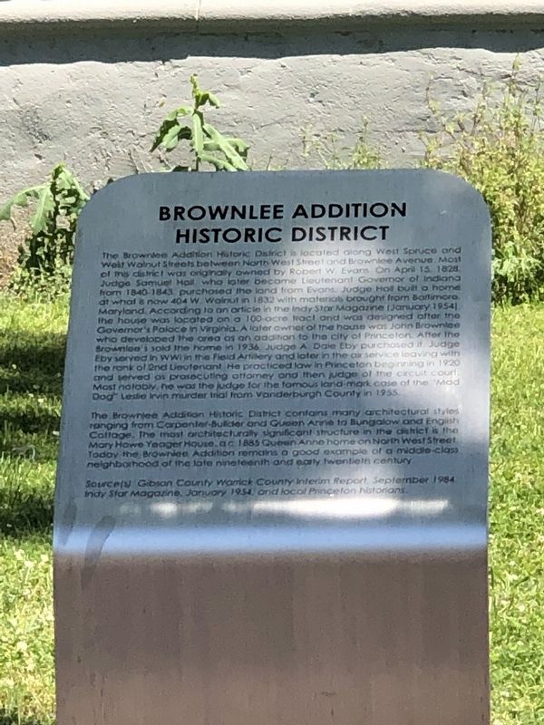
The Brownlee Addition Historic District is located along West Spruce and
West Walnut Streets between North West Street and Brownlee Avenue. Most
of this district was originally owned by Robert W. Evans. On April 15, 1828
Judge Samuel Hall, who later become Lieutenant Governor of Indiana
from 1840-1843, purchased the land from Evans. Judge Hall built a home
at what is now 404 W. Walnut in 1832 with materials brought from Baltimore,
Maryland. According to an article in the Indy Star Magazine (January 1954)
the house was located on a 100-acre tract and was designed after the
Governor's Palace in Virginia. A later owner of the house was John Brownlee
who developed the area as an addition to the city of Princeton. After the
Brownlees sold the home in 1936 Judge A. Dale Eby purchased it. Judge
Eby served in WWI in the Field Artillery and later in the air service leaving with
the rank of 2nd Lieutenant. He practiced law in Princeton beginning in 1920
and served as prosecuting attorney and then judge of the circuit court.
Most notably, he was the judge for the famous landmark case of the “Mad
Dog” Leslie Irvin murder trial from Vanderburgh County in 1955.
The Brownlee Addition Historic District contains many architectural styles ranging from Carpenter-Builder and Queen Anne to Bungalow and English Cottage. The most architecturally significant structure in the district is the Mary Hawe Yeager House, a c. 1885 Queen Anne home on North West Street. Today the Brownlee Addition remains a good example of a middle-class neighborhood of the late nineteenth and early twentieth century.
Source(s): Gibson County Warrick County Interim Report, September 1984; Indy Star Magazine, January 1954; and local Princeton historians.
Topics. This historical marker is listed in this topic list: Architecture. A significant historical month for this entry is January 1954.
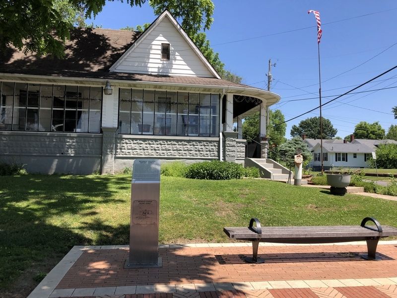
Location. 38° 21.496′ N, 87° 34.21′ W. Marker is in Princeton, Indiana, in Gibson County. It is in Patoka Township. Marker is at the intersection of West Brumfield Avenue and North West Street, on the right when traveling west on West Brumfield Avenue. Touch for map. Marker is at or near this postal address: 405 N West St, Princeton IN 47670, United States of America. Touch for directions.
Other nearby markers. At least 8 other markers are within walking distance of this marker. Declaration of Friendship (about 800 feet away, measured in a direct line); Courthouse (approx. 0.2 miles away); Black Civil War Substitutes (approx. 0.2 miles away); Coal Mining (approx. 0.2 miles away); Industry (approx. 0.2 miles away); Lyles Station (approx. 0.2 miles away); Railroads (approx. 0.2 miles away); Tri-State Tornado (approx. 0.2 miles away). Touch for a list and map of all markers in Princeton.
Also see . . .
Brownlee Addition Historic District (PDF). This excerpt from the Indiana Historic Sites and Structures Survey has additional information about the historic district, including a map and listing of structures within it. Click the right arrow in the vertical blue bar for the next page. (Historic Landmarks Foundation of Indiana, via Indiana Memory) (Submitted on June 22, 2023, by Duane and Tracy Marsteller of Murfreesboro, Tennessee.)
Credits. This page was last revised on June 22, 2023. It was originally submitted on June 20, 2023, by Duane and Tracy Marsteller of Murfreesboro, Tennessee. This page has been viewed 57 times since then and 15 times this year. Photos: 1. submitted on June 20, 2023, by Duane and Tracy Marsteller of Murfreesboro, Tennessee. 2. submitted on June 22, 2023, by Duane and Tracy Marsteller of Murfreesboro, Tennessee.

