Munising in Alger County, Michigan — The American Midwest (Great Lakes)
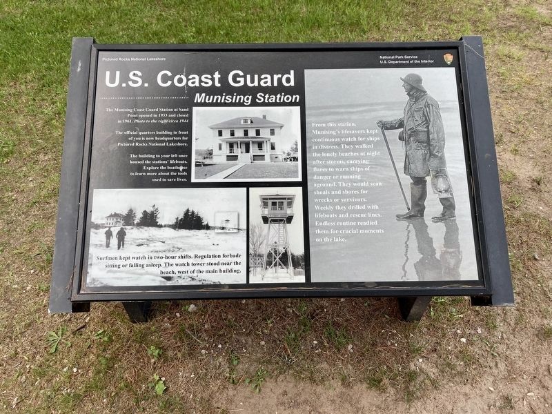
U.S. Coast Guard
Munising Station
The Munising Coast Guard Station at Sand Point opened in 1933 and closed in 1961. Photo to the right circa 1944
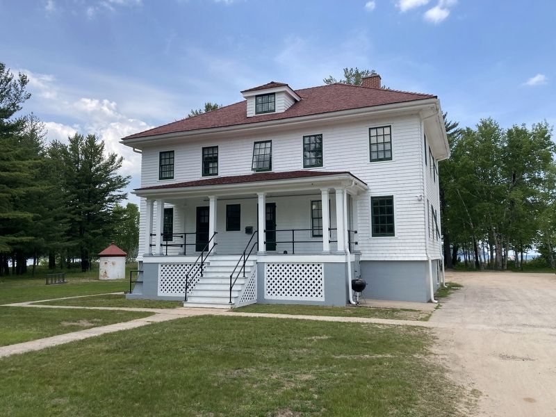
The official quarters building in front of you is now headquarters for Pictured Rocks National Lakeshore.
The building to your left once housed the stations' lifeboats. Explore the boathouse to learn more about the tools used to save lives.
Surfmen kept watch in two-hour shifts. Regulation forbade sitting or falling asleep. The watch tower stood near the beach, west of the main building.
From this station, Munising's lifesavers kept continuous watch for ships in distress. They walked the lonely beaches at night after storms, carrying flares to warn ships of danger or running aground. They would scan shoals and shores for wrecks or survivors. Weekly they drilled with lifeboats and rescue lines. Endless routine readied them for crucial moments on the lake.
Erected by Pictured Rocks National Lakeshore, National Park Service, US Department of the Interior.
Topics. This historical marker is listed in this topic list: Military. A significant historical year for this entry is 1933.
Location. 46° 27.126′ N, 86° 36.434′ W. Marker is in Munising, Michigan, in Alger County. Marker is on Sand Point Road near Washington Street, on the left when traveling north. Touch for map. Marker is at or near this postal address: N8391 Sand Point Road, Munising MI 49862, United States of America. Touch for directions.
Other nearby markers. At least 8 other markers are within 4 miles of this marker, measured as the crow flies. Munising Falls (approx. 2.1 miles away); Munising Public Dock (approx. 3˝ miles away); Shipwrecks of the Alger Underwater Preserve (approx. 3˝ miles away); Russell A. Alger (approx. 3.8 miles away); Grand Island View (approx. 3.9 miles away); Different Perspectives (approx. 3.9 miles away); Lake Superior Basin Geology (approx. 4 miles away); Crumbling Into Time (approx. 4 miles away). Touch for a list and map of all markers in Munising.
Credits. This page was last revised on June 24, 2023. It was originally submitted on June 23, 2023, by Connor Olson of Kewaskum, Wisconsin. This page has been viewed 78 times since then and 10 times this year. Photos: 1, 2. submitted on June 23, 2023, by Connor Olson of Kewaskum, Wisconsin. • J. Makali Bruton was the editor who published this page.

