Blaine in Belmont County, Ohio — The American Midwest (Great Lakes)
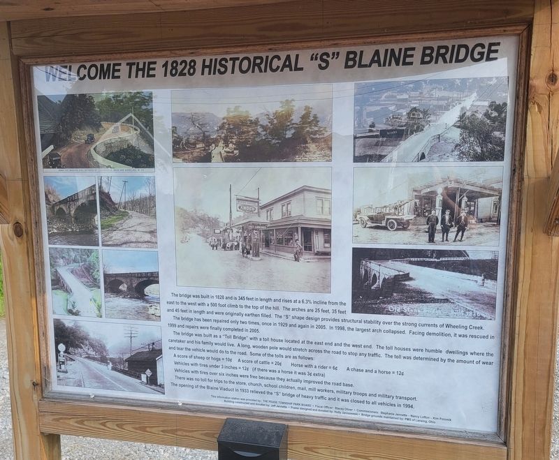
Welcome The 1828 Historical "S" Blaine Bridge
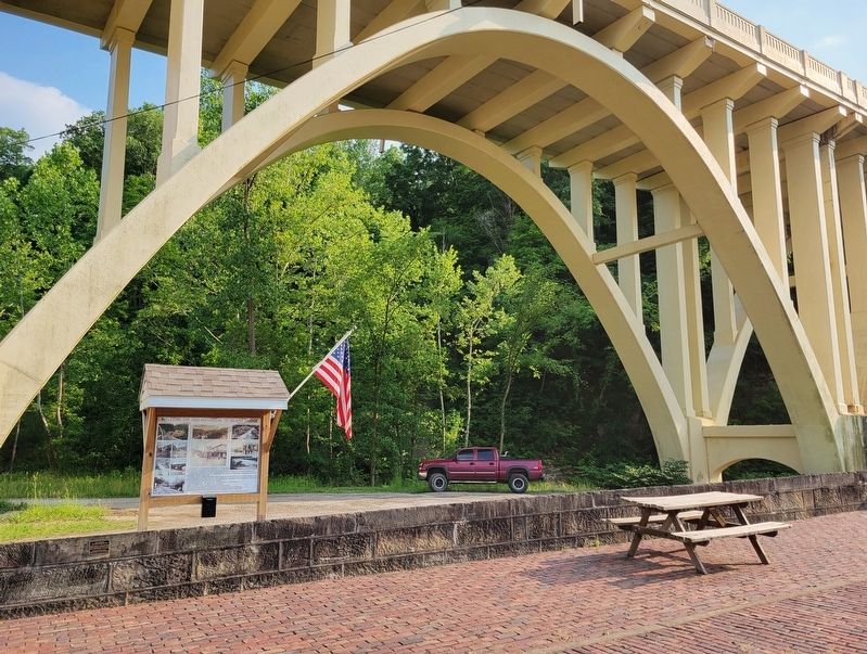
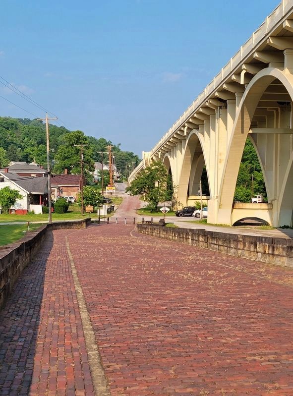
The bridge was built in 1828 and is 345 feet in length and rises at a 6.3% incline from the east to the west with a 500 foot climb to the top of the hill. The arches are 25 feet, 35 feet and 45 feet in length and were originally earthen filled. The "S" shape design provides structural stability over the strong currents of Wheeling Creek.
The bridge has been repaired only two times, once in 1929 and again in 2005. In 1998, the largest arch collapsed. Facing demolition, it was rescued in 1999 and repairs were finally completed in 2005.
The bridge was built as a "Toll Bridge" with a toll house located at the east end and the west end. The toll houses were humble dwellings where the caretaker and his family would live. A long, wooden pole would stretch across the road to stop any traffic. The toll was determined by the amount of wear and tear the vehicle would do to the road. Some of the tolls are as follows:
A score of sheep or hogs = 10˘ • A score of cattle = 20˘ • Horse with a rider = 6˘ • A chase and a horse = 12˘
Vehicles with tires under 3 inches = 12˘ (if there was a horse it was 3˘ extra)
Vehicles with tires over six inches were free because they actually improved the road base.
There was no toll for trips to the store, church, school children, mail, mill workers, military troops and military transport.
The opening of the Blaine Viaduct in 1933 relieved the "S" bridge of heavy traffic and it was closed to all vehicles in 1994.
This information station was provided by: The Pease Township Park Board • Fiscal Officer: Stacey Oliver • Commissioners: Stephanie Jennette - Nancy Lofton - Kim Polomik
Building constructed and donated by: Jeff Jennette Poster designed and donated by: Holly Janiszewski • Bridge grounds maintained by: PMS of Lansing, Ohio
Erected by The Pease Township Park Board.
Topics. This historical marker is listed in these topic lists: Bridges & Viaducts • Industry & Commerce. A significant historical year for this entry is 1828.
Location. 40° 4.013′ N, 80° 49.211′ W. Marker is in Blaine, Ohio, in Belmont County. Marker is on Pasco Drive west of Blaine Barton Road (County Route 10), on the left when traveling west. Marker is located on the east side of the "S" bridge. Touch for map. Marker is at or near this postal address: 53603 Pasco Drive, Blaine OH 43909, United States of America. Touch for directions.
Other nearby markers. At least 8 other markers are within 5 miles of this marker, measured as the crow flies. Blaine Hill "S" Bridge / Blaine Hill Viaduct (here, next to this marker); Lansing (Scott) Cemetery (approx. 1.6 miles away); Lansing Community War Memorial (approx. 1.7 miles away); In Honor of Sgt. Sylvester Antolak US Army (approx. 3.4 miles away); Historic Bridgeport (approx. 4.2 miles away); Veterans Memorial (approx. 4.2 miles away); The National Historic Road in Ohio (approx. 4.2 miles away); Josiah Fox (approx. 4.2 miles away).
Photographed By Bradley Owen, June 17, 2023
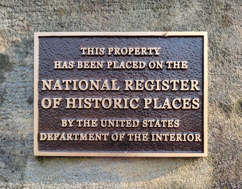
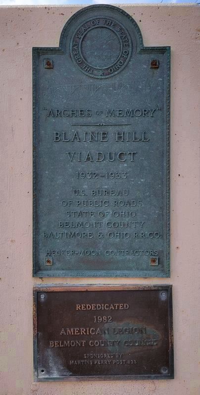
5. Plaque on the Modern Blaine Hill Viaduct
Blaine Hill Viaduct
1932-1933
U.S. Bureau of Public Roads
State of Ohio Belmont County
Baltimore & Ohio R.R.Co.
Hecker-Moon Contractors
Rededicated 1982
American Legion
Belmont County Council
Sponsored by Martins Ferry Post #33
Credits. This page was last revised on June 23, 2023. It was originally submitted on June 23, 2023, by Bradley Owen of Morgantown, West Virginia. This page has been viewed 88 times since then and 27 times this year. Photos: 1, 2, 3, 4, 5. submitted on June 23, 2023, by Bradley Owen of Morgantown, West Virginia.
