Currie in Pender County, North Carolina — The American South (South Atlantic)
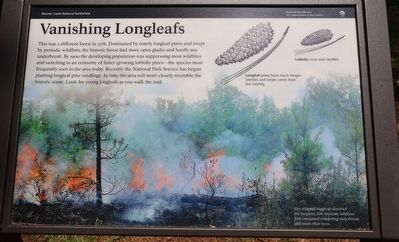
Vanishing Longleafs
— Moores Creek National Battlefield —
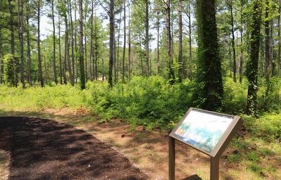
This was a different forest in 1776. Dominated by stately longleaf pines and swept by periodic wildfires, the historic forest had more open glades and hardly any underbrush. By 190o the developing population was suppressing most wildfires and switching to an economy of faster-growing loblolly pines—the species most frequently seen in the area today. Recently the National Park Service has begun planting longleaf pine seedlings. In time the area will more closely resemble the historic scene. Look for young longleafs as you walk the trail.
Erected by National Park Service, U.S. Department of the Interior.
Topics. This historical marker is listed in these topic lists: Horticulture & Forestry • War, US Revolutionary. A significant historical year for this entry is 1776.
Location. 34° 27.422′ N, 78° 6.486′ W. Marker is in Currie, North Carolina, in Pender County. Marker can be reached from Moores Creek Drive, 0.3 miles west of North Carolina Route 210, on the left when traveling west. Located along the Tarheel trail. Touch for map. Marker is at or near this postal address: 103 Moores Creek Dr, Currie NC 28435, United States of America. Touch for directions.
Other nearby markers. At least 8 other markers are within walking distance of this marker. Boxing the Pines (within shouting distance of this marker); Tar Kiln (within shouting distance of this marker); Ghosts of an Industry (about 300 feet away, measured in a direct line); Blackwater Highways (about 300 feet away); Trees for a Navy (about 400 feet away); Tarheel Trail (about 500 feet away); A Changing Landscape (about 500 feet away); Brave Patriots (about 600 feet away). Touch for a list and map of all markers in Currie.
Also see . . . Moores Creek National Battlefield. National Park Service (Submitted on June 25, 2023.)
Credits. This page was last revised on June 25, 2023. It was originally submitted on June 23, 2023, by Dave W of Co, Colorado. This page has been viewed 47 times since then and 5 times this year. Photos: 1, 2. submitted on June 23, 2023, by Dave W of Co, Colorado. • Bernard Fisher was the editor who published this page.

