Near Grand Marais in Alger County, Michigan — The American Midwest (Great Lakes)
Tools of the Trade
Photographed by Connor Olson, June 21, 2023
1. Tools of the Trade Marker
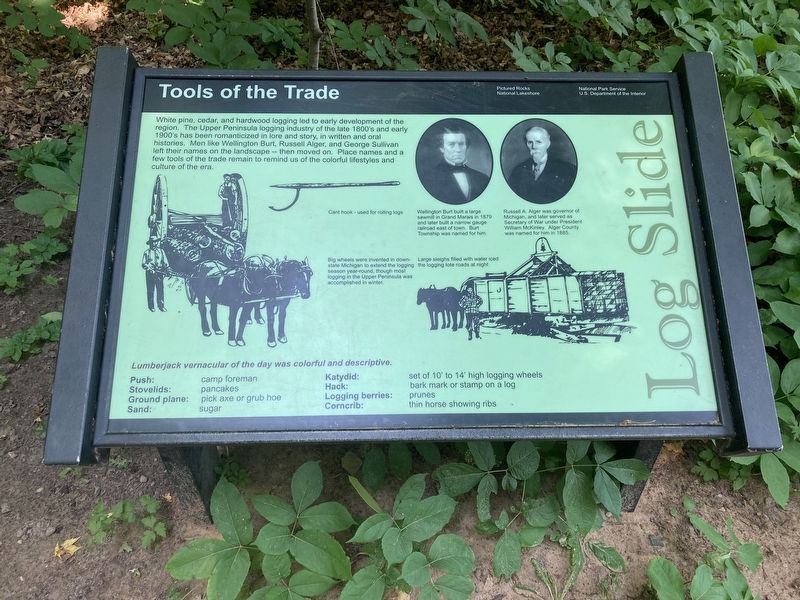
White pine, cedar, and hardwood logging led to early development of the region. The Upper Peninsula logging industry of the late 1800's and early 1900's has been romanticized in lore and story, in written and oral histories. Men like Wellington Burt, Russell Alger, and George Sullivan left their names on the landscape - - then moved on. Place names and a few tools of the trade remain to remind us of the colorful lifestyles and culture of the era.
Lumberjack vernacular of the day was colorful and descriptive.
Push: camp foreman
Stovelids: pancakes
Ground plane: pick axe or grub hoe
Sand: sugar
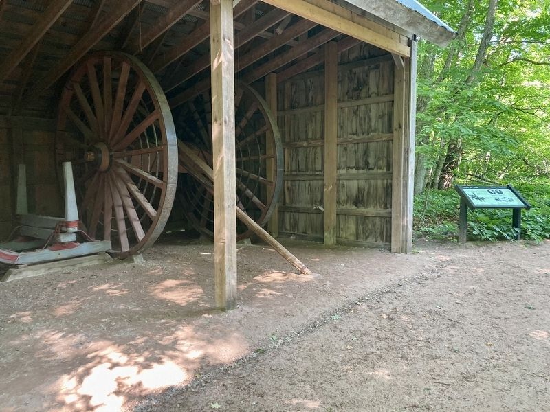
Katydid: set of 10' to 14' high logging wheels
Hack: bark mark or stamp on a log
Logging berries: prunes
Corncrib: thin horse showing ribs
Captions:
Cant hook - used for rolling logs
Wellington Burt built a large sawmill in Grand Marais in 1879 and later built a narrow gauge railroad east of town. Burt Township was named for him.
Russell A. Alger was governor of Michigan, and later served as Secretary of War under President William McKinley. Alger County was named for him in 1885.
Big wheels were invented in downstate Michigan to extend the logging season year-round, though most logging in the Upper Peninsula was accomplished in winter. Large sleighs filled with water iced the logging tote roads at night.
Erected by Pictured
this page online
Topics. This historical marker is listed in this topic list: Industry & Commerce. A significant historical year for this entry is 1879.
Location. 46° 39.155′ N, 86° 6.649′ W. Marker is near Grand Marais, Michigan, in Alger County. It can be reached from Log Slide Road north of County Route H58. The marker is located on the Log Slide Overlook Trail. Touch for map. Marker is in this post office area: Grand Marais MI 49839, United States of America. Touch for directions.

Regionally, this marker is on Michigan’s Upper Peninsula. It is also in the American Midwest and on Lake Superior’s South Shore Region. Globally, it is in North America, in the Great North Woods, on the Great Lakes, in the Western Hemisphere, in the Western World, and in the Anglosphere. Historically, it finds itself in what was once the Northwest Territory.
Other nearby markers. At least 7 other markers are within 7 miles of this marker, measured as the crow flies: Cabin in the Clearing (about 600 feet away, measured in a direct line); Final Solution for a Long and Difficult Issue
Photographed by Connor Olson, June 21, 2023
2. Tools of the Trade Marker
Credits. This page was last revised on July 1, 2023. It was originally submitted on June 26, 2023, by Connor Olson of Menomonee Falls, Wisconsin. This page has been viewed 259 times since then and 24 times this year. Photos: 1, 2. submitted on June 26, 2023, by Connor Olson of Menomonee Falls, Wisconsin. • J. Makali Bruton was the editor who published this page.
