Niantic in East Lyme in New London County, Connecticut — The American Northeast (New England)
The Iron Horse
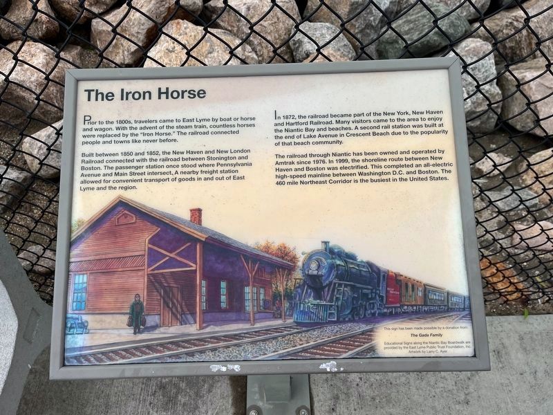
Prior to the 1800s, travelers came to East Lyme by boat or horse and wagon. With the advent of the steam train, countless horses were replaced by the "Iron Horse." The railroad connected people and towns like never before.
Built between 1850 and 1852, the New Haven and New London Railroad connected with the railroad between Stonington and Boston. The passenger station once stood where Pennsylvania Avenue and Main Street intersect. A nearby freight station allowed for convenient transport of goods in and out of East Lyme and the region.
In 1872, the railroad became part of the New York, New Haven and Hartford Railroad. Many visitors came to the area to enjoy the Niantic Bay and beaches. A second rail station was built at the end of Lake Avenue in Crescent Beach due to the pouplarity of that beach community.
The railroad through Niantic has been owned and operated by Amtrak since 1976. In 1999, the shoreline route between New Haven and Boston was electrified. This completed an all-electric high-speed mainline between Washington D.C. and Boston. The 460 mile Northeast Corridor is the busiest in the United States.
Erected by East Lyme Public Trust Foundation, made possible with a donation from The Gada Family.
Topics. This historical marker is listed in this topic list: Railroads & Streetcars. A significant historical year for this entry is 1850.
Location. 41° 19.383′ N, 72° 11.52′ W. Marker is in East Lyme, Connecticut, in New London County. It is in Niantic. Marker is on Boardwalk, 0.3 miles east of Baptist Lane, on the left when traveling east. Touch for map. Marker is at or near this postal address: 224 Main Street, Niantic CT 06357, United States of America. Touch for directions.
Other nearby markers. At least 8 other markers are within 3 miles of this marker, measured as the crow flies. A Glimpse into the Past (within shouting distance of this marker); East Lyme Veterans Memorial (within shouting distance of this marker); East Lyme Honor Roll (within shouting distance of this marker); A Place for Play (about 300 feet away, measured in a direct line); McCook Point (about 700 feet away); The Hole in the Wall (approx. 0.2 miles away); East Lyme (approx. 0.3 miles away); Bride Brook (approx. 2.7 miles away). Touch for a list and map of all markers in East Lyme.
Credits. This page was last revised on March 27, 2024. It was originally submitted on June 30, 2023, by Devry Becker Jones of Washington, District of Columbia. This page has been viewed 67 times since then and 11 times this year. Photos: 1, 2. submitted on June 30, 2023, by Devry Becker Jones of Washington, District of Columbia.

