Downtown in New Haven in New Haven County, Connecticut — The American Northeast (New England)
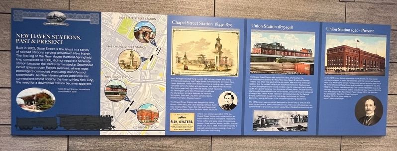
New Haven Stations, Past & Present
The Hartford Line
Built in 2002, State Street is the latest in a series of railroad stations serving downtown New Haven. The first leg of the New Haven-Hartford-Springfield line, completed in 1838, did not require a separate station because the tracks terminated at Steamboat Wharf (present-day Forbes Avenue), where most passengers connected with Long Island Sound steamboats. As New Haven gained additional rail connections (most notably the line to New York City), the need for a downtown station became apparent.
Chapel Street Station 1849 - 1875
With its large size (300' long overall), 140'-tall clock tower, and exotic architectural detailing, the Chapel Street Station became an instant New Haven landmark. Inside were ticket counter, a reading room, lavishly furnished parlors for ladies and gentlemen, and administrative offices. The station was built right over the tracks, which ran in the old Farmington Canal bed. Passengers could take the stairs down to trains destined for Hartford, Springfield, New York City, New London, Derby, and Northampton, Massachusetts.
The Chapel Street Station was designed by Henry Austin (1804-1891), the city's leading architect. Austin also designed New Haven City Hall and Dwight Hall at Yale (Austin portrait from the New Haven Museum).
After a new station opened in 1875, the Chapel Street Station was converted into an indoor market with a newsstand, restaurant, florist, coffee and spice store, three produce dealers, three seafood stores, and four butcher shops. On July 4, 1894, fireworks for sale by a sidewalk vendor ignited, causing a huge fire that destroyed the building.
Union Station 1875 - 1918
The Chapel Street Station was replaced in 1875, shortly after the consolidation that created the New York, New Haven & Hartford Railroad. The site was a half mile south of the old station, near the shop and freight facilities that the railroad had built on reclaimed marshland. Ready access to public transportation (horsecars and later, electric streetcars) partly made up for the greater distance from the center of New Haven. The side-terminal plan provided covered platforms for four tracks, along with several uncovered through tracks. Henry Austin had drawn conceptual plans for the Second Empire-style station, though the final design is attributed to Charles Danforth, a young draftsman in the railroad's engineering department.
The 1875 station was completely destroyed by fire on May 8, 1918. By that time, construction of a new union station was under way, with passengers accommodated by a temporary station nearby (Glenn Duda/allhandsworking.net).
Union Station 1920 - Present
As the 1875 Union Station entered its fourth decade, its once-stylish architecture began to seem old-fashioned, and the interior had become worn. City leaders and railroad management wanted a station that would be more reflective of New Haven as a prosperous, progressive city. The 1920 Union Station was designed by Cass Gilbert (1859-1934), one of the country's foremost architects. Gilbert co-authored New Haven's 1910 City Plan and designed the New Haven Public Library (1911). He also was the architect for New York City's Woolworth Building (1912), for many years the world's tallest skyscraper.
Topics. This historical marker is listed in these topic lists: Architecture • Railroads & Streetcars. A significant historical date for this entry is May 8, 1918.
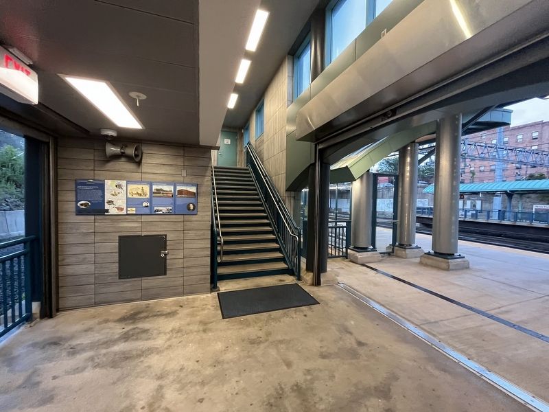
Location. 41° 18.313′ N, 72° 55.314′ W. Marker is in New Haven, Connecticut, in New Haven County. It is in Downtown. Marker can be reached from State Street north of Chapel Street, on the right when traveling north. The marker hangs in the open-air Terminal 1 of the State Street Station. Touch for map. Marker is at or near this postal address: 259 State Street, New Haven CT 06510, United States of America. Touch for directions.
Other nearby markers. At least 8 other markers are within walking distance of this marker. Service, Not Servitude: African American Workers on the New Haven (a few steps from this marker); Memorial Playground (approx. 0.2 miles away); “Make Us Free” (approx. 0.2 miles away); New Haven Water Company (approx. 0.2 miles away); New Haven Green (approx. 0.2 miles away); New Haven (approx. 0.2 miles away); Renovation of the New Haven Green (approx. 0.2 miles away); Welcome to the New Haven Green (approx. ¼ mile away). Touch for a list and map of all markers in New Haven.
Credits. This page was last revised on July 1, 2023. It was originally submitted on July 1, 2023, by Devry Becker Jones of Washington, District of Columbia. This page has been viewed 62 times since then and 13 times this year. Photos: 1, 2. submitted on July 1, 2023, by Devry Becker Jones of Washington, District of Columbia.

