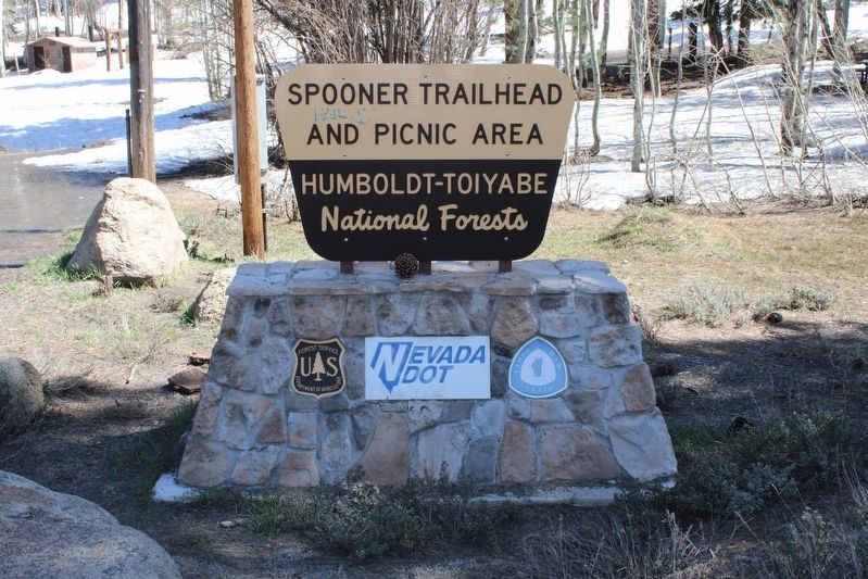
Spooner Summit near Carson City in Douglas County, Nevada — The American Mountains (Southwest)
Green Gold
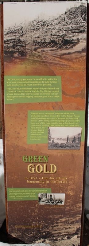
The Territorial government, in an effort to settle the area, was encouraging its residents to build lumber mills and harvest as much lumber as possible.
Then, only four years later, miners hit pay dirt with the Comstock Load in nearby Virginia City. Mining created a huge demand for both fuelwood and milled lumber, helping these small logging ventures grow into a major industry.
Viewed as an “unlimited” resource at the time, immense stands of pine and fir in the Carson Range and Tahoe Basin were cut to support the Comstock mines. Of the many sawmills springing up around the lake, one of the most notable was at Glenbrook, on the eastern shore of Lake Tahoe and four miles from here. There, raw timber, floated across the lake from distant stands, was milled into lumber.
Until railroads were built, teams of oxen were the only way to haul Glenbrook’s mill products up to Spooner Summit and down to the Carson River, on their way to build the vast infrastructure of a booming mining economy.
Panel Two:
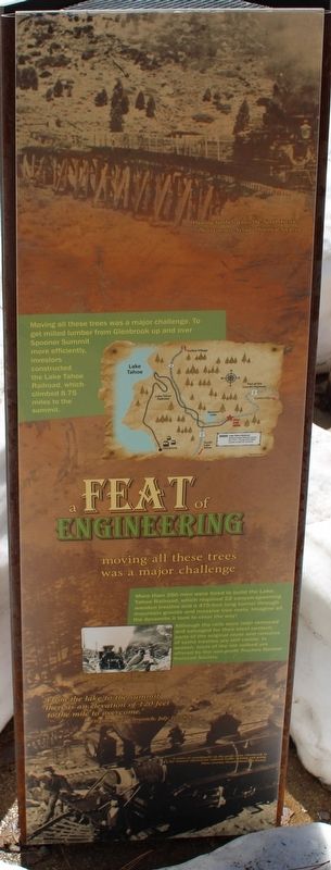
Moving all these trees was a major challenge. To get milled lumber from Glenbrook up and over Spooner Summit more efficiently, investors constructed the Lake Tahoe Railroad, which climbed 8.75 miles to the summit.
More than 250 men were hired to build the Lake Tahoe Railroad, which required 22 canyon-spanning wooden trestles and a 475-foot long tunnel through mountain granite and massive tree roots. Imagine all the dynamite it took to clear the way!
Although the rails were later removed and salvaged for their steel content, parts of the original route and remains of some trestles are still visible. In season, tours of the old railroad are offered by the non-profit Truckee Donner Railroad Society.
”From the lake to the summit there is an elevation of 120 feet to the mile to overcome.”
- Virginia City Chronicle, July 10, 1874
Panel Three:
technology developed quickly
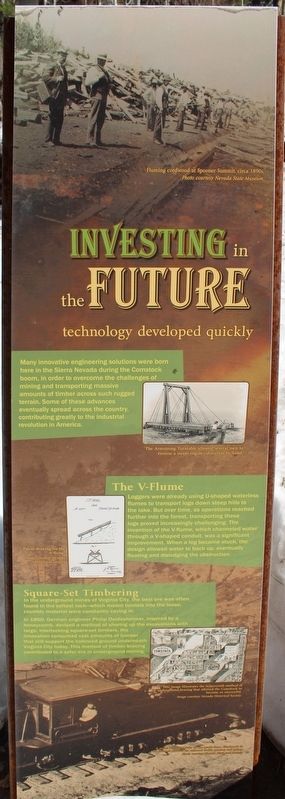
Many innovative engineering solutions were born here in the Sierra Nevada during the Comstock boom, in order to overcome the challenges of mining and transporting massive amounts of timber across such rugged terrain. Some of these advances eventually spread across the country, contributing greatly to the industrial revolution in America.
The V-Flume
Loggers were already using u-shaped waterless flumes to transport logs down steep hills to the lake. But over time, as operations reached further into the forest, transporting these logs proved increasingly challenging. The invention of the V-flume, which channeled water through a V-shaped conduit, was a significant improvement. When a log became stuck, the design allowed water to back up, eventually floating and dislodging the obstruction.
Square-Set Timbering
In the underground mines of Virginia City, the best ore was often found in the softest rock-which meant tunnels into the loose, crumbly material were constantly caving in.
In 1860, German engineer Philip Deidesheimer, inspired by a honeycomb, devised a method of shoring up the excavations with large, interlocking square-set timbers. His innovation consumed vast amounts of lumber that still support the hollowed ground underneath Virginia City today. This method of timber bracing contributed to a safer era in underground mining.
Erected by US Forest Service.
Topics. This historical marker is listed in these topic lists: Horticulture & Forestry • Railroads & Streetcars. A significant historical year for this entry is 1851.
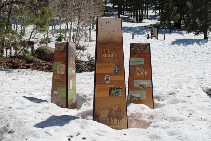
Location. 39° 6.216′ N, 119° 53.708′ W. Marker is near Carson City, Nevada, in Douglas County. It is in Spooner Summit. Marker can be reached from Lincoln Highway (U.S. 50 at milepost 13) west of Kings Canyon Road. The resin markers are mounted as pillars at the Spooner Summit Trailhead. Touch for map. Marker is in this post office area: Carson City NV 89703, United States of America. Touch for directions.
Other nearby markers. At least 8 other markers are within walking distance of this marker. Life at the Summit (here, next to this marker); Tomb of the Sierras (here, next to this marker); Riding the Flume (here, next to this marker); Spooner Summit (about 300 feet away, measured in a direct line); The Flume Trail (about 600 feet away); Tahoe Rim Trail (about 600 feet away); Marlette Lake Trail (about 700 feet away); Hiking the Tahoe Rim Dream (about 700 feet away). Touch for a list and map of all markers in Carson City.
More about this marker. Panel One Images:
Unloading wood at the Summit, 1876. Photo courtesy Nevada Historical Society
The mills at Glenbrook, Nevada. Photo courtesy Nevada Historical Society
Logging with ox team. Photo courtesy Nevada Historical Society.
A series of switchbacks on the grade from Glenbrook to the Summit allowed for railroad traffic coming and going. Photo courtesy Nevada Historical Society.
Panel Two Images:
Hauling lumber across the North Trestle, Photo courtesy Nevada Historical Society
Travelers often paused for a portrait and a picnic at Devi’s Gate enroute to the Summit, Photo courtesy Nevada Historical Society.
A series of switchbacks on the grade from Glenbrook to the summit allowed for railroad traffic coming and going. Photo courtesy Nevada Historical Society
Panel Three Images:
The Armstrong Turntable allowed several men to reverse a steam engine’s direction by hand.
Patent drawing for the V-flume. Image courtesy Nevada Historical Society.
This image illustrates the honeycomb method of underground bracing that allowed the Comstock to become so successful. Image courtesy Nevada Historical Society.
Related marker. Click here for another marker that is related to this marker. Spooner Summit
Credits. This page was last revised on July 7, 2023. It was originally submitted on July 7, 2023, by Joseph Alvarado of Livermore, California. This page has been viewed 58 times since then and 10 times this year. Photos: 1, 2, 3. submitted on July 7, 2023, by Joseph Alvarado of Livermore, California. 4, 5. submitted on July 5, 2023, by Joseph Alvarado of Livermore, California.
