Ashland in Boyd County, Kentucky — The American South (East South Central)
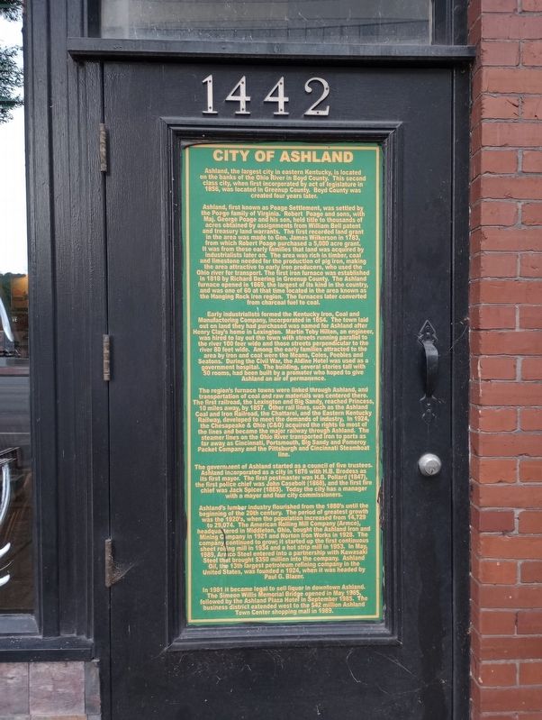
City Of Ashland
Ashland, first known as Poage Settlement, was settled by the Poage family of Virginia. Robert Poage and sons, with Maj. George Poage and his son, held title to thousands of acres obtained by assignments from William Bell patent and treasury land warrants. The first recorded land grant in the area was made to Gen. James Wilkerson in 1783, from which Robert Poage purchased a 5,000 acre grant. It was from these early families that land was acquired by industrialists later on. The area was rich in timber, coal and limestone needed for the production of pig iron, making the area attractive to early iron producers, who used the Ohio river for transport. The first iron furnace was established in 1818 by Richard Deering in Greenup County. The Ashland furnace opened in 1869, the largest of its kind in the country, and was one of 60 at that time located in the area known as the Hanging Rock iron region. The furnaces later converted from charcoal fuel to coal.
Early industrialists formed the Kentucky Iron, Coal and Manufacturing Company, incorporated in 1854. The town laid out on land they had purchased was named for Ashland after Henry Clay's home in Lexington. Martin Toby Hilton, an engineer, was hired to lay out the town with streets running parallel to the river 100 feet wide and those streets perpendicular to the river 80 feet wide. Among the early families attracted to the area by iron and coal were the Means, Coles, Peebles and Seatons. During the Civil War, the Aldine Hotel was used as a government hospital. The building, several stories tall with 50 rooms, had been built by a promoter who hoped to give Ashland an air of permanence.
The region's furnace towns were linked through Ashland, and transportation of coal and raw materials was centered there. The first railroad, the Lexington and Big Sandy, reached Princess, 10 miles away, by 1857. Other rail lines, such as the Ashland Coal and Iron Railroad, the Chattaroi, and the Eastern Kentucky Railway, developed to meet the demands of industry. In 1924, the Chesapeake & Ohio (C&O) acquired the rights to most of the lines and became the major railway through Ashland. The steamer lines on the Ohio River transported iron to ports as far away as Cincinnati, Portsmouth, Big Sandy and Pomeroy Packet Company and the Pittsburgh and Cincinnati Steamboat line.
The government of Ashland started as a council of five trustees. Ashland incorporated as a city in 1876 with H.B. Brodess as its first mayor. The first postmaster was H.B. Pollard (1847), the first police chief was John Casebolt (1868), and the first fire chief was Jack Spicer (1885). Today the city has a manager with a mayor and four city commissioners.
Ashland's lumber industry flourished from the 1880's until the beginning of the 20th century. The period of greatest growth was the 1920's, when the population increased from 14,729 to 29,074. The American Rolling Mill Company (Armco), headquartered in Middleton, Ohio, bought the Ashland Iron and Mining Company in 1921 and Norton Iron Works in 1928. The company continued to grow; it started up the first continuous sheet rolling mill in 1934 and a hot strip mill in 1953. In May 1989, Armico Steel entered into a partnership with Kawasaki Steel that brought $350 million into the company. Ashland Oil, the 13th largest petroleum refining company in the United States, was founded n 1924, when it was headed by Paul G. Blazer.
In 1981 it became legal to sell liquor in downtown Ashland.. The Simeon Willis Memorial Bridge opened in May 1985, followed by the Ashland Plaza Hotel in September 1985. The business district extended west to the $42 million Ashland Town Center shopping mall in 1989.
Topics. This historical marker is listed in these topic lists: Industry & Commerce • Natural Resources • Railroads & Streetcars • Settlements & Settlers. A significant historical month for this entry is May 1989.
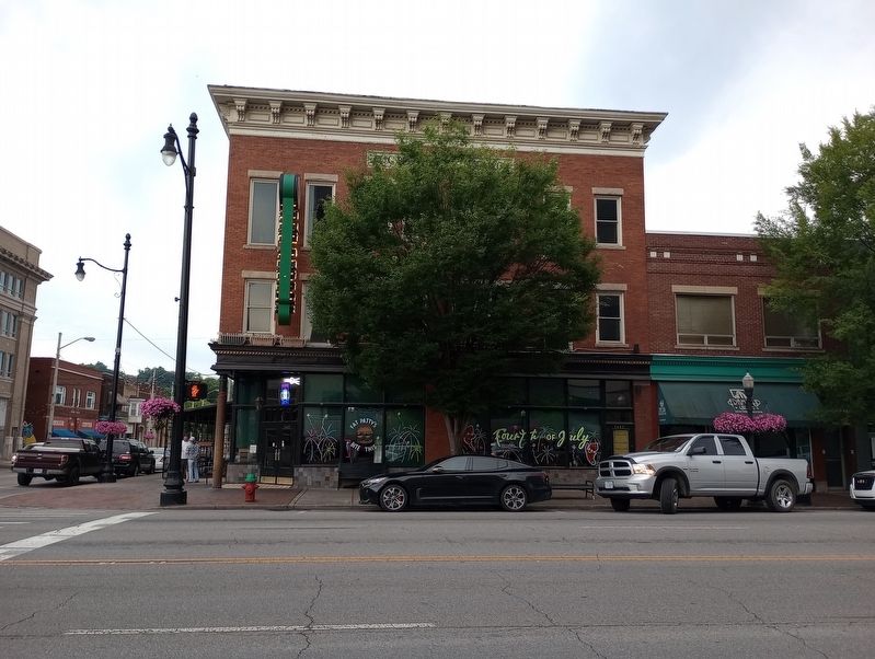
Location. 38° 28.76′ N, 82° 38.464′ W. Marker is in Ashland, Kentucky, in Boyd County. Marker is at the intersection of Winchester Avenue and 15th Street, on the left when traveling west on Winchester Avenue. Touch for map. Marker is at or near this postal address: 1442 Winchester Avenue, Ashland KY 41101, United States of America. Touch for directions.
Other nearby markers. At least 8 other markers are within walking distance of this marker. Presbyterian Church (about 600 feet away, measured in a direct line); Ashland Schools Faculty (about 600 feet away); Kentucky Native, Laura White (about 700 feet away); The Bandstand at Central Park (about 700 feet away); Ashland Veterans Mural (about 700 feet away); Trail of Fame (about 700 feet away); Proud to Serve One Family's Part in "The Greatest Generation" (about 700 feet away); Elizabeth Roseberry Mitchell's Graveyard Quilt Top (about 700 feet away). Touch for a list and map of all markers in Ashland.
Credits. This page was last revised on July 14, 2023. It was originally submitted on July 12, 2023, by Craig Doda of Napoleon, Ohio. This page has been viewed 95 times since then and 25 times this year. Photos: 1, 2, 3. submitted on July 12, 2023, by Craig Doda of Napoleon, Ohio. • James Hulse was the editor who published this page.


