Spooner Summit near Carson City in Douglas County, Nevada — The American Mountains (Southwest)
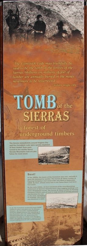
Tomb of the Sierras
a forest of underground timbers
The forest immediately around Virginia City and the Comstock Lode were quickly depleted of their timber. Eyes soon turned to the nearby Sierra Nevada Mountains east of Lake Tahoe for more wood.
Bust!
In the 1890s, the boom of the Comstock was over, and with it went the demand for lumber. The Carson & Tahoe Lumber & Fluming Company’s last wood order was filled in September 1898. By then, almost every tree in the Tahoe Basin had been harvested.
By the early 1900s, all that remained of the once-flourishing settlement at Spooner Summit were a few sagging buildings and some dilapidated corrals. The Carson & Tahoe Lumber & Fluming Company (CTLFC) sold off land in large parcels to private interests and donated the rest to the state, liquidating its holdings. The CTLFC was dissolved in 1947.
In all, the Comstock produced nearly $400 million in silver and gold over its 20-year lifespan. Its rich lodes created several fortunes, helped finance the rebuilding of San Francisco after the 1906 earthquake, and persuaded the U.S. government to welcome Nevada as a state even though it hadn’t yet met the population requirements (compensating instead with excess wealth).
”The Comstock Lode may truthfully be said to be the tomb of the forests of the Sierras. Millions on millions of feet of lumber are annually buried in the mines, nevermore to be resurrected.”
- William Wright, 1976
Panel Two:
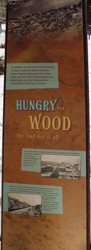
the fuel for it all
In addition to serving as mine-bracing lumber, wood was also needed to power steam engines for mines, mills, and railroads; build houses and storefronts; and fuel thousands of woodstoves in the harsh winters.
Once the wood arrived in Carson City by flume, it was stacked, dried, and loaded on Virginia & Truckee Railroad flatcars for the 21-mile route to Virginia City.
More than 750 million board-feet of lumber and 500,000 cords of firewood passed through Spooner Summit to meet this great demand. Yet this huge harvest represented only a fraction of the total timber felled for the Comstock – enough to have circled the Earth in a 30-foot-wide, 4-inch-thick boardwalk!
Panel Three:
planning for the future
Managing for Multiple Uses
Tasked with protecting the forestlands from overgrazing, timber harvest and unauthorized mining ventures, forest managers have stewarded the land back to health. Spooner Summit is now dramatically healthier than it was on hundred years ago.
A Recreational Gem
Since the 1950s, when a four-lane highway was constructed to connect Carson City to Lake Tahoe, the area surrounding Spooner Summit has become a pristine playground in winter and summer.
Erected by US Forest Service.
Topics. This historical marker is listed in these topic lists: Horticulture & Forestry • Railroads & Streetcars. A significant historical month for this entry is September 1898.
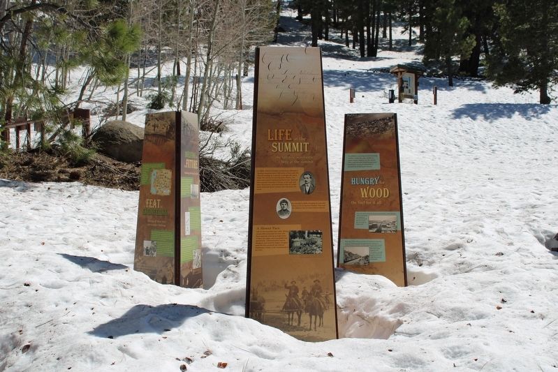
Location. 39° 6.214′ N, 119° 53.711′ W. Marker is near Carson City, Nevada, in Douglas County. It is in Spooner Summit. Marker can be reached from Lincoln Highway (U.S. 50 at milepost 13) west of Kings Canyon Road, on the right when traveling east. The resin markers are mounted as pillars at the Spooner Summit Trailhead. Touch for map. Marker is in this post office area: Carson City NV 89705, United States of America. Touch for directions.
Other nearby markers. At least 8 other markers are within walking distance of this marker. Green Gold (here, next to this marker); Life at the Summit (here, next to this marker); Riding the Flume (a few steps from this marker); Spooner Summit (about 300 feet away, measured in a direct line); The Flume Trail (about 600 feet away); Tahoe Rim Trail (about 600 feet away); Marlette Lake Trail (about 700 feet away); Hiking the Tahoe Rim Dream (about 700 feet away). Touch for a list and map of all markers in Carson City.
More about this marker. Panel One Inset Images:
Cordwood was floated down the Carson River to the Virginia & Truckee Railroad station. Photo courtesy Nevada State Museum.
The Carson City lumber yard. Photo courtesy Nevada Historical Society.
Wood train with picnickers at the Summit. Photo courtesy Nevada State Museum.
Clear Creek V-Flume, 1890. Photo courtesy Nevada State Museum.
Panel Two Inset Images:
Underground miners working the Comstock Lode. Photo courtesy Nevada Historical Society.
Spooner Summit, 1876. Photo courtesy Nevada Historical Society.
The last wood order at Spooner Summit was filled in 1898. Notice the few trees on the hillsides that provided the seeds for the forest that exists here today. Photo courtesy Nevada Historical Society.
Clear Creek V-Flume, 1890. Photo courtesy Nevada State Museum.
Panel Three Inset Images:
The USDA Forest Service now manages much of the land surrounding Lake Tahoe and other forested watersheds in the West. Photo courtesy Andrew Bray
The forest was in poor shape when the system of Forest Reserves was first created. U.S. Forest Service photo courtesy Forest History Society, Durham, N.C.
Winter sports such as cross country skiing and snowmobiling are just part of the attraction today. Photo courtesy iStockphoto.
Clear Creek V-Flume, 1890. Photo courtesy Nevada State Museum.
Credits. This page was last revised on July 22, 2023. It was originally submitted on July 22, 2023, by Joseph Alvarado of Livermore, California. This page has been viewed 91 times since then and 17 times this year. Photos: 1, 2, 3, 4. submitted on July 22, 2023, by Joseph Alvarado of Livermore, California. 5. submitted on July 5, 2023, by Joseph Alvarado of Livermore, California.


