Colonna in Roma in Città metropolitana di Roma Capitale, Latium, Rome, Italy — Central Italy (Tyrrhenian Coast)
Rione III Colonna / Colonna District III
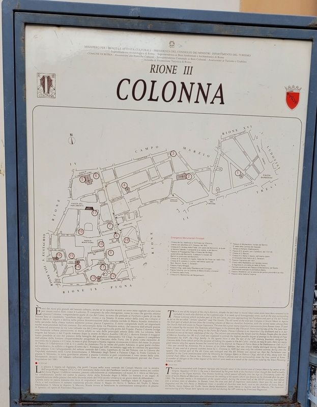
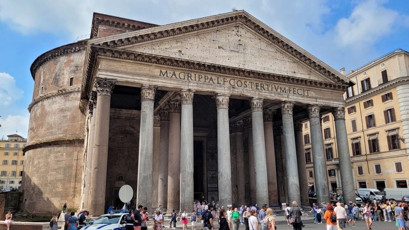
La piazza è legata ad Agrippa, che portò l'acqua nella zona centrale del Campo Marzio con la mostra dell'acquedotto Vergine (19 a.C) ed è dominata dalla mole del Pantheon (anche se questo rientra nei confini del rione Pigna). L'edificio romano, passato ufficialmente al cristianesimo col nome di S. Maria ad Martyres, ha condizionato anche nel nome la piazza, detta della Rotonda dopo il Mille. La
fontana è un segno di riqualificazione della piazza che nella seconda metà del XVII secolo versava in un grave stato di abbandono. Questa zona in epoca romana era ricca di importanti nuclei monumentali: l'orologio solare di Augusto, l'Ara Pacis; e nel medioevo vi sorsero numerose piccole chiese: S. Biagio De Hortis, S. Stefano del Trullo, S. Maria Maddalena, S. Maria in Aquiro, S. Macuto. Risale invece al Settecento la sistemazione scenografica di piazza S. Ignazio, ad opera di Francesco Raguzzini.
This is one of the largest of the city's districts, despite the fact that in recent times some areas have been removed to be included in such new districts as the Ludovisi area. It is made up of heterogeneous areas, such as the area surrounding Piazza Colonna which includes part of Via del Corso, the area approaching the Pantheon and part of Via del Tritone as far as the so-called "Artists' Quarter" near Via Veneto. The old name of the area was Colupne et Sancte Marie in Aquiro the first part of which derives from the winding column of Marcus Aurelius Antonino, with the second name coming from the church that still exists in Piazza Capranica. The area has a great many important monuments from Roman times. It used to be crossed by the ancient Via Flaminia, which began in the present-day Piazza di Pietra and by way of the Via Lata (now Via
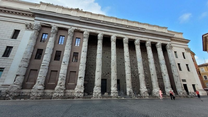
del Corso) ran all the way along to the Porta del Popolo. Piazza Colonna is an important city landmark and is in fact situated on one of the main roadways of the city. The column was erected by the Senate and the Roman People after the death of Marcus Aurelius (in 180 A.D.) and was supposed to provide the highest possible degree of prestige to the family of Pope Alessandro the VIIth, the Chigi family. In the square there is also the last of the 16th century fountains designed by Giacomo della Porta which serves the purpose of linking the square to Via del Corso - and so, as may be seen, there are many good reasons why this square became the central hub of the district. In Piazza di Pietra there is the Hadrianeum (145 A.D.) - this was erected by Antonino Pio in honour of his father Hadrian, but was almost totally destroyed during Medieval times. It was used as a ground customs house by C. Fontana in 1695 but now only the columns survive, facing onto the square. The central part of Via del Corso was enlarged and Via del Tritone was opened up, then the Parliament was installed in the Curia Innocenziana with the Ministry for Foreign Afairs in Palazzo Chigi, and all of this, along with the Central Post Office in Piazza San Silvestro, make Piazza Colonna and its surrounding areas the true centre of Rome. A number of changes to the urban layout of the district were made as a result of the clearances ruled by the Town Planning Scheme of 1883.
This area is associated with Emperor Agrippa who brought water to the central area of Campo Marzio by means of the Vergine Aqueduct (19 B.C.); the area is dominated by the great bulk of the Pantheon (even though this itself actually belongs to the Pigna district). This Roman building, which passed officially into the Age of Christianity under the name of Santa Maria ad Martyres, also influenced the naming of the square which was known as the Rotonda after the year 1000. The fountain marks a re-evaluation of the square which, during the second half of the XVIIth century, had lapsed into a serious state of abandon. In Roman times the area was full of important monuments: there was the sun dial of Augustus and the Ara Pacis; in Medieval times a number of churches were built, such as the churches of Santo Biagio De Hortis, Santo Stefano del Trullo, Santa Maria Maddalena, Santa Maria in Aquiro, and San Macuto. The theatrical restructuring of the Piazza Sant' Ignazio was carried out during the 18th century by Francesco Raguzzini.
Erected by Ministero per i Beni e le Attivita Culturali, Presidenza Del Consiglio dei Ministri, Dipartimento del Turismo, Soprintendenza Archeologica di Roma, Soprintendenza ai Beni Ambientali e Architettonici di Roma, Comune di Roma, Assessorato alle Politiche Culturali, Sovraintendenza Comunale ai Beni Culturali, Assessorato al Turismo e Giubileo and Azienda di Promozione Turistica di Roma.
Topics. This historical marker is listed in these topic lists: Architecture • Arts, Letters, Music • Churches & Religion. A significant historical year for this entry is 1695.
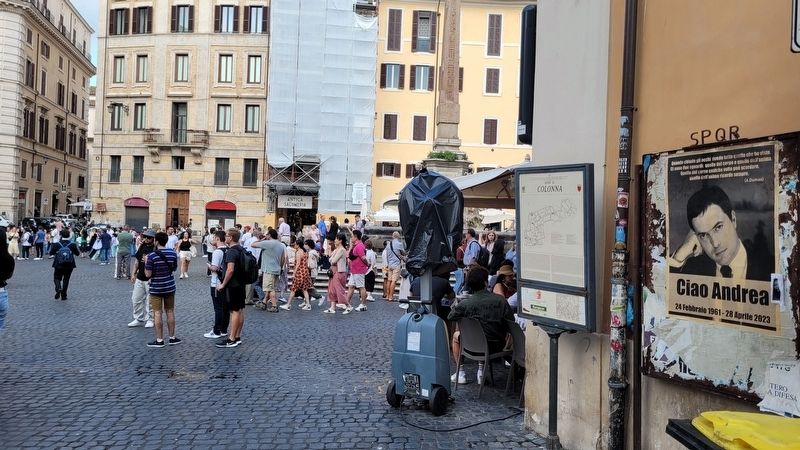
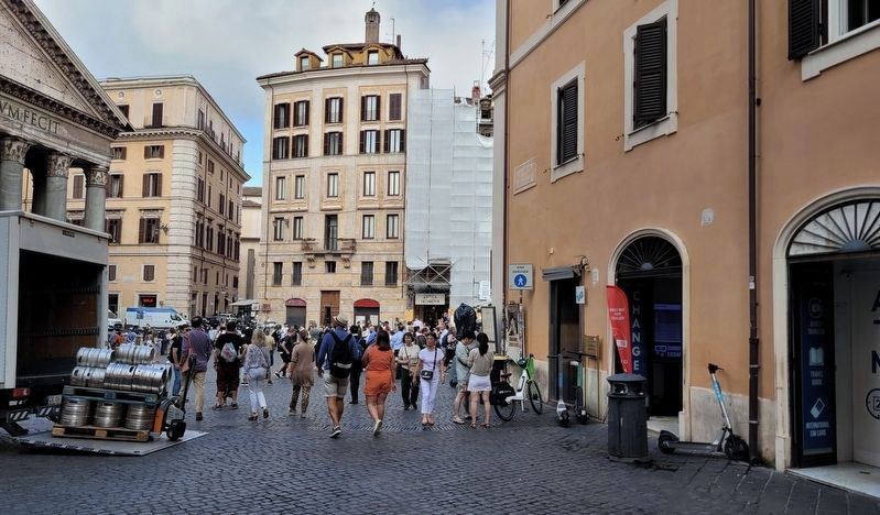
Location. 41° 53.959′ N, 12° 28.62′ E. Marker is in Roma, Lazio (Latium, Rome), in Città metropolitana di Roma Capitale. It is in Colonna. Marker is at the intersection of Piazza della Rotonda and Via degli Orfani, on the right when traveling west on Piazza della Rotonda. The marker is located at the southwest corner of the building. Touch for map. Marker is at or near this postal address: Piazza della Rotonda, 68, Roma, Lazio 00186, Italy. Touch for directions.
Other nearby markers. At least 8 other markers are within walking distance of this marker. The Trevi-Pantheon Route (a few steps from this marker); Hotel del Sole (within shouting distance of this marker); Piazza della Rotonda (within shouting distance of this marker); Pantheon (within shouting distance of this marker); Hotel Pantheon (within shouting distance of this marker); L'eclisse / The Eclipse (about 90 meters away, measured in a direct line); a different marker also named Trevi-Pantheon Route (about 120 meters away); Chiesa di San Luigi dei Francesi / Church of St. Louis of the French (about 180 meters away). Touch for a list and map of all markers in Roma.
Credits. This page was last revised on July 26, 2023. It was originally submitted on July 25, 2023, by James Hulse of Medina, Texas. This page has been viewed 175 times since then and 13 times this year. Photos: 1, 2, 3, 4, 5. submitted on July 26, 2023, by James Hulse of Medina, Texas.
