Rutland in Rutland County, Vermont — The American Northeast (New England)
A Brief History of a Long War
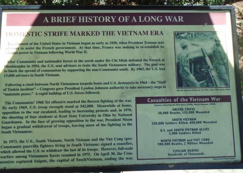
DOMESTIC STRIFE MARKED THE VIETNAM ERA
Involvement of the United States in Vietnam began as early as 1950, when President Truman sent advisors to assist the French government. At that time, France was seeking to re-establish its colonial power in Vietnam following World War II.
After Communist and nationalist forces in the north under Ho Chi Minh defeated the French at Dienbienphu in 1954, the U.S. sent advisors to train the South Vietnamese military. The goal was to block the spread of communism by supporting the non-Communist south. By 1963, the U.S. had 15,000 advisors in South Vietnam.
Following a clash between North Vietnamese torpedo boats and U.S. destroyers in 1964- the "Gulf of Tonkin incident" - Congress gave President Lyndon Johnson authority to take necessary steps to "maintain peace." A rapid buildup of U.S. forces followed.
The Communists' 1968 Tet offensive marked the fiercest fighting of the war. By early 1969, U.S. troop strength stood at 542,000. Meanwhile at home, opposition to the war escalated, leading to increasing protests and, in 1970, the shooting of four students at Kent State University in Ohio by National Guardsmen. In the face of growing opposition to the war, President Nixon began a gradual withdrawal of troops, leaving more of the fighting to the South Vietnamese.
In 1973, the U.S., South Vietnam, North Vietnam and the Viet Cong (pro-Communist guerrilla fighters living in South Vietnam) signed a ceasefire, which allowed the U.S. to withdraw the last of its troops. However, full-scale warfare among Vietnamese forces resumed in 1975. On April 30, the Communists captured Saigon, the capital of South Vietnam, ending the war.
Casualties of the Vietnam War
Sources: Encyclopedia Brittanica (1990), World Almanac (2000)
UNITED STATES
58,000 Deaths, 153,000 Wounded
SOUTH VIETNAM
250,000 Soldiers Killed, 600,000 Wounded
U.S. and SOUTH VIETNAM ALLIES
5,000 Soldiers Killed
NORTH VIETNAM and VIET CONG
900,000 Deaths, 2 Million Wounded
CIVILIAN DEATHS
Hundreds of Thousands
[Photo caption reads] Mortar platoon firing at Lai Khe, late 1965-early 1966.
Erected 2000 by Vietnam Veterans of America Chapter 1 and Concerned Citizens and Organizations.
Topics. This memorial is listed in these topic lists: Patriots & Patriotism • War, Vietnam. A significant historical date for this entry is April 30, 1950.
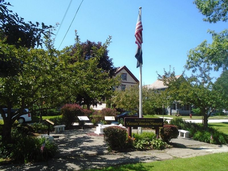
Location. 43° 36.314′ N, 72° 58.32′ W. Marker is in Rutland, Vermont, in Rutland County. Memorial is at the intersection of Main Street (U.S. 4/7) and Spellman Terrace, on the right when traveling south on Main Street. Marker is part of the Rutland County Vietnam Veterans Memorial, on the Green. Touch for map. Marker is at or near this postal address: 45 South Main Street, Rutland VT 05701, United States of America. Touch for directions.
Other nearby markers. At least 8 other markers are within walking distance of this marker. Vietnam Veterans of America Chapter 1 - First in the Nation (here, next to this marker); A Soldier Carved in Stone (here, next to this marker); Rutland County Vietnam Veterans Memorial (here, next to this marker); Rutland County Vietnam Honor Roll (here, next to this marker); Rutland G.A.R. Memorial (about 400 feet away, measured in a direct line); Major General Merritt A. Edson (about 500 feet away); Korea War Memorial (about 600 feet away); Rutland World War I Memorial (about 700 feet away). Touch for a list and map of all markers in Rutland.
Credits. This page was last revised on August 2, 2023. It was originally submitted on August 2, 2023, by William Fischer, Jr. of Scranton, Pennsylvania. This page has been viewed 48 times since then and 9 times this year. Photos: 1, 2. submitted on August 2, 2023, by William Fischer, Jr. of Scranton, Pennsylvania.

