Lake Natoma Shores in Folsom in Sacramento County, California — The American West (Pacific Coastal)
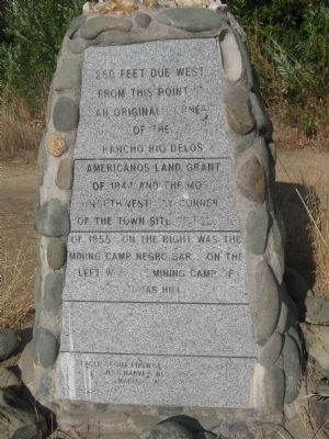
Rancho Rio de los Americanos
from this point is an original corner
of the
Rancho Rio Delos
Americanos Land Grant
of 1844 and the most
Northwesterly corner
of the town site of Folsom
of 1855. On the right was the
mining camp of Negro Bar. On the
left was the mining camp of
Texas Hill.
Erected 1996 by Jess Harvey BSA Troop 97, and Mariano Monuments.
Topics. This historical marker is listed in these topic lists: Notable Places • Settlements & Settlers. A significant historical year for this entry is 1844.
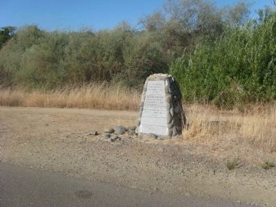
Location. 38° 40.407′ N, 121° 11.253′ W. Marker is in Folsom, California, in Sacramento County. It is in Lake Natoma Shores. Marker can be reached from Young Wo Circle near Forrest Street. Marker is located on the Folsom Lake State Recreation Area East Lake Natoma Multi-Purpose Trail north of the Young Wo Circle entrance to the hiking trail. Touch for map. Marker is in this post office area: Folsom CA 95630, United States of America. Touch for directions.
Other nearby markers. At least 8 other markers are within walking distance of this marker. The Young Wo Memorial Site (approx. 0.2 miles away); Southern Pacific Railroad Superintendent's House (approx. 0.4 miles away); St. John the Baptist Catholic Church (approx. 0.4 miles away); Folsom Terminal (approx. 0.4 miles away); Leidesdorff Plaza (approx. 0.4 miles away); W.L. Perkins Warehouse (approx. half a mile away); Site of Car/Carpenter Shop (1863) (approx. half a mile away); Turning the Trains (approx. half a mile away). Touch for a list and map of all markers in Folsom.
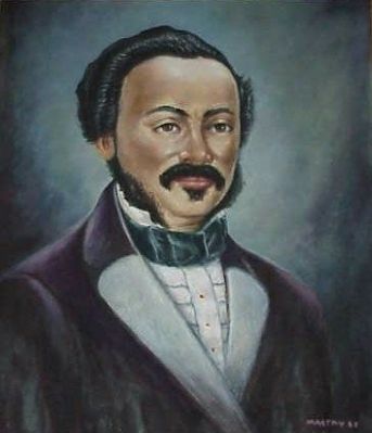
Regarding Rancho Rio de los Americanos. Also see Nearby Marker Leidesdorff Plaza for additional information.
Also see . . .
1. Rancho Rio de los Americanos. Wikipedia article regarding the Rancho. (Submitted on October 4, 2009, by Syd Whittle of Mesa, Arizona.)
2. Photo of the Original Land Grant Map from the Bancroft Library Collection. (Submitted on October 4, 2009, by Syd Whittle of Mesa, Arizona.)
Additional keywords. Mexican Land Grants
Credits. This page was last revised on February 7, 2023. It was originally submitted on October 4, 2009, by Syd Whittle of Mesa, Arizona. This page has been viewed 1,530 times since then and 41 times this year. Photos: 1, 2, 3. submitted on October 4, 2009, by Syd Whittle of Mesa, Arizona. 4. submitted on February 2, 2009, by Syd Whittle of Mesa, Arizona.


