Pratt in Pratt County, Kansas — The American Midwest (Upper Plains)
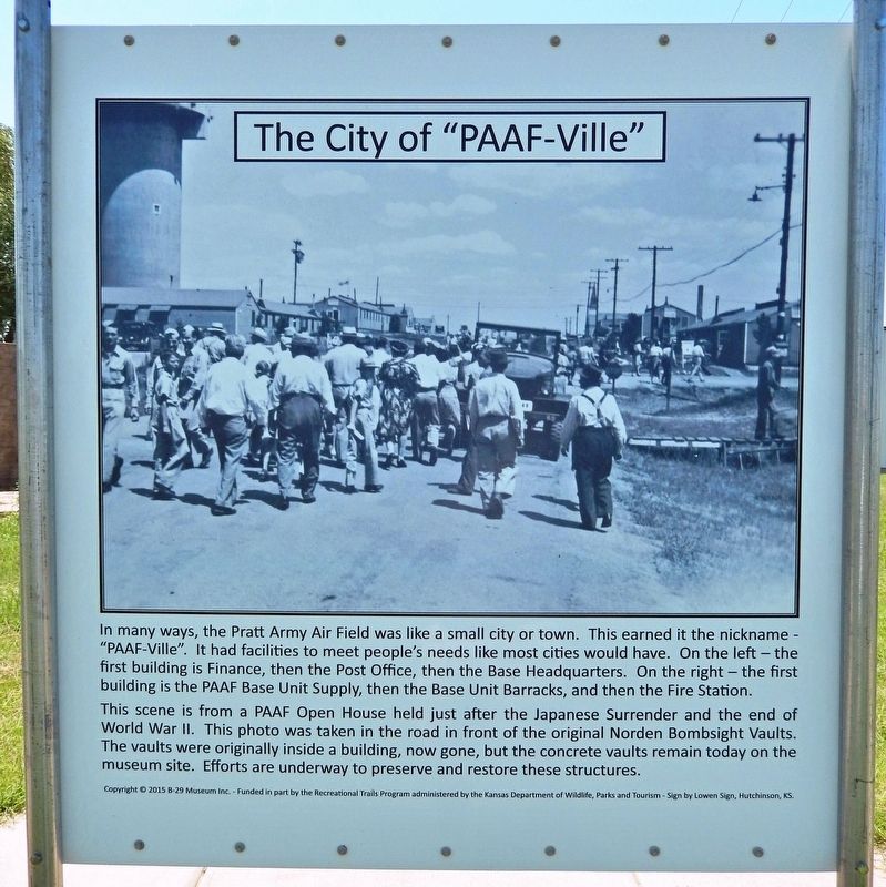
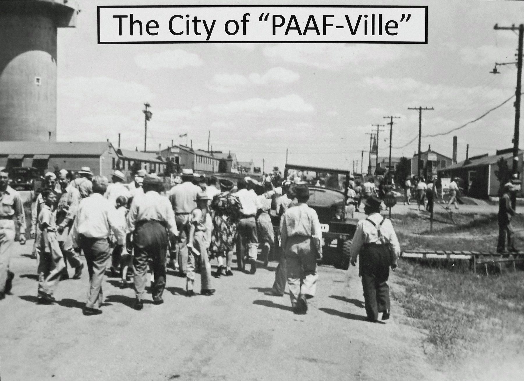
The City of "PAAF-Ville"
In many ways, the Pratt Army Air Field was like a small city or town. This earned it the nickname — "PAAF-Ville". It had facilities to meet people's needs like most cities would have. On the left — the first building is Finance, then the Post Office, then the Base Headquarters. On the right — the first building is the PAAF Base Unit Supply, then the Base Unit Barracks, and then the Fire Station.
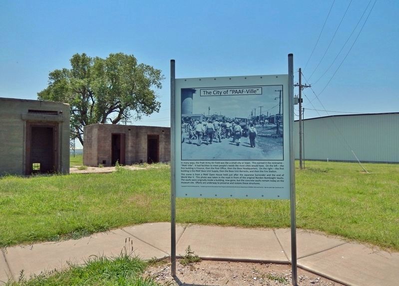
This scene is from a PAAF Open House held just after the Japanese Surrender and the end of World War II. This photo was taken in the road in front of the original Norden Bombsight Vaults. The vaults were originally inside a building, now gone, but the concrete vaults remain today on the museum site. Efforts are underway to preserve and restore these structures.
Copyright © 2015 B-29 Museum Inc. - Funded in part by the Recreational Trails Program administered by the Kansas Department of Wildlife, Parks and Tourism - Sign by Lowen Sign, Hutchinson, KS.
Erected by Kansas Department of Wildlife, Parks and Tourism; B-29 Museum; City of Pratt; and Airport Authority.
Topics. This historical marker is listed in these topic lists: Air & Space • Industry & Commerce • War, World I.
Location. 37° 42.241′ N, 98° 44.552′ W. Marker is in Pratt, Kansas, in Pratt County. Marker is on Flint Road just west of Kennedy Avenue, on the left when traveling west. Marker is about 2 blocks west of the B-29 All Veterans Memorial. Touch for map. Marker is at or near this postal address: 40131 Barker Ave, Pratt KS 67124, United States of America. Touch for directions.
Other nearby markers. At least 8 other markers are within walking distance of this marker. Base Operations Building (here, next to this marker); Norden Bombsight Vaults (here, next to this marker); Aircraft Control Tower (a few steps from this marker); Celestial Navigation and Bombing Trainer (within shouting distance of this marker); Link Aviation Flight Simulation Trainer (within shouting distance of this marker); PAAF - Pratt Army Airfield (about 400 feet away, measured in a direct line); Pratt Army Air Field Historical Walk (about 500 feet away); Pratt Army Air Field and the B-29 "Superfortress" (about 600 feet away). Touch for a list and map of all markers in Pratt.
Related markers. Click here for a list of markers that are related to this marker. Pratt Army Air Field Historical Walk
Also see . . . Pratt Army Air Field (Wikipedia). Excerpt:
Construction of Pratt Army Air Field was begun in September 1942. The field is located about three miles north of the city of Pratt, which was the only urban area readily accessible to personnel of the field. Eventually, Pratt AAF would have three 8,000-foot-long main runways and five hangars. Station construction was of the theater of operations type. By the time of the official dedication of the field in May 1943, some 60 barracks had been completed, giving accommodations to 2,460 enlisted men. Total authorized construction called for 72 barracks with a capacity of 3,060 enlisted men and eight officers' quarters with a housing capacity of 522.(Submitted on August 6, 2023, by Cosmos Mariner of Cape Canaveral, Florida.)
Credits. This page was last revised on August 8, 2023. It was originally submitted on August 5, 2023, by Cosmos Mariner of Cape Canaveral, Florida. This page has been viewed 53 times since then and 8 times this year. Photos: 1, 2, 3. submitted on August 6, 2023, by Cosmos Mariner of Cape Canaveral, Florida.


