Pratt in Pratt County, Kansas — The American Midwest (Upper Plains)
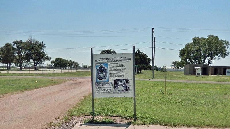
Celestial Navigation and Bombing Trainer
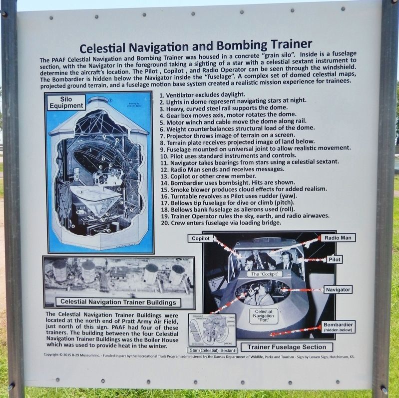
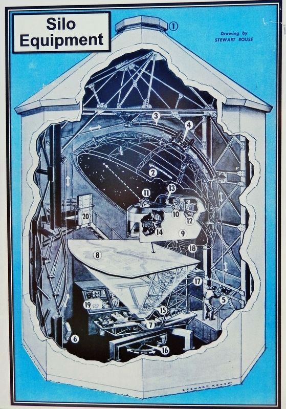
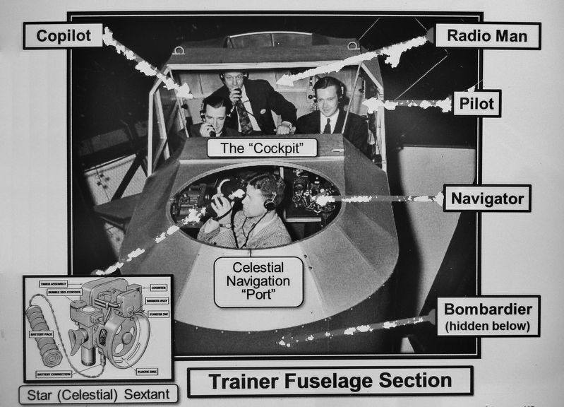
The PAAF Celestial Navigation and Bombing Trainer was housed in a concrete "grain silo". Inside is a fuselage section, with the Navigator in the foreground taking a sighting of a star with a celestial sextant instrument to determine the aircraft's location. The Pilot, Copilot, and Radio Operator can be seen through the windshield. The Bombardier is hidden below the Navigator inside the "fuselage". A complex set of domed celestial maps, projected ground terrain, and a fuselage motion base system created a realistic mission experience for trainees.
1. Ventilator excludes daylight.
2. Lights in dome represent navigating stars at night.
3. Heavy, curved steel rail supports the dome.
4. Gear box moves axis, motor rotates the dome.
5. Motor winch and cable move the dome along rail.
6. Weight counterbalances structural load of the dome.
7. Projector throws image of terrain on a screen.
8. Terrain plate receives projected image of land below.
9. Fuselage mounted on universal joint to allow realistic movement.
10. Pilot uses standard instruments and controls.
11. Navigator takes bearings from stars using a celestial sextant.
12. Radio Man sends and receives messages.
13. Copilot or other crew member.
14. Bombardier uses bombsight. Hits are shown.
15. Smoke blower produces cloud effects for added realism.
16. Turntable revolves as Pilot uses rudder (yaw).
17. Bellows tip fuselage for dive or climb (pitch).
18. Bellows bank fuselage as ailerons used (roll).
19. Trainer Operator rules the sky, earth, and radio airwaves.
20. Crew enters fuselage via loading bridge.
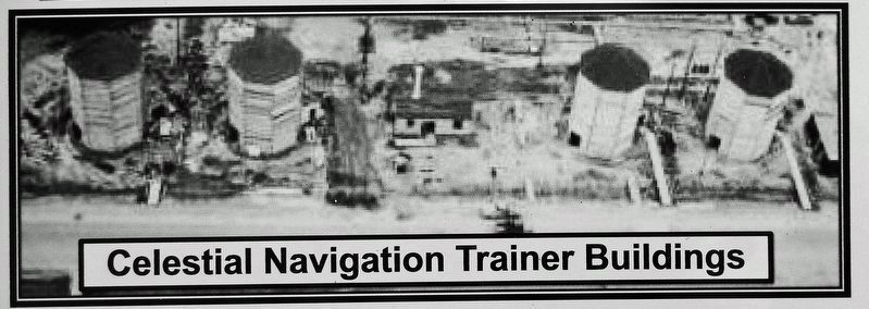
The Celestial Navigation Trainer Buildings were located at the north end of Pratt Army Air Field, just north of this sign. PAAF had four of these trainers. The building between the four Celestial Navigation Trainer Buildings was the Boiler House which was used to provide heat in the winter.
Copyright © 2015 B-29 Museum Inc. - Funded in part by the Recreational Trails Program administered by the Kansas Department of Wildlife, Parks and Tourism - Sign by Lowen Sign, Hutchinson, KS.
Erected by Kansas Department of Wildlife, Parks and Tourism; B-29 Museum; City of Pratt; and Airport Authority.
Topics. This historical marker is listed in these topic lists: Air & Space • Education • War, World II.
Location. 37° 42.258′ N, 98° 44.539′ W. Marker is in Pratt, Kansas, in Pratt County. Marker is on Kennedy Avenue just north of Flint Road, on the right when traveling south. Marker is about 2 blocks west of the B-29 All Veterans Memorial. Touch for map. Marker is at or near this postal address: 40131 Barker Avenue, Pratt KS 67124, United States of America. Touch for directions.
Other nearby markers. At least 8 other markers are within walking distance of this marker. Link Aviation Flight Simulation Trainer (a few steps from this marker); Aircraft Control Tower (within shouting distance of this marker); Base Operations Building (within shouting distance of this marker); The City of "PAAF-Ville" (within shouting distance of this marker); Norden Bombsight Vaults (within shouting distance of this marker); Pratt Army Air Field Historical Walk (about 400 feet away, measured in a direct line); PAAF - Pratt Army Airfield (about 400 feet away); Pratt Army Air Field and the B-29 "Superfortress" (about 500 feet away). Touch for a list and map of all markers in Pratt.
Related markers. Click here for a list of markers that are related to this marker. Pratt Army Air Field Historical Walk
Credits. This page was last revised on August 8, 2023. It was originally submitted on August 6, 2023, by Cosmos Mariner of Cape Canaveral, Florida. This page has been viewed 69 times since then and 22 times this year. Photos: 1, 2, 3, 4, 5. submitted on August 7, 2023, by Cosmos Mariner of Cape Canaveral, Florida.
