Near Swift Run in Rockingham County, Virginia — The American South (Mid-Atlantic)
Greene County / Rockingham County
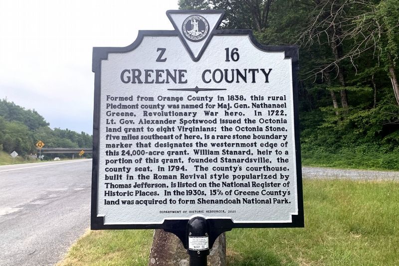
GREENE COUNTY
Formed from Orange County in 1838, this rural Piedmont county was named for Maj. Gen. Nathanael Greene, Revolutionary War hero. In 1722, Lt. Gov. Alexander Spotswood issued the Octonia land grant to eight Virginians; the Octonia Stone, five miles southeast of here, is a rare stone boundary marker that designates the westernmost edge of this 24,000-acre grant. William Stanard, heir to a portion of this grant, founded Stanardsville, the county seat, in 1794. The county's courthouse, built in the Roman Revival style popularized by Thomas Jefferson, is listed on the National Register of Historic Places. In the 1930s, 15% of Greene County's land was acquired to form Shenandoah National Park.
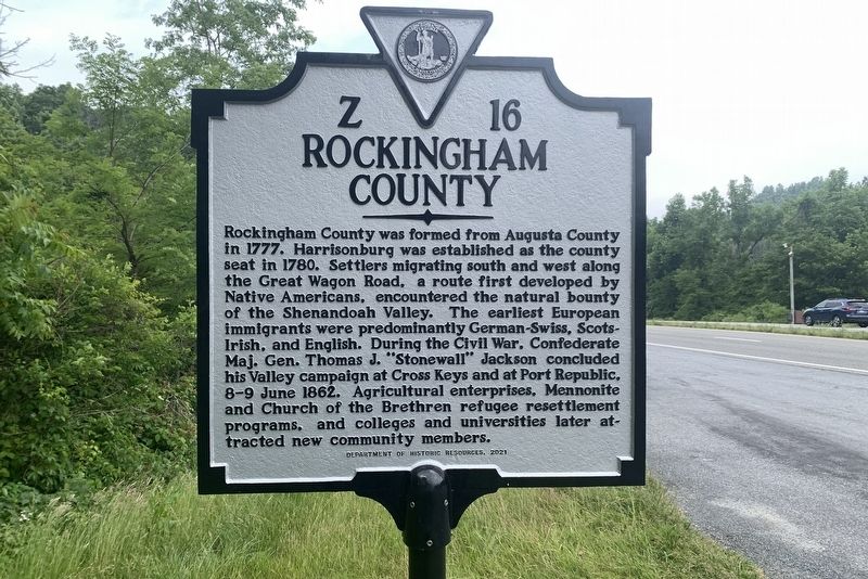
ROCKINGHAM COUNTY
Rockingham County was formed from Augusta County in 1777. Harrisonburg was established as the county seat in 1780. Settlers migrating south and west along the Great Wagon Road, a route first developed by Native Americans, encountered the natural bounty of the Shenandoah Valley. The earliest European immigrants were predominantly German-Swiss, Scots-Irish, and English. During the Civil War, Confederate Maj. Gen. Thomas J. “Stonewall” Jackson concluded his Valley campaign at Cross Keys and at Port Republic, 8–9 June 1862. Agricultural enterprises, Mennonite and Church of the Brethren refugee resettlement programs, and colleges and universities later attracted new community members.
Erected 2021 by Department of Historic Resources. (Marker Number Z-16.)
Topics and series. This historical marker is listed in this topic list: Political Subdivisions. In addition, it is included in the Virginia Department of Historic Resources (DHR) series list. A significant historical year for this entry is 1838.
Location. 38° 21.467′ N, 78° 32.834′ W. Marker is near Swift Run, Virginia, in Rockingham County. Marker is on Spotswood Trail (U.S. 33) just north of Skyline Drive, on the right when traveling south. It is west of Skyline Drive, between the Skyline Drive overpass and the entrance to Skyline Drive. Touch for map. Marker is in this post office area: Elkton VA 22827, United States of America. Touch for directions.
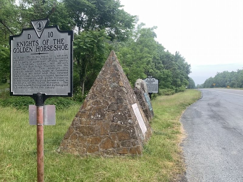
Other nearby markers. At least 8 other markers are within 6 miles of this marker, measured as the crow flies. Alexander Spotswood Discovers the Valley of the Shenandoah (a few steps from this marker); “Sic Juvat Transcendere Montes” (a few steps from this marker); Knights of the Golden Horseshoe (a few steps from this marker); a different marker also named Greene County / Rockingham County (about 700 feet away, measured in a direct line); Civilian Conservation Corps (approx. 3˝ miles away); Newtown (East Elkton) School (approx. 4.9 miles away); Miller-Argabright-Cover-Kite House (approx. 5.1 miles away); Jennings House (approx. 5.3 miles away). Touch for a list and map of all markers in Swift Run.
More about this marker. Another marker with identical titles and number but and with older text, is located on the opposite side of the road about 700 feet east on U.S. 33.
Credits. This page was last revised on October 11, 2023. It was originally submitted on August 13, 2023, by Tim Fillmon of Webster, Florida. This page has been viewed 69 times since then and 27 times this year. Photos: 1, 2, 3. submitted on August 13, 2023, by Tim Fillmon of Webster, Florida.


