Sunriver in Deschutes County, Oregon — The American West (Northwest)
Military Might Along The River: Camp Abbot
Inscription.
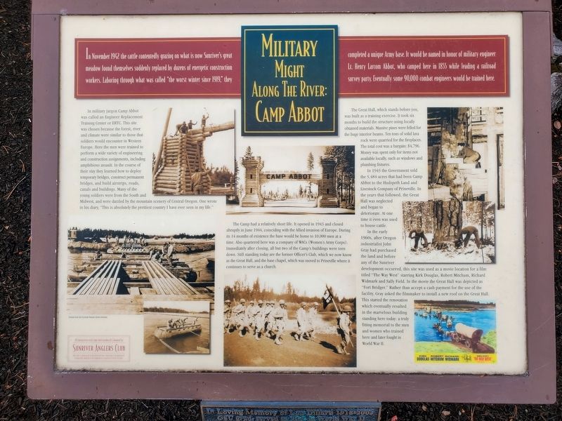
In November 1942 the cattle contentedly grazing on what is now Sunriver’s great meadow found themselves suddenly replaced by dozens of energetic construction workers. Laboring through what was called “the worst winter since 1919,” they completed a unique Army base. It would be named in honor of military engineer Lt. Henry Larcom Abbot, who camped here in 1855 while leading a railroad survey party. Eventually some 90,000 combat engineers would be trained here.
In military jargon Camp Abbot was called an Engineer Replacement Training Center or ERTC. This site was chosen because the forest, river and climate were similar to those that soldiers would encounter in Western Europe. Here the men were trained to perform a wide variety of engineering and construction assignments, including amphibious assault. In the course of their stay they learned how to deploy temporary bridges, construct permanent bridges, and build airstrips, roads, canals and buildings. Many of the young soldiers were from the South and Midwest, and were dazzled by the mountain scenery of Central Oregon. One wrote in his diary, “This is absolutely the prettiest country I have ever seen in my life.”
The Camp had a relatively short life. It opened in 1943 and closed abruptly in June 1944, coinciding with the Allied invasion of Europe. During its 14 months of existence the base would be home to 10,000 men at a time. Also quartered here was a company of WACs (Women's Army Corps). Immediately after closing, all but two of the Camp’s buildings were torn down. Still standing today are the former Officer’s Club, which we now know as the Great Hall, and the base chapel, which was moved to Prineville where it continues to serve as a church.
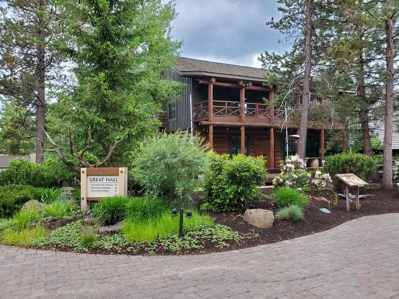
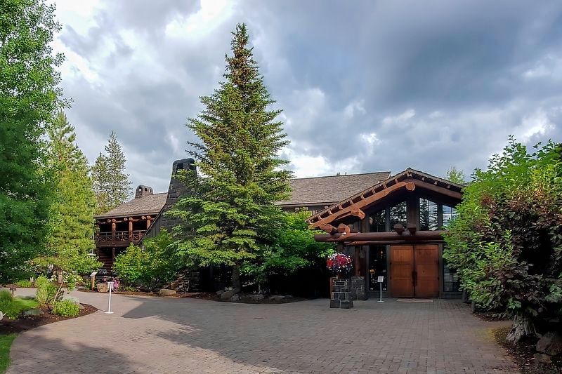
The Great Hall which stands before you, was built as a training exercise. It took six months to build the structure using locally obtained materials. Massive pines were felled for the huge interior beams. Ten tons of solid lava rock were quarried for the fireplaces. The total cost was a bargain: $4,796. Money was spent only for items not available locally, such as windows and plumbing fixtures.
In 1945 the Government sold the 5,484 acres that had been Camp Abbot to the Hudspeth Land and Livestock Company of Prineville. In the years that followed, the Great Hall was neglected and began to deteriorate. At one time it even was used to house cattle.
In the early 1960s, after Oregon industrialist John Gray had purchased the land and before any of the Sunriver development occurred, this site was used as a movie location for a film titled “The Way West” starring Kirk Douglas, Robert Mitchum, Richard Widmark and Sally Field. In the movie the Great Hall was depicted
as “Fort Bridger.” Rather than accept cash payment for the use of the facility, Gray asked the filmmaker to install a new roof on the Great Hall. This started the renovation which eventually resulted in the marvelous building standing here today: a truly fitting memorial to the men and women who trained here and later fought in World War II.
Erected by Sunriver Anglers Club.
Topics. This memorial is listed in this topic list: War, World II. A significant historical month for this entry is November 1942.
Location. 43° 52.329′ N, 121° 26.672′ W. Marker is in Sunriver, Oregon, in Deschutes County. Memorial is on Great Hall Loop, on the right when traveling east. Touch for map. Marker is in this post office area: Bend OR 97707, United States of America. Touch for directions.
Other nearby markers. At least 8 other markers are within 14 miles of this marker, measured as the crow flies. Lava River Cave (approx. 4.1 miles away); Some Lava Flows Build Their Own Pipelines (approx. 4.1 miles away); River Ruler (approx. 4.4 miles away); Lava Butte (approx. 5.4 miles away); Big Tree Ponderosa Pine (approx. 7.9 miles away); Journey of the Log to Lumber (approx. 13˝ miles away); Location, Location & Location (approx. 13˝ miles away); Today's Old Mill District (approx. 13.6 miles away).
Also see . . . Sunriver Blog site. View a beautiful photo of
the Great Hall and one of five photo-op locations promoted within Sunriver. (Submitted on August 31, 2023, by Douglass Halvorsen of Klamath Falls, Oregon.)
Credits. This page was last revised on September 1, 2023. It was originally submitted on August 31, 2023, by Douglass Halvorsen of Klamath Falls, Oregon. This page has been viewed 80 times since then and 38 times this year. Photos: 1, 2, 3. submitted on August 31, 2023, by Douglass Halvorsen of Klamath Falls, Oregon. • J. Makali Bruton was the editor who published this page.


