University in Minneapolis in Hennepin County, Minnesota — The American Midwest (Upper Plains)
The West Bank
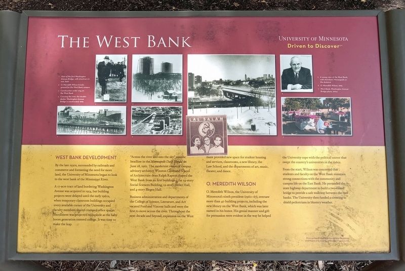
1 View of the first Washington Avenue Bridge, with streetcars in use, 1940
2 O. Meredith Wilson breaks ground for the West Bank campus
3 Construction under way on the West Bank
4 Crossing the river: the double-decker Washington Avenue Bridge is constructed, 1965
5 A snowy view of the West Bank, with downtown Minneapolis in the distance
6 O. Meredith Wilson, 1965
7 West Bank, Washington Avenue Bridge plaza, 2004
West Bank Development
By the late 1930s, surrounded by railroads and commerce and foreseeing the need for more land, the University of Minnesota began to look to the west bank of the Mississippi River.
A 17-acre tract of land bordering Washington Avenue was acquired in 1954, but building projects were delayed until the early 1960s, when temporary classroom buildings occupied every available corner of the University and faculty members shared cramped office spaces. Enrollment was projected to explode as the baby boom generation entered college. It was time to make the leap.
"Across the river and into the sky" was the headline in the Minneapolis Daily Herald on June 28, 1962. The modernist vision of campus advisory architect Winston Close and School of Architecture dean Ralph Rapson shaped the West Bank form its first buildings—the 14-story Heller Hall, and 4-story Blegen Hall.
Business administration and departments of the College of Science, Literature, and Art vacated Ford and Vincent halls and were the first to move across the river. Throughout the next decade and beyond, expansion on the West Bank provided new space for student housing and services, classrooms, a new library, the Law School, and the departments of art, music, theater, and dance.
O. Meredith Wilson
O. Meredith Wilson, the University of Minnesota's ninth president (1960–67), oversaw more than 40 building projects, including the new library on the West Bank, which was later named in his honor. His genial manner and gift for persuasion were evident in the way he helped the University cope with the political unrest that swept the country's universities in the 1960s.
From the start, Wilson was concerned that students and faculty on the West Bank maintain strong connections with the community and campus life on the East Bank. He persuaded the state highway department to build a two-tiered bridge to provide a safe walkway between the two banks. The University then funded a covering to shield pedestrians in the blustery weather.
Erected by University of Minnesota.
Topics. This historical marker is listed
in these topic lists: Architecture • Bridges & Viaducts • Education. A significant historical year for this entry is 1954.
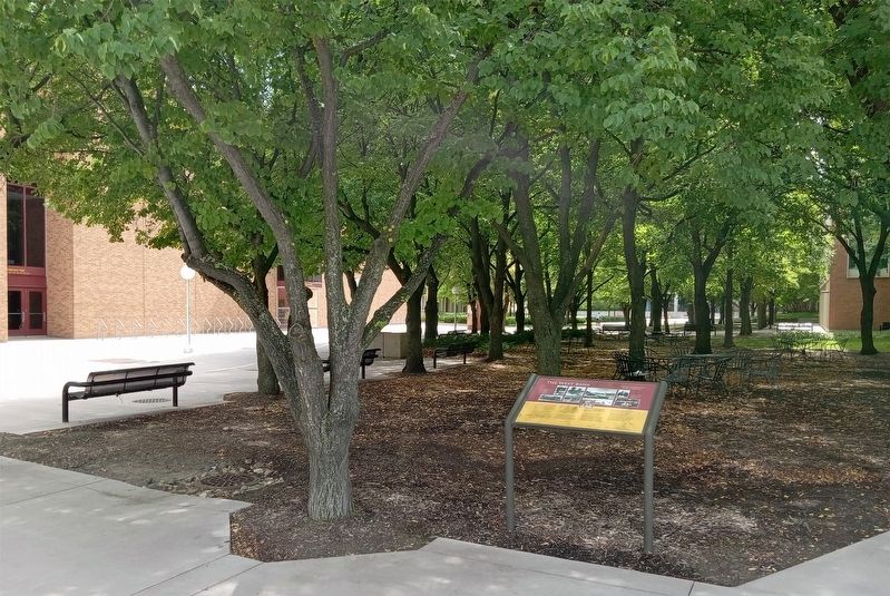
Location. 44° 58.326′ N, 93° 14.564′ W. Marker is in Minneapolis, Minnesota, in Hennepin County. It is in University. Marker can be reached from S. 19th Avenue. The marker is on the University of Minnesota's West Bank campus, in the plaza between Anderson Hall and Blegen Hall, just south of the Washington Avenue Bridge. Touch for map. Marker is at or near this postal address: 257 S 19th Avenue, Minneapolis MN 55455, United States of America. Touch for directions.
Other nearby markers. At least 8 other markers are within walking distance of this marker. Mulford Q. Sibley Grove (a few steps from this marker); A Legacy of Public Service (about 300 feet away, measured in a direct line); A Global University (about 600 feet away); Distance Learning (about 700 feet away); You Are Here… Bohemian Flats (approx. 0.2 miles away); Old Portage Trail (approx. ¼ mile away); Rail Traffic in the Twin Cities (approx. 0.3 miles away); Spanning the Sciences (approx. 0.4 miles away). Touch for a list and map of all markers in Minneapolis.
Credits. This page was last revised on September 4, 2023. It was originally submitted on August 28, 2023, by McGhiever of Minneapolis, Minnesota. This page has been viewed 93 times since then and 33 times this year. Last updated on September 3, 2023, by McGhiever of Minneapolis, Minnesota. Photos: 1, 2. submitted on August 28, 2023, by McGhiever of Minneapolis, Minnesota. • J. Makali Bruton was the editor who published this page.

