Iōjima in Ogasawara Subprefecture, Tokyo Prefecture, Japan — 日本国 (East Asia)
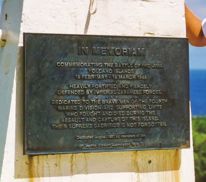
Commemorating the Battle of Iwo Jima
19 February – 16 March 1945
In the collection of Glen T. Backman. Used with permission., October 1990
1. Commemorating the Battle of Iwo Jima Marker
Heavily Fortified and fiercely defended by Imperial Japanese Forces.
Dedicated to the brave men of the Fourth Marine Division and supporting units who fought and died during the assault and capture of this Island. Their supreme sacrifice is not forgotten.
Erected 1957 by members of the 4th Marine Division Association [WW II] in the month of August.
Topics. This memorial is listed in this topic list: War, World II.
Location. Memorial has been permanently removed. It was located near 24° 48.445′ N, 141° 19.54′ E. Memorial was in Iōjima, Tokyo Prefecture, in Ogasawara Subprefecture. It could be reached from Doro. It was near the north point of the island, near the end of the road there, on the left. Touch for map. Memorial was in this post office area: Iōjima, Tokyo Prefecture 100-2100, Japan.
We have been informed that this memorial is no longer there and will not be replaced. This page is an archival view of what was.
Regionally, it was in Asia, specifically

this page online
More about this memorial. This memorial plaque was placed at the U.S. Coast Guard Station for the LORAN-C transmitter on Iwo Jima. On September 29, 1993 the Iwo Jima LORAN-C transmitter was transferred from the U.S. Coast Guard to the Government of Japan. In 1994, the transmitter was shut down, and its tower was taken down. The station’s buildings are no longer standing.
Also see . . .
1. Wikipedia entry for the Battle of Iwo Jima. This article details the different phases of this long and brutal battle. Excerpt:
The Battle of Iwo Jima ... was a major battle in which the United States Marine Corps and United States Navy (USN) landed on and eventually captured the island of Iwo Jima from the Imperial Japanese Army during World War II. The American invasion, designated Operation Detachment, had the purpose of capturing the island with its two airfields. ...(Submitted on September 4, 2023.)
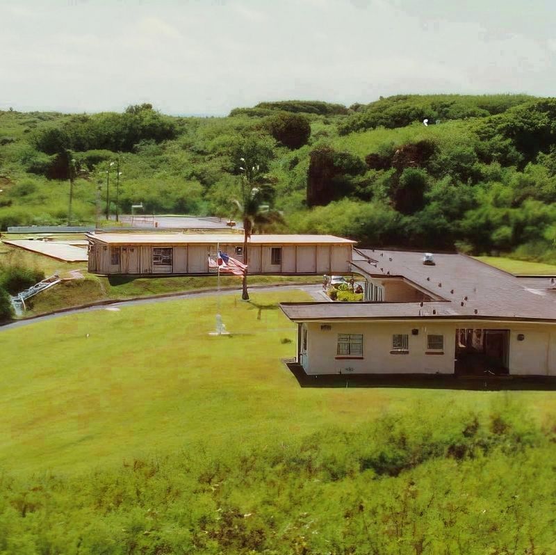
Raising the Flag on Iwo Jima is a black and white photograph taken by Joe Rosenthal depicting six Marines from E Company, 2nd Battalion,28th Marines, raising a U.S. flag atop Mount Suribachi on 23 February 1945, which was the second of two flag-raisings on the site that day. The photograph was extremely popular, being reprinted in thousands of publications. Later, it became the only photograph to win the Pulitzer Prize for Photography in the same year as its publication, and ultimately came to be regarded as one of the most significant and recognizable images of the war, and possibly the most reproduced photograph of all time. The flag raising picture was later used by Felix de Weldon to sculpt the Marine Corps War Memorial which is located adjacent to Arlington National Cemetery since 1954.In the collection of Glen T. Backman. Used with permission., 19912. Flagpole with Marker at the Administrative/Mess Deck Wing of BuildingU.S. Coast Guard LORAN Station Iwo Jima. The plaque is at the base of the flagpole. The plaque faces the administrative/mess deck wing of the building seen in the foreground.
2. Iwo Jima’s Costs, Gains, and Legacies. Excerpt from CClosing In: Marines in the Seizure of Iwo Jima by Colonel Joseph H. Alexander, U.S. Marine Corps (Ret). It begins,
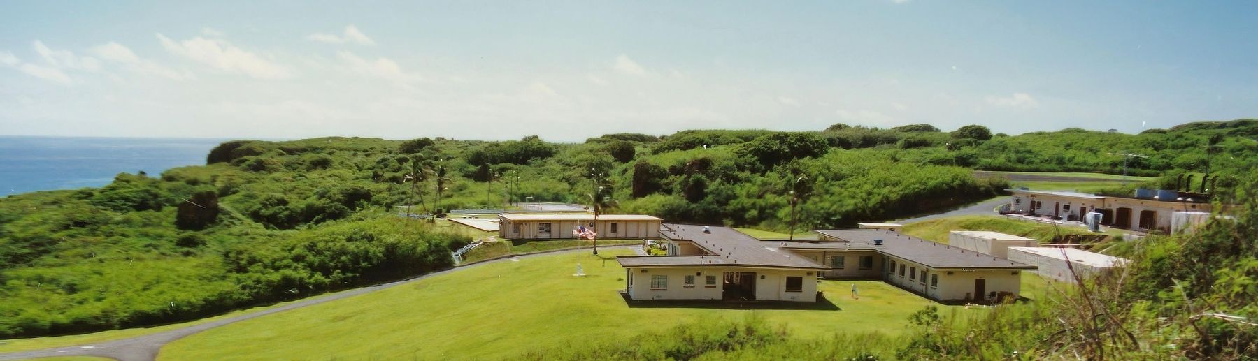
In its 36 days of combat on Iwo Jima, the V Amphibious Corps killed approximately 22,000 Japanese soldiers and sailors. The cost was staggering. The assault units of the corps—Marines and organic Navy personnel—sustained 24,053 casualties, by far the highest single-action(Submitted on September 4, 2023.)losses in Marine Corps history. Of these, a total of 6,140 died. Roughly one Marine or corpsman became a casualty for every three who landed on Iwo Jima.In the collection of Glen T. Backman. Used with permission., 19913. U.S. Coast Guard LORAN Station Iwo JimaThis view is north northeast. In the foreground is the administrative building. The barracks section is to the right, behind the administrative/mess deck wing. Further to the right is the engineering, generator, and LORAN timer building.
In the collection of Glen T. Backman. Used with permission., 1991
4. View Roughly North from the LORAN-C Tower
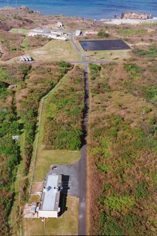
This view of the station taken by a climber some ways up the LORAN transmitter tower, which was about 1200 feet high. The transmitter building is in the foreground. The black rectangle was the rain catchment basin, the station’s only source of fresh water. You can make out the administrative and barracks wings of the main building just to the left of the catchment basin. Running left to right below the catchment basin is the road that rings the island. Click on image to enlarge.
Credits. This page was last revised on September 4, 2023. It was originally submitted on September 4, 2023, by J. J. Prats of Powell, Ohio. This page has been viewed 444 times since then and 63 times this year. Photos: 1, 2, 3, 4. submitted on September 4, 2023, by J. J. Prats of Powell, Ohio.
