Near Cambridge in Washington County, Idaho — The American West (Mountains)
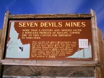
Seven Devils Mines
They started with Albert Kleinschmidt's road grade down from their mine, more than a vertical mile above Snake River, and more than 30 miles downstream from here. After a steamboat failed in 1891, a railroad (now under water) was built past here to their river landing. That did not work either. Large ore trucks finally solved their problem in 1968.
Erected by Idaho Historical Society. (Marker Number 378.)
Topics and series. This historical marker is listed in these topic lists: Industry & Commerce • Natural Resources • Railroads & Streetcars. In addition, it is included in the Idaho State Historical Society series list. A significant historical year for this entry is 1891.
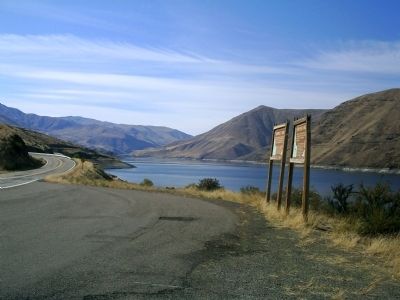
Location. 44° 49.723′ N, 116° 54.212′ W. Marker is near Cambridge, Idaho, in Washington County. Marker is on State Highway 71 at milepost 2,, 10 miles west of Camp Creek Road, on the left when traveling north. Marker is 28 miles from Cambridge near Brownlee Dam. Touch for map. Marker is in this post office area: Cambridge ID 83610, United States of America. Touch for directions.
Other nearby markers. At least 1 other marker is within walking distance of this marker. Brownlee Ferry (here, next to this marker).
Credits. This page was last revised on June 16, 2016. It was originally submitted on October 12, 2009, by Rebecca Maxwell of Boise, Idaho. This page has been viewed 1,581 times since then and 33 times this year. Photos: 1, 2. submitted on October 12, 2009, by Rebecca Maxwell of Boise, Idaho. • Craig Swain was the editor who published this page.

