Dixon Township in Lee County, Illinois — The American Midwest (Great Lakes)
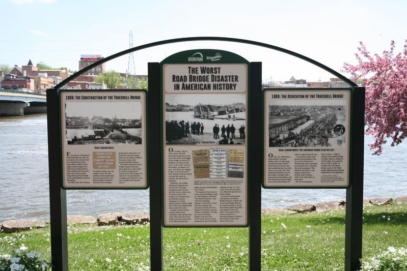
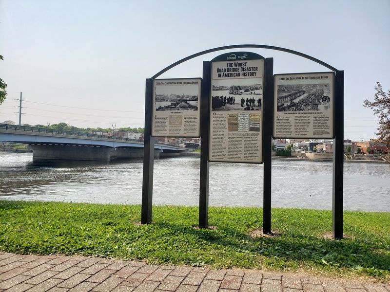
The Worst Road Bridge Disaster in American History
Inscription.
1868: The Construction of the Truesdell Bridge
From Dixon’s founding in 1830 until 1846, the only way to cross the river was by boat or by John Dixon’s ferry. From 1846 to 1868, at least eight wooden bridges were built across the Rock River. None of them survived more than a few years, usually being destroyed by the high water and floating ice jams in the spring.
In 1868, after the washout of another bridge, the city sought a more durable solution and accepted bids from 14 contractors. The Dixon bridge committee selected an iron bridge proposed by contractor L. E. Truesdell, who had already built several bridges in Illinois, but none as long as the proposed bridge in Dixon.
Truesdell’s patented lattice bridge design used many short light pieces that could be easily transported to remote areas. His design was said to be “unequalled for strength and symmetry” and was “rapidly growing into favor.”
1869: The Dedication of the Truesdell Bridge
On Jan. 21, 1869, Dixon dedicated the Truesdell Bridge with a 1⁄2 mile-long parade featuring “Father” John Dixon (see inset), who had established the town with a ferry across the river. The dedication included a test of the bridge’s strength with a large group of bystanders and four harnessed teams hauling stone and a load of flour, all said to weigh at least 45 tons.
“A structure more truly grand and beautiful to the eye can be found in no Western city and we presume in no Eastern one,” reported the local newspaper. The 660-foot structure, a toll bridge, featured an 18-foot-wide roadway with two 5-foot sidewalks on both sides.
The city was largely unaware that, on Dec. 7, 1868, a portion of Truesdell’s bridge at Elgin, Illinois, collapsed. That bridge was repaired, but on July 5, 1869, six months after the Dixon bridge opened, the Elgin bridge collapsed again during Independence Day festivities.
[Thanks to the Loveland Community House and the Lee County Historical and Genealogical Society for their research assistance. Sign erected in 2023.]
1873: The Collapse of the Truesdell Bridge
On Sunday, May 4, 1873, about 150-200 spectators gathered on the west side of the north span of the bridge to observe a baptism ceremony in the river “a few rods” west of the bridge. At about 1:15 p.m., the choir was singing as Rev. J. H. Pratt of the First Baptist Church waded out into the water to conduct the third of six baptisms.
Suddenly, the bridge collapsed, tipping over toward the west and dropping about 18 feet into the water, which was 15-20 feet deep. The bridge’s iron latticework pivoted like scissors, trapping or severely injuring many victims,
while the 15-foot truss imprisoned many under the water.
In spite of many heroic rescues, bodies were constantly retrieved from the water. Days later, five more bodies were recovered as far as 10 miles downstream. Eighty percent of all fatalities were female.
Newspapers from coast to coast carried headlines such as “The Baptism of Death,” “The Dixon Disaster,” and “The Great Bridge Murder.” Only three weeks after the tragedy, the American Society of Civil Engineers formed a special “Dixon committee” to study the causes of bridge failures. The two-year ASCE study led to several proposals to prevent bridge collapses in the U.S. The cause of the Dixon failure was ultimately pinned on a faulty design.
In terms of total deaths and injuries, the Dixon Bridge Disaster is likely the worst road bridge disaster in American history. In all, the collapse killed 46 people and injured at least 56 others. The names of the dead are listed on a memorial plaque in Dixon’s Riverfront on the south bank of the river.
Erected 2023 by Discover Dixon (the Dixon Chamber of Commerce) and the Dixon Park District.
Topics. This historical marker is listed in these topic lists: Bridges & Viaducts • Disasters. A significant historical date for this entry is May 4, 1873.
Location. 41° 50.783′ N, 89° 29.07′ W. Marker is in Dixon, Illinois, in Lee County. It is in Dixon Township. Marker can be reached from North Galena Avenue (U.S. 52) just south of Boyd Street, on the right when traveling south. The marker stands on the grounds of Presidents Park along the riverfront, near the Abraham Lincoln Statue and the Old Settlers Cabin. Touch for map. Marker is at or near this postal address: 103 N Galena Ave, Dixon IL 61021, United States of America. Touch for directions.
Other nearby markers. At least 8 other markers are within walking distance of this marker. Abraham Lincoln (within shouting distance of this marker); 115 West First Street (approx. 0.2 miles away); 105-107 West First Street (approx. 0.2 miles away); 101-103 West First Street (approx. 0.2 miles away); 102 South Galena Avenue (approx. ¼ mile away); 202 West First Street (approx. ¼ mile away); 123 East First Street (approx. ¼ mile away); 212 West First Street (approx. ¼ mile away). Touch for a list and map of all markers in Dixon.
Credits. This page was last revised on September 27, 2023. It was originally submitted on September 13, 2023, by Tom Wadsworth of Dixon, Illinois. This page has been viewed 982 times since then and 306 times this year. Photos: 1, 2. submitted on September 13, 2023, by Tom Wadsworth of Dixon, Illinois. • Devry Becker Jones was the editor who published this page.

