Adams in Berkshire County, Massachusetts — The American Northeast (New England)
The Railroad Solved A Problem / The Railroad Changed Everything
Explore Adams History
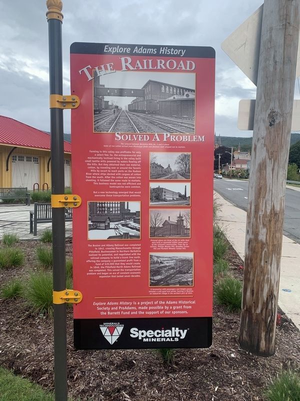
The Railroad Solved A Problem
Farming in this valley was profitable for only a select few. So, the entrepreneurial and mechanically inclined living in the valley built small textile mills powered by waters flowing off the hills. But they obtained their raw material, cotton, by traveling over or around the Taconic Hills by oxcart to reach ports on the Hudson River where ships docked with cargoes of cotton from the south. After the cotton was woven into sheeting it followed the same route to markets. This business model was not efficient and bankruptcies were common.
But a new technology emerged that would overcome these transportation problems. The Boston and Albany already was competes in 1847, crossing Massachusetts through Pittsfield. Businessmen in North Berkshire realized its potential and negotiated with the railroad company to build a trunk line north, offering the company a guaranteed profit from a fund of $20,000 that they would create. In 1846, the Pittsfield-North Adams Railroad was completed. This solved the transportation problem and began an era of constant economic expansion that lasted seven decades.
(photo captions, top to bottom)
- The railyard between Berkshire Mills No. 3 and 4 where bales of raw cotton from Mississippi fields and finished cloth shipped out to markets.
- Pictured above are three of the six mills that were built or expanded within seven years of the railroad' comstruction. From top to bottom, Phillips Woo;en Mill, Bradley Cotton Mill and Pluckett Wheeler Cotton Mill.
- A locomotive with passengers and freight passes between a mill pond and workers housing in Renfrew, an industrial village in the northern part of town.
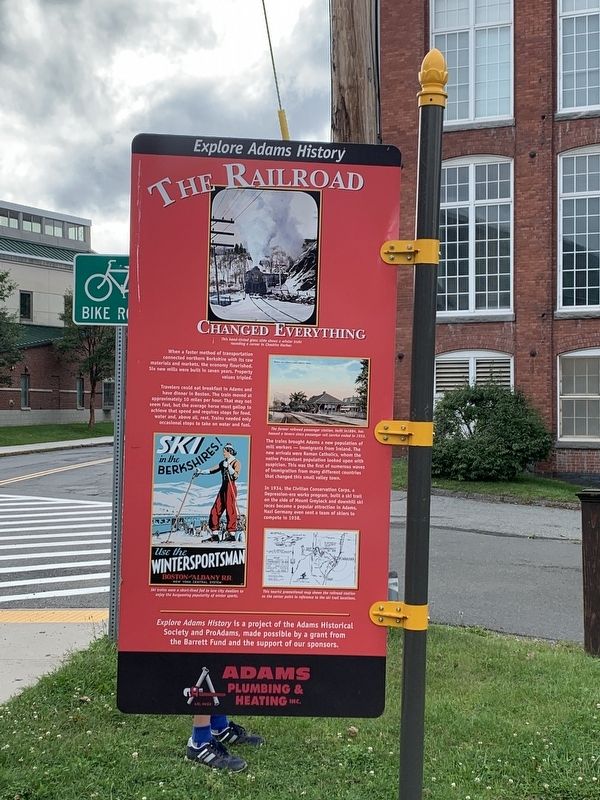
The railroad Changed Everything
When a faster method of transportation connected northern Berkshire with its raw materials and markets, the economy flourished. Six new mills were built in seven years. Property values tripled.
Travelers could eat breakfast in Adams and have dinner in Boston. The train moved ay approximately 10 miles per hour. That may not seem fast, but the average horse must gallop to achieve that speed and requires stops for food water, and above all, rest. Trains needed only occasional stops for water and fuel.
The trains brought Adams a new population of mill workers -- immigrants from Ireland. The new arrivals were Roman Catholics, whom the local Protestant population looked upon with suspicion. This was the first of numerous waves of immigration that changes this small valley town.
In 1934, the Civilian Conservation Corps, a Depression-era works program, built a ski trail on the side of Mount Greylock and downhill ski races became a
popular attraction in Adams. Nazi Germany even sent a set a team of skiers in 1938.
(photo captions, top to bottom)
- This hand-tinted glass slide shows a winter train rounding a curve in Chesire Harbor.
- The former railroad passenger station , built in 1854, has housed a tavern since passenger rail service ended in 1953.
- Ski trains were a short lived fad to lure city dwellers to enjoy the burgeoning popularity of winter sports.
- This tourist promotional map shows the railroad station as the center point to the ski trail locations.
Explore Adams History is a project of the Adams Historical Society and ProAdams, made possible by a grant from the Barrett Fund and support of our sponsors.
Erected by Adams Historical Society, ProAdams.
Topics. This historical marker is listed in these topic lists: Industry & Commerce • Railroads & Streetcars. A significant historical year for this entry is 1847.
Location. 42° 37.503′ N, 73° 7.044′ W. Marker is in Adams, Massachusetts, in Berkshire County. Marker is on Hoosac Street east of Columbia Street (Massachusetts Route 8), on the right when traveling west. Located next to Adams Station and the Ashuwillticook Rail Trail. Touch for map. Marker is at or near this postal address: 4 Hoosac Street, Adams MA 01220, United States of America. Touch for directions.
Other nearby markers. At least 8 other markers are within walking distance of this marker. Big Business of Cotton Cloth / Working in the Berkshires (within shouting distance of this marker); William McKinley (about 800 feet away, measured in a direct line); Why McKinley? / A Library & Civil War Veterans (approx. 0.2 miles away); War Memorial (approx. 0.2 miles away); Columbia World War I Memorial Park (approx. 0.2 miles away); Maple Street Cemetery (approx. 0.2 miles away); Civil War Memorial (approx. 0.2 miles away); Prosperity! (approx. 0.3 miles away). Touch for a list and map of all markers in Adams.
Credits. This page was last revised on September 24, 2023. It was originally submitted on September 15, 2023, by Steve Stoessel of Niskayuna, New York. This page has been viewed 59 times since then and 10 times this year. Photos: 1, 2, 3, 4. submitted on September 15, 2023, by Steve Stoessel of Niskayuna, New York. • Michael Herrick was the editor who published this page.


