Harsens Island in St. Clair County, Michigan — The American Midwest (Great Lakes)
Stewart Farm / Memoir of Aura Stewart
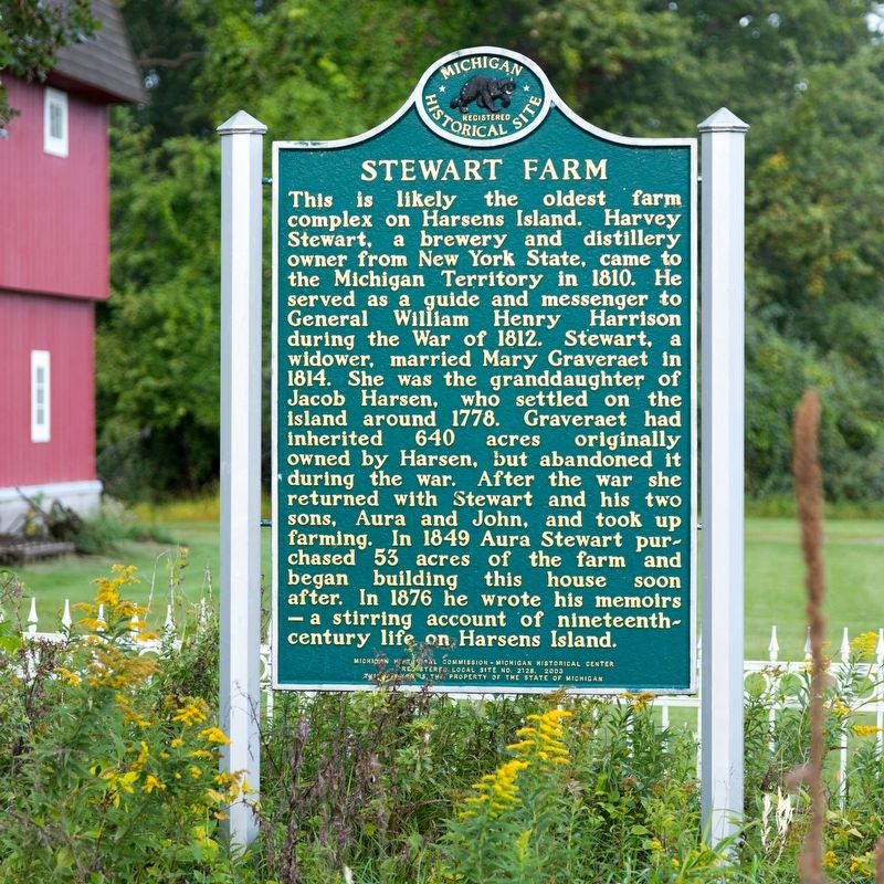
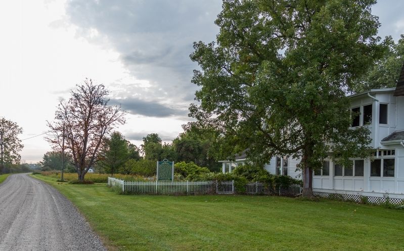
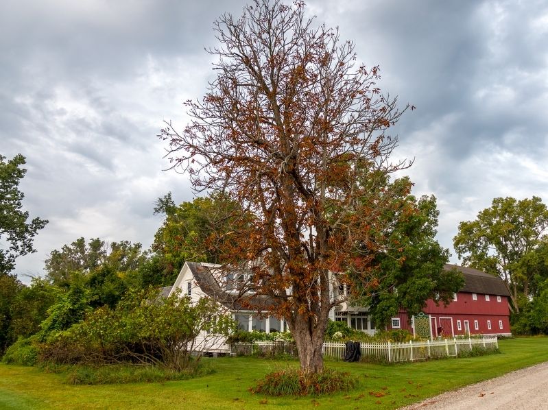
Stewart Farm. This is likely the oldest farm complex on Harsens Island. Harvey Stewart, a brewery and distillery owner from New York State, came to the Michigan Territory in 1810. He served as a guide and messenger to General William Henry Harrison during the War of 1812. Stewart, a widower, married Mary Graveraet in 1814. She was the granddaughter of Jacob Harsen, who settled on the island around 1778. Graveraet had inherited 640 acres originally owned by Harsen, but abandoned it during the war. After the war she returned with Stewart and his two sons, Aura and John, and took up farming. In 1849 Aura Stewart purchased 53 acres of the farm and began building this house soon after. In 1876 he wrote his memoirs a stirring account of nineteenth-century life on Harsens Island.
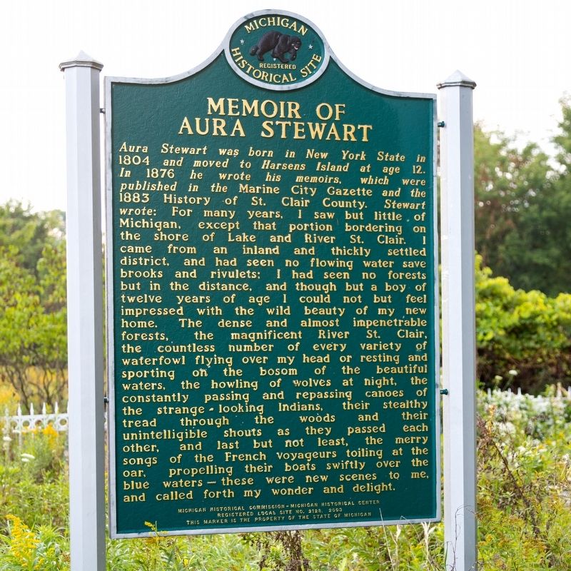
Memoir of Aura Stewart. Aura Stewart was born in New York State in 1804 and moved to Harsens Island at age 12. In 1876 he wrote his memoirs, which were published in the Marine City Gazette and the 1883 History of St. Clair County. Stewart wrote: For many years, I saw but little of Michigan, except that portion bordering on the shore of Lake and River St. Clair. I came from an inland and thickly settled district, and had seen no flowing water save brooks and rivulets; I had seen no forests but in the distance, and though but a boy of twelve years of age I could not but feel impressed with the wild beauty of my new home. The dense and almost impenetrable forests, the magnificent River St. Clair, the countless number of every variety of waterfowl flying over my head or resting and sporting on the bosom of the beautiful waters, the howling of wolves at night, the constantly passing and repassing canoes of the strange-looking Indians, their stealthy tread through the woods and their unintelligible shouts as they passed each other, and last but not least, the merry songs of the French voyageurs toiling at the oar, propelling their boats swiftly over the blue waters — these were new scenes to me, and called forth my wonder and delight.
Erected 2003 by Michigan Historical Commission-Michigan History Center. Registered local site No. 2128. This marker is the property of the State of Michigan. (Marker Number 2128.)
Topics. This historical marker is listed in these topic lists: Arts, Letters, Music • Horticulture & Forestry • Settlements & Settlers. A significant historical year for this entry is 1810.
Location. 42° 36.567′ N, 82° 34.303′ W. Marker is on Harsens Island, Michigan, in St. Clair County. Marker is on Stewart Road west of Columbine Road (Michigan Route 154), on the left when traveling west. Touch for map. Marker is at or near this postal address: 2007 Stewart Rd, Harsens Island MI 48028, United States of America. Touch for directions.
Other nearby markers. At least 8 other markers are within 3 miles of this marker, measured as the crow flies. Harsen House (approx. 0.3 miles away); St. John's Marsh Project (approx. 2.1 miles away); Water Speed Capital (approx. 2.1 miles away); Christopher Columbus Smith / Garfield A. "Gar" Wood (approx. 2.1 miles away); Saint Andrew's Parish / Saint Andrew's Church (approx. 2.2 miles away); Clay Township Library (approx. 2.2 miles away); Algonac Civil War / Vietnam Memorial (approx. 2.3 miles away); Colony Tower (approx. 2.7 miles away).
More about this marker. This marker is on Harsens Island, on the U.S. side of the St. Clair River on the northern end of Lake St. Clair. The island is reached by auto ferry from Algonac. The ferry dock is at 3647 Pointe Tremble Road (Michigan Route 29). The ferry itself is signed for Michigan Route 154, which is the main road on the island. Fare is $15 per vehicle going and no charge returning. The three-lane 10 to 12 car ferry departs every 15 minutes during the day for a five minute ride, sooner if it fills. Check the website for the Harsens Island Ferry for operating hours.
Also see . . .
1. A History of Stewart Farm. Compiled by Robert Williams, May 2004. The quote on the marker is continued here:
I have witnessed the improvements made in the county of St. Clair; flourishing towns have sprung up, and a large portion of our older settlers have become wealthy; all have shared in the conveniences of modern improvements and comforts, but yet, for my own part, I could enjoy no greater pleasure that for a short time to see Michigan as I saw it in 1815, wild and romantic as it then was; to traverse its dense forests, to paddle my canoe over its waters, surrounded by game of every description on river, lake and shore; and at night, while partaking of a supper of game taken through the day, hear the howling of the wolves, the hooting owls and other voices of the night. Fancy ofttimes leads me back to the dear old primitive days, and then I am a boy again. Alas, the vision lingers not! I am an old man with increasing infirmities, and nothing is left to me but the memories of the past.(Submitted on September 26, 2023.)
2. History of St. Clair County Michigan . 1883 book which includes the Memoirs of Aura P. Stewart, beginning on page 272. (Submitted on September 26, 2023.)
Credits. This page was last revised on September 26, 2023. It was originally submitted on September 26, 2023, by J. J. Prats of Powell, Ohio. This page has been viewed 56 times since then and 11 times this year. Photos: 1, 2, 3, 4. submitted on September 26, 2023, by J. J. Prats of Powell, Ohio.


