Prince William Forest Park in Montclair in Prince William County, Virginia — The American South (Mid-Atlantic)
Pyrite Mine
— National Park Service, U.S. Department of the Interior —
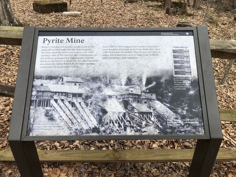
"Before I will give you another penny, I will let the shafts fill up with water and the frogs jump in," the mine superintendent told workers who were seeking a raise of 50 cents per day. Unbeknownst to the workers, a cheaper but higher grade of pyrite had been discovered in Spain. So, the superintendent shut down the Cabin Branch Pyrite Mine that was located here along the Quantico Creek.
From 1889 to 1919, miners from nearby communities used dynamite to extract pyrite from shafts more than 1,000 feet below the surface. The ore was mined for its sulfur, which industries used to make soap, fertilizer, paper, medicines, and explosives.
[Captions:]
In 1919 miners received $3.50 to $4.25 per day. Some of their pay consisted of coupons redeemable only at the company store.
The Cabin Branch Pyrite Mine consisted of more than 70 buildings and had 250 employees.
Erected by National Park Service, U.S. Department of the Interior.
Topics. This historical marker is listed in this topic list: Industry & Commerce. A significant historical year for this entry is 1889.
Location. 38° 34.636′ N, 77° 21.153′ W. Marker is in Montclair, Virginia, in Prince William County. It is in Prince William Forest Park. Marker is on Pyrite Mine Road, 0.7 miles east of Scenic Drive, on the left when traveling east. Touch for map. Marker is at or near this postal address: 17200 Pyrite Mine Rd, Dumfries VA 22025, United States of America. Touch for directions.
Other nearby markers. At least 8 other markers are within 2 miles of this marker, measured as the crow flies. Reclaiming the Land (approx. ¼ mile away); Old Cabin Branch / Clarkson School (approx. 0.3 miles away); Little Union Baptist Church (approx. 0.3 miles away); a different marker also named Little Union Baptist Church (approx. 0.3 miles away); Pyrite Mine Road (approx. 0.7 miles away); Mary Bird Branch Trail (approx. 1.1 miles away); White Oak (approx. 1.2 miles away); Eastern Red Cedar (approx. 1.2 miles away).
Credits. This page was last revised on October 23, 2023. It was originally submitted on March 12, 2021, by Devry Becker Jones of Washington, District of Columbia. This page has been viewed 116 times since then and 12 times this year. Last updated on October 3, 2023, by N. Jozsa of Woodbridge, Virginia. Photos: 1, 2. submitted on March 12, 2021, by Devry Becker Jones of Washington, District of Columbia.

