Wertheim in Main-Tauber-Kreis, Baden-Württemberg, Germany — Central Europe
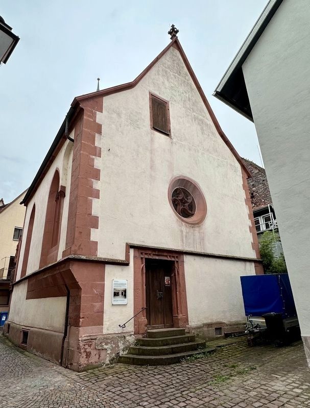
Marienkapelle / Marian Chapel (former synagogue)

Photographed By Andrew Ruppenstein, September 18, 2023
1. Marienkapelle / Marian Chapel (former synagogue) Marker
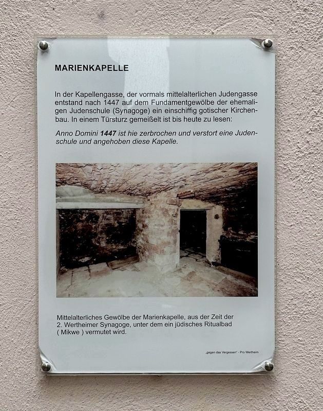
The caption to the photo reads (in translation): Medieval vault of the Marian Chapel, from the period of second Wertheim Synagogue, under which a Jewish ritual bath (Mikvah) is thought to be located. (Click on photo to enlarge)
In der Kapellengasse, der vormals mittelalterlichen Judengasse entstand nach 1447 auf dem Fundamentgewölbe der ehemaligen Judenschule (Synagoge) ein einschiffig gotischer Kirchenbau. In einem Türsturz gemeißelt ist bis heute zu lesen: Anno Domini 1447 ist hie zerbrochen und verstort eine Judenschule und angehoben diese Kapelle.
Mittelalterliches Gewölbe der Marienkapelle, aus der Zeit der 2. Wertheimer Synagoge, unter dem ein jüdisches Ritualbad (Mikwe) vermutet wird.
In Kapellengasse (“Chapel Lane”), the former medieval Judengasse (“Jews Lane”), a single-nave Gothic church building was built after 1447 on the foundation vault of the former Jewish school (synagogue). Carved into a lintel you can still read today: Anno Domini 1447 a Jewish school was broken and destroyed here and this chapel was raised.
Erected 2016 by Gegen das Vergessen - Pro Wertheim.
Topics. This historical marker is listed in this topic list: Churches & Religion. A significant historical year for this entry is 1447.
Location. 49° 45.575′ N, 9° 30.976′ E. Marker is in Wertheim, Baden-Württemberg, in Main-Tauber-Kreis. Marker is on Kapellengasse, on the right when traveling east. Touch for map. Marker is at or near this postal address: Kapellengasse 1, Wertheim BW 97877, Germany. Touch for directions.
Other nearby markers. At least 6 other markers are within 23 kilometers of this marker, measured as the crow flies. Kilianskapelle / Kilians Chapel (about 120 meters away, measured in a direct line); Heinrich-Hofmann-Haus (about 150 meters away); Kallenbach’sches Haus / Kallenbach House (about 180 meters away); Spitzer Turm / Spitzer Tower (about 210 meters away); Alte Schmiede / Former Metal Works (approx. 11.3 kilometers away in Bayern); Herzlich Welkommen in Duttenbrunn / Welcome to Duttenbrunn (approx. 21.3 kilometers away in Bayern).
Also see . . . Zur Geschichte der jüdischen Gemeinde (Alemannia-Judaica).
On Wertheim’s synagogues (in translation): Over the course of its 700-year history, the community has had five synagogues. A document from Count Johann I von Wertheim dated December 24, 1381 provides information about the location of the two oldest synagogues. John I granted the Jews of Wertheim tax exemption for a property, more precisely a farm including a farmstead. It is said that it is the “old Jewish school” and that it is “located in the Judengasse in Wertheim”. The Jews should have their “school” here again. The document shows that there was already an old and a new Jewish school at that time. Both were in the same place. One can assume that the first synagogue was destroyed during the persecution in 1349 and a few years later a new, second synagogue was built on the same site. However, this did not last long as it was destroyed by the Christian population in 1447. In its place, the Marienkapelle (still located in Kapellengasse) was built in 1452, where the inscription can still be read: "Anno Domoni 1447, a Jewish school was broken and destroyed here and this chapel was raised". The inscription refers to the location of these first two synagogues, which were then in Judengasse, now Kapellengasse. In contrast to the later location, this was very close to the center of the city, the market square.(Submitted on October 5, 2023.)
Credits. This page was last revised on October 5, 2023. It was originally submitted on October 5, 2023, by Andrew Ruppenstein of Lamorinda, California. This page has been viewed 49 times since then and 16 times this year. Photos: 1, 2. submitted on October 5, 2023, by Andrew Ruppenstein of Lamorinda, California.
