Saint Anthony Main in Minneapolis in Hennepin County, Minnesota — The American Midwest (Upper Plains)
From Power Plant to Light Switch
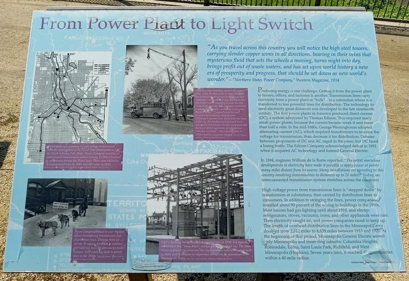
"As you travel across this country you will notice the high steel towers, carrying slender copper wires in all directions, bearing in their veins that mysterious fluid that sets the wheels a moving, turns night into day, brings profit out of waste waters, and has set upon world history a new era of prosperity and progress, that should be set down as a new world's wonder." — "Northern States Power Company," Western Magazine, 1914
Producing energy is one challenge. Getting it from the power plant to homes, offices, and factories is another. Transmission lines carry electricity from a power plant in "bulk"—to a substation were it is transferred to less powerful lines for distribution. The technology to send electricity great distances was developed in the late nineteenth century. The first power plants in America produced direct current (DC), a system advocated by Thomas Edison. This required many small power plants, because the current became weak if sent more than half a mile. In the mid-1880s, George Westinghouse adopted alternating current (AC), which required transformers to increase the voltage for transmission, then decrease it for distribution. Debates between proponents of DC and AC raged in the press, but DC faced a losing battle. The Edison Company acknowledged defeat in 1892 when it acquired AC technology and formed General Electric.
In 1894, engineer William de la Barre reported: "The recent marvelous developments in electricity have made it possible to apply power at points many miles distant from its source. Many installations are operating in this country involving transmissions to distances up to 26 miles." Today, an interconnected transmission system stretches across the continent.
High voltage power from transmission lines is "stepped down" by transformers at substations, then carried by distribution lines to consumers. In addition to stringing the lines, power companies installed about 90 percent of the wiring in buildings in the 1890s. Most houses had gas lighting until about 1910, and electric refrigerators, stoves, vacuums, irons, and other appliances were rare. Then electricity caught on, and power companies raced to keep up. The length of overhead distribution lines in the Minneapolis area doubled from 2,312 miles to 4.639 miles between 1913 and 1920. At the beginning of that period, Minneapolis General Electric served only Minneapolis and inner-ring suburbs: Columbia Heights, Robinsdale, Edina, Saint Louis Park, Richfield, and West Minneapolis (Hopkins). Seven years later, it reached 49 communities within a 40-mile radius.
Minneapolis was a pioneer in high-voltage transmission. With the development
of the Lower Dam power plant in 1897, the Saint Anthony Falls Water Power Company installed an underground transmission system to bring 12,000-volt power to substations around the Twin Cities. There were 148 miles of underground lines by 1913, and 507 miles by 1920. Minneapolis General Electric Company's System in Electric World, April 27, 1912
Power companies must be ever vigilant about maintaining transmission and distribution lines. Damage from ice storms in winter, tornados in summer, and toppling trees all year causes power outages. NSP used dog sleds to patrol lines in the 1920s. Photo by Brown's Photo Studios, Minnesota Historical Society
These men were installing a power line pole in 1936. A few decades earlier in Saint Paul, this was particularly dangerous work because two companies—Consumers Power and Saint Paul Gas Light—were competing to serve the city. "Line crews from the two companies sometimes engaged in hostilities," according to historian Herbert Meyer. "Competition of this sort proved to be extremely costly because distribution systems were duplicated over most of the city. Eventually a sort of armed truce was established between the two companies and the more violent aggressive manifestations subsided somewhat." Peace finally came in 1925 when the companies merged. Photo by Norton and Peel, Minnesota Historical Society
NSP's Snelling Substation, photographed here in 1930, is a typical installation that "steps down" voltage for neighborhood use. The Main Street hydroelectric plant was the city's primary substation when built in 1894, and it remains an important substation for downtown Minneapolis today. Photo by North and Peel, Minnesota Historical Society
Topics. This historical marker is listed in this topic list: Industry & Commerce. A significant historical year for this entry is 1885.
Location. 44° 58.977′ N, 93° 15.351′ W. Marker is in Minneapolis, Minnesota, in Hennepin County. It is in Saint Anthony Main. Marker can be reached from SE Main Street. The marker is in Water Power Park. Touch for map. Marker is at or near this postal address: 204 SE Main Street, Minneapolis MN 55414, United States of America. Touch for directions.
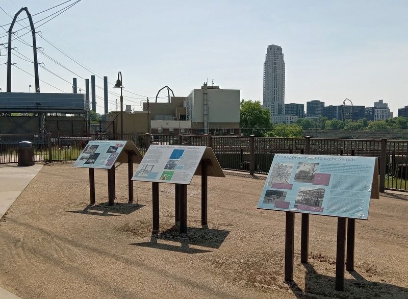
Other nearby markers. At least 8 other markers are within walking distance of this marker. The Spin on Turbines and Generators (here, next to this marker); A Complex Family Tree (here, next to this marker); A Tale of Two Waterpower Companies (within shouting distance of this marker); Beneath Your Feet (within shouting distance of this marker); Hydroelectricity Comes of Age (within shouting distance of this marker); Reshaping the Island (within shouting distance of this marker); Hydroelectricity: The Early Years (within shouting distance of this marker); The Falls Evolve (about 400 feet away, measured in a direct line). Touch for a list and map of all markers in Minneapolis.
Credits. This page was last revised on March 25, 2024. It was originally submitted on October 7, 2023, by McGhiever of Minneapolis, Minnesota. This page has been viewed 116 times since then and 7 times this year. Photos: 1, 2. submitted on October 7, 2023, by McGhiever of Minneapolis, Minnesota. • J. Makali Bruton was the editor who published this page.

