
Ridgefield in Western Region, Connecticut — The American Northeast (New England)
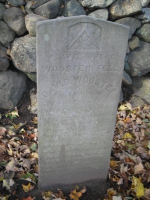
Place Where Wooster Fell
Photographed by Bill Coughlin, October 17, 2009
1. Place Where Wooster Fell Marker
Born in Stratford March 13, 1711
Mortally wounded April 27, 1777
while defending the liberties of America
and nobly died at Danbury May 2, 1777.
Give me Liberty of give me death.
Topics. This historical marker is listed in this topic list: War, US Revolutionary. A significant historical date for this entry is March 13, 1906.
Location. 41° 18.317′ N, 73° 30.528′ W. Marker is in Ridgefield in Western Region, Connecticut. It is on N Salem Road (Connecticut Route 116), on the right when traveling south. Touch for map. Marker is in this post office area: Ridgefield CT 06877, United States of America. Touch for directions.

Regionally, this marker is on the Connecticut Shoreline, on the Gold Coast, and in Greater Bridgeport. It is also in the American Northeast and in New England. Globally, it is in North America, the Western Hemisphere, the Western World, and the Anglosphere. Historically, it finds itself in what was once Fairfield County and also one of the original Thirteen Colonies.
Other nearby markers. At least 8 other markers are within 2 miles of this marker, measured as the crow
this page online
Also see . . .
1. Biography of General David Wooster. (Submitted on October 18, 2009, by Bill Coughlin of Woodland Park, New Jersey.)
2. Battle of Ridgefield. Wikipedia entry (Submitted on July 10, 2021, by Larry Gertner of New York, New York.)
3. Battle of Ridgefield. Keeler Tavern Museum website entry (Submitted on July 10, 2021, by Larry Gertner of New York, New York.)
Photographed by Bill Coughlin, October 17, 2009
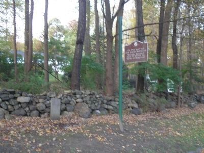
2. Markers on N Salem Road
Photographed by Bill Coughlin, October 17, 2009
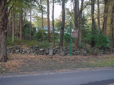
3. Place Where Wooster Fell Markers
The marker is located at the site of the second engagement of the April 27, 1777 Battle of Ridgefield.
Photographed by Bill Coughlin, October 17, 2009
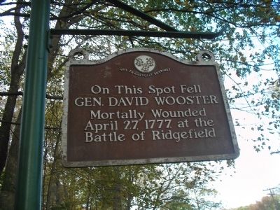
4. Nearby Marker
A second marker noting the place where Gen. Wooster fell is located next to the tablet.
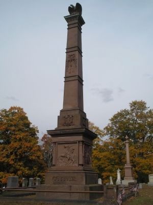
Photographed by Bill Coughlin, October 17, 2009
5. Grave of Gen. David Wooster
Gen. Wooster died 5 days after his wounding at the Battle of Ridgefield. He is buried in Wooster Cemetery in Danbury.
Credits. This page was last revised on May 19, 2026. It was originally submitted on October 18, 2009, by Bill Coughlin of Woodland Park, New Jersey. This page has been viewed 1,607 times since then and 69 times this year. Photos: 1, 2, 3, 4, 5. submitted on October 18, 2009, by Bill Coughlin of Woodland Park, New Jersey.
Editor’s want-list for this marker. Complete text from marker. • Can you help?
