Freeport, The Bahamas — North Atlantic (Lucayan Archipelago of the West Indies)
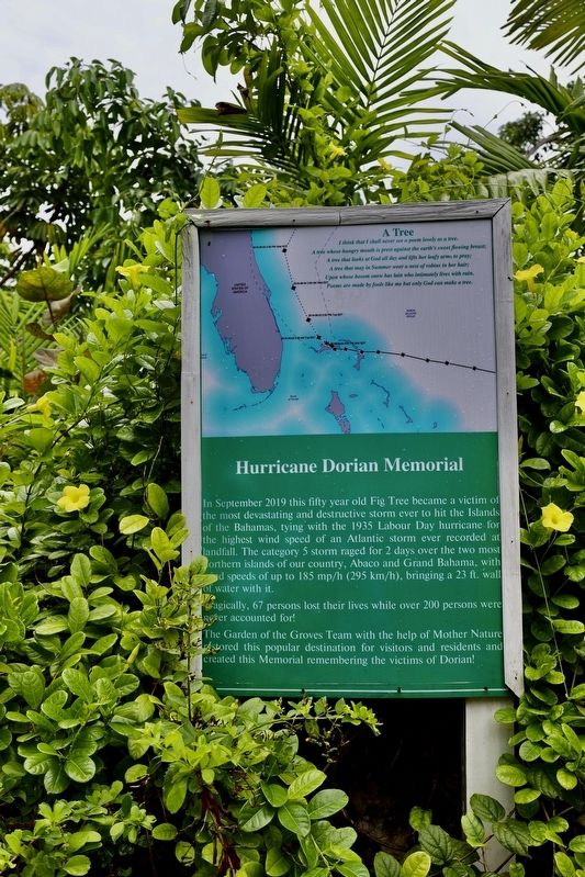
Hurricane Dorian Memorial
In September 2019 this fifty-year-old Fig Tree became a victim of the most devastating and destructive storm ever to hit the Islands of the Bahamas, tying with the 1935 Labour Day hurricane for the highest wind speed of an Atlantic storm ever recorded at landfall. The category 5 storm raged for 2 days over the two most northern islands of our country, Abaco and Grand Bahama, with land speeds of up to 185 mp/h (295 km/h), bringing a 23 ft. wall of water with it.
Tragically, 67 persons lost their lives over 200 persons were never accounted for!
The Garden of the Groves Team with the help of Mother Nature restored this popular destination for visitors and residents and created this Memorial remembering the victims of Dorian!
A Tree
I think that I shall never see a poem as lovely as a tree.
A tree whose hungry mouth is pressed against the earth's sweet flowing breast;
A tree that looks at God all day and lifts her leafy arms to pray;
A tree that may in Summer wear a nest of robins in her hair;
Upon whose bosom snow has lain who intimately lives with rain.
Poems are made by fools like me but only God can make a tree.
Topics. This historical marker and memorial is listed in this topic list: Disasters. A significant historical date for this entry is September 3, 2019.
Location. 26° 33.157′ N, 78° 34.4′ W. Marker is in Freeport. Marker is on Magellan Drive. Marker is located at the entrance to the Garden. Touch for map. Touch for directions.
Other nearby markers. At least 6 other markers are within 21 kilometers of this marker, measured as the crow flies. Wallace and Georgette Groves (about 120 meters away, measured in a direct line); Welcome to the Labyrinth (about 120 meters away); Sir Winston Leonard Spencer Churchill (about 150 meters away); Burial Mound Cave (approx. 18 kilometers away in East Grand Bahama); Ben's Cave (approx. 18 kilometers away in East Grand Bahama); Pineridge Locomotive Axle (approx. 20.1 kilometers away in West Grand Bahama).
Also see . . . ‘Total devastation': Hurricane slams parts of the Bahamas (Associated Press, September 3, 2019). (Submitted on October 19, 2023.)
Credits. This page was last revised on October 19, 2023. It was originally submitted on October 19, 2023, by Sandra Hughes Tidwell of Killen, Alabama, USA. This page has been viewed 41 times since then and 9 times this year. Photo 1. submitted on October 19, 2023, by Sandra Hughes Tidwell of Killen, Alabama, USA. • Andrew Ruppenstein was the editor who published this page.
Editor’s want-list for this marker. Wide shot of photo of marker in context • Can you help?
