Deadwood in Lawrence County, South Dakota — The American Midwest (Upper Plains)
Early Placer Mining Operations in Deadwood
— A Trail to Deadwood's Past —
Inscription.
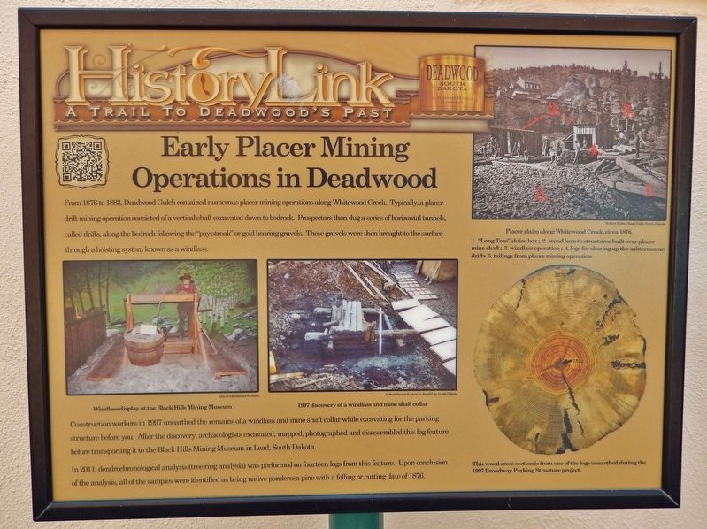
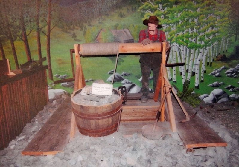
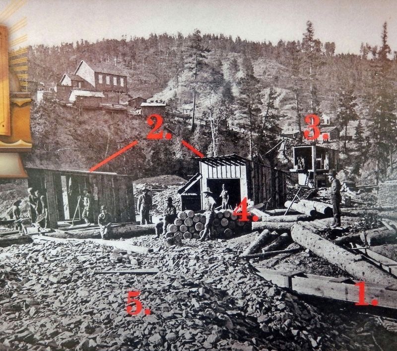
From 1876 to 1883, Deadwood Gulch contained numerous placer mining operations along Whitewood Creek. Typically, a placer drift mining operation consisted of a vertical shaft excavated down to bedrock. Prospectors then dug a series of horizontal tunnels, called drifts, along the bedrock following the "pay streak" or gild bearing gravels. These gravels were then brought to the surface through a hoisting system known as a windlass.
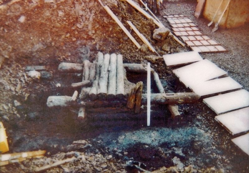
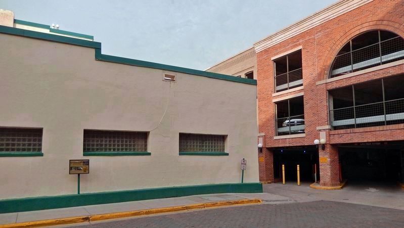
Construction workers in 1997 unearthed the remains of a windlass and mine shaft collar while excavating for the parking structure before you. After the discovery, archaeologists excavated, mapped, photographed and disassembled this log feature before transporting it to the Black Hills Mining Museum in Lead, South Dakota.
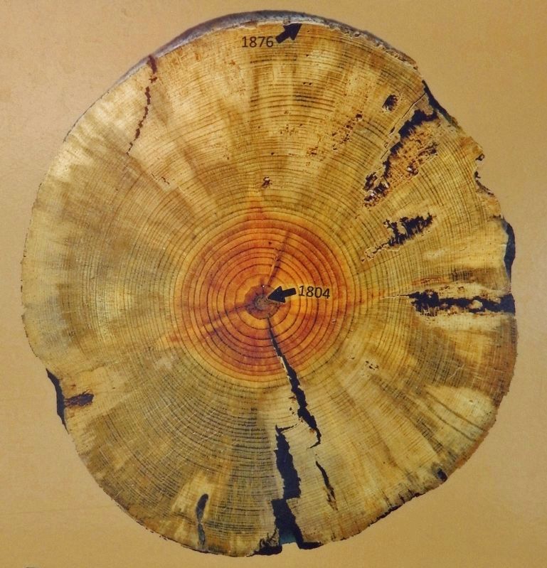
In 2011, dendrochronological analysis (tree ring analysis) was performed on fourteen logs from this feature. Upon conclusion of the analysis, all of the samples were identified as being native ponderosa pine with a felling or cutting date of 1876.
Erected by Deadwood Historic Preservation Commission.
Topics. This historical marker is listed in these topic lists: Industry & Commerce • Settlements & Settlers. A significant historical year for this entry is 1876.
Location. 44° 22.683′ N, 103° 43.773′ W. Marker is in Deadwood, South Dakota, in Lawrence County. Marker is on Wall Street just west of Main Street, on the left when traveling west. Marker is located along the sidewalk on the north side of the building at this address. Touch for map. Marker is at or near this postal address: 634 Main Street, Deadwood SD 57732, United States of America. Touch for directions.
Other nearby markers. At least 8 other markers are within walking distance of this marker. Jewish American Pioneers and Deadwood (a few steps from this marker); The Badlands (a few steps from this marker); Historic Site Saloon Number 10 (within shouting distance of this marker); Wall & Main Street: Commercial Center (within shouting distance of this marker); Historic Facade Replication (within shouting distance of this marker); Broadway Street (about 400 feet away, measured in a direct line); Deadwood 1876 (about 400 feet away); Forest Hill (about 400 feet away). Touch for a list and map of all markers in Deadwood.
Also see . . . Deadwood, South Dakota. (This Western Mining History article features numerous excellent 1870's photographs.)
Excerpt:
The first miners in the Deadwood area came in two separate parties late in the summer of 1875. One included William Smith who broke a trail from Montana and found a small amount of gold near the mouth of a creek. They named the creek Whitewood for the thick growth of cottonwood timber. The other party, including A.S. Blanchard, came from Custer and dug through a gulch of dead timber — giving the name Deadwood to the creek — and found rich placer deposits.(Submitted on October 20, 2023, by Cosmos Mariner of Cape Canaveral, Florida.)The average placer mine in Deadwood employed around six men and paid wages of $4 to $7 per day for experienced miners. Gold dust was the accepted currency, at $20 per ounce. Following Montana Gulch mining rules, placer claims were limited to 300 feet in length along gulches with a width “from rim rock to rim rock.”
Courtesy Robert Kolbe, Sioux Falls, South Dakota
4. Marker detail: Placer claim along Whitewood Creek, circa 1876
1. "Long Tom" sluice box; 2. wood lean-to structures built over placer mine shaft; 3. windlass operation; 4. logs for shoring up the subterranean drifts; 5. tailings from placer mining operation
Credits. This page was last revised on October 20, 2023. It was originally submitted on October 19, 2023, by Cosmos Mariner of Cape Canaveral, Florida. This page has been viewed 63 times since then and 13 times this year. Photos: 1, 2, 3, 4, 5, 6. submitted on October 19, 2023, by Cosmos Mariner of Cape Canaveral, Florida.
