Scotlandville in Baton Rouge in East Baton Rouge Parish, Louisiana — The American South (West South Central)
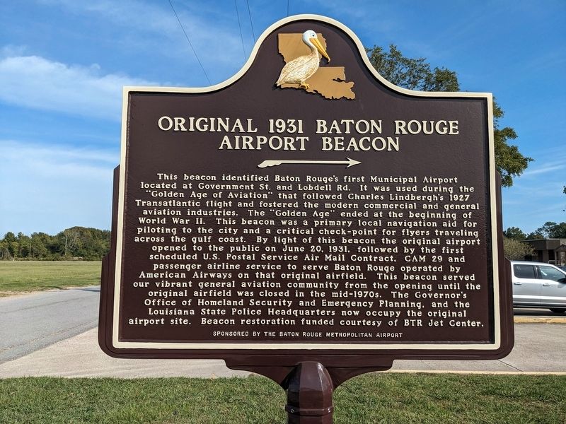
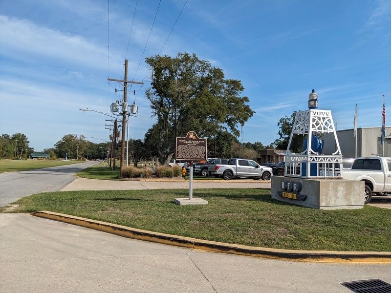
Original 1931 Baton Rouge Airport Beacon
⟼
Inscription.
This beacon identified Baton Rouge's first Municipal Airport located at Government St. and Lobdell Rd. It was used during the "Golden Age of Aviation" that followed Charles Lindbergh's 1927 Transatlantic flight and fostered the modern commercial and general aviation industries. The "Golden Age" ended at the beginning of World War II. This beacon was a primary local navigation aid for piloting to the city and a critical check-point for flyers traveling across the gulf coast. By light of this beacon the original airport opened to the public on June 20. 1931. followed by the first scheduled U.S. Postal Service Air Mail Contract, CAM 29 and passenger airline service to serve Baton Rouge operated by American Airways on that original airfield. This beacon served our vibrant general aviation community from the opening until the original airfield was closed in the mid-1970s. The Governor's Office of Homeland Security and Emergency Planning, and the Louisiana State Police Headquarters now occupy the original airport site. Beacon restoration funded courtesy of BTR Jet Center.
Erected by Baton Rouge Metropolitan Airport.
Topics. This historical marker is listed in this topic list: Air & Space.
Location. 30° 31.874′ N, 91° 8.646′ W. Marker is in Baton Rouge, Louisiana, in East Baton Rouge Parish. It is in Scotlandville. Marker is on Blanche Noyes Avenue, half a mile west of Plank Road (Louisiana Highway 67). Touch for map. Marker is at or near this postal address: 4490 Blanche Noyes Ave, Baton Rouge LA 70807, United States of America. Touch for directions.
Other nearby markers. At least 8 other markers are within 3 miles of this marker, measured as the crow flies. Southern University (approx. 2.2 miles away); Camphor Memorial United Methodist Church (approx. 2.3 miles away); Baron Keith Jackson (approx. 2.7 miles away); Jacklyn Winfield (approx. 2.8 miles away); Isiah "Butch" Robertson (approx. 2.8 miles away); Aeneas Williams (approx. 2.8 miles away); Ben Jobe (approx. 2.8 miles away); Willie Davenport (approx. 2.8 miles away). Touch for a list and map of all markers in Baton Rouge.
Credits. This page was last revised on October 24, 2023. It was originally submitted on October 21, 2023, by Cajun Scrambler of Assumption, Louisiana. This page has been viewed 69 times since then and 24 times this year. Photos: 1, 2. submitted on October 21, 2023, by Cajun Scrambler of Assumption, Louisiana.

