Durand in Hamilton, Ontario — Central Canada (North America)
MacNab-Charles Heritage Conservation District
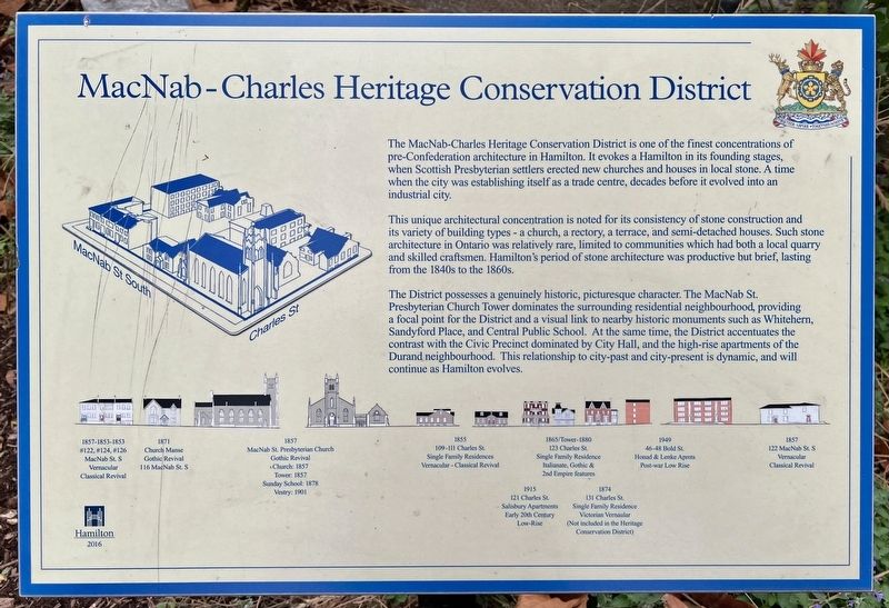
The MacNab-Charles Heritage Conservation District is one of the finest concentrations of pre-Confederation architecture in Hamilton. It evokes a Hamilton in its founding stages, when Scottish Presbyterian settlers erected new churches and houses in local stone. A time when the city was establishing itself as a trade centre, decades before it evolved into an industrial city.
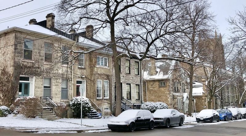
This unique architectural concentration is noted for its consistency of stone construction and its variety of building types - a church, a rectory, a terrace, and semi-detached houses. Such stone architecture in Ontario was relatively rare, limited to communities which had both a local quarry and skilled craftsmen. Hamilton's period of stone architecture was productive but brief, lasting from the 1840s to the 1860s.
The District possesses a genuinely historic, picturesque character. The MacNab St. Presbyterian Church Tower dominates the surrounding residential neighbourhood, providing a focal point for the District and a visual link to nearby historic monuments such as Whitehern, Sandyford Place, and Central Public School. At the same time, the District accentuates the contrast with the Civic Precinct dominated by City Hall, and the high-rise apartments of the Durand neighbourhood. This relationship to city-past and city-present is dynamic, and will continue as Hamilton evolves.
Erected 2016 by City of Hamilton.
Topics. This historical marker is listed in these topic lists: Architecture • Settlements & Settlers.
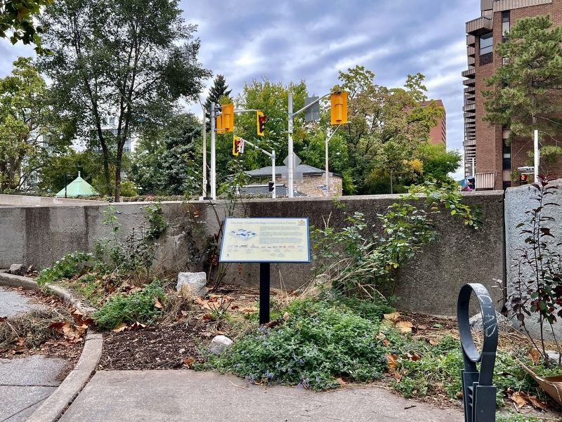
Location. 43° 15.232′ N, 79° 52.315′ W. Marker is in Hamilton, Ontario. It is in Durand. Marker is at the intersection of MacNab Street South and Hurst Place, on the right when traveling north on MacNab Street South. Touch for map. Marker is in this post office area: Hamilton ON L8P 3C2, Canada. Touch for directions.
Other nearby markers. At least 8 other markers are within walking distance of this marker. Whitehern (about 90 meters away, measured in a direct line); a different marker also named Whitehern (about 120 meters away); The Toronto, Hamilton & Buffalo Railway (about 120 meters away); St. Paul’s Presbyterian Church / L’église Presbytérienne St. Paul (about 180 meters away); St. Paul’s Church (about 180 meters away); Sandyford Place (about 240 meters away); Dedicated to the Irish Who Settled in Hamilton (approx. 0.2 kilometers away); The First Telephone Exchange in the British Empire (approx. 0.3 kilometers away). Touch for a list and map of all markers in Hamilton.
Also see . . . University of Waterloo - Heritage Conservation District Study MacNab-Charles - City of Hamilton. While stone architecture was relatively rare in Ontario, Hamilton’s Mountain offered a ready supply of limestone. The local resource was used to great advantage in the hands of the newly-arrived Scottish stonemasons, establishing pre-Confederation Hamilton as a city renowned for its wealth of handsome stone architecture. (Submitted on October 21, 2023, by Tim Boyd of Hamilton, Ontario.)
Credits. This page was last revised on October 22, 2023. It was originally submitted on October 21, 2023, by Tim Boyd of Hamilton, Ontario. This page has been viewed 82 times since then and 22 times this year. Photos: 1, 2, 3, 4, 5, 6. submitted on October 21, 2023, by Tim Boyd of Hamilton, Ontario. • Andrew Ruppenstein was the editor who published this page.
