
Fort Gregg-Adams in Prince George County, Virginia — The American South (Mid-Atlantic)
T12 High Explosive (HE) Bomb
The "Cloudmaker"
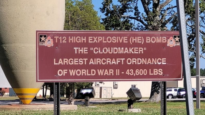
Photographed by James Hulse, October 4, 2023
1. T12 High Explosive (HE) Bomb Marker
Erected by U.S. Army - Ordnance Corps.
Topics. This historical marker is listed in this topic list: Military.
Location. 37° 14.914′ N, 77° 20.148′ W. Marker is in Fort Gregg-Adams, Virginia, in Prince George County. It is at the intersection of Shop Road and 11th Street, in the median on Shop Road. The marker is located on Fort Gregg-Adams, an active U.S. military installation. Appropriate identification is required for access for Fort Gregg-Adams. Touch for map. Marker is in this post office area: Fort Lee VA 23801, United States of America. Touch for directions.

Regionally, this marker is in Coastal Virginia. It is also in the American South, specifically in the Upper South, in the Tidewater, and on the Eastern Seaboard. Globally, it is in the North Atlantic Region, North America, the Western Hemisphere, the Western World, and the Anglosphere. Historically, it finds itself in what was once the territory of the Mississippian Culture, one of the original Thirteen Colonies, one of the Confederate
this page online
Other nearby markers. At least 8 other markers are within walking distance of this marker: M32B3 Recovery Vehicle (approx. 0.4 miles away); M2 Bradley Fighting Vehicle (approx. 0.4 miles away); Pershing II Battlefield Support Missile and Launcher (approx. half a mile away); American Civil War (approx. 0.6 miles away); World War II (approx. 0.6 miles away); Vietnam War (approx. 0.6 miles away); American Revolution (approx. 0.6 miles away); World War I (approx. 0.6 miles away). Touch for a list and map of all markers in Fort Gregg-Adams.
More about this marker. Fort Lee redesignated as Fort Gregg-Adams
Also see . . . T-12 Cloudmaker. Wikipedia
The T-12 (also known as Cloudmaker) earthquake bomb was developed by the United States from 1944 to 1948 and deployed until the withdrawal of the Convair B-36 Peacemaker bomber aircraft in 1958. It was one of a small class of bombs designed to attack targets invulnerable to conventional "soft" bombs, such as bunkers and viaducts. It achieved this by having an extremely thick, hardened nose section designed to penetrate deeply into(Submitted on October 22, 2023, by James Hulse of Medina, Texas.)hardened concrete structures and then detonate inside the target after a short time delay.Photographed by James Hulse, October 4, 20232. The T12 High Explosive (HE) Bomb and Marker
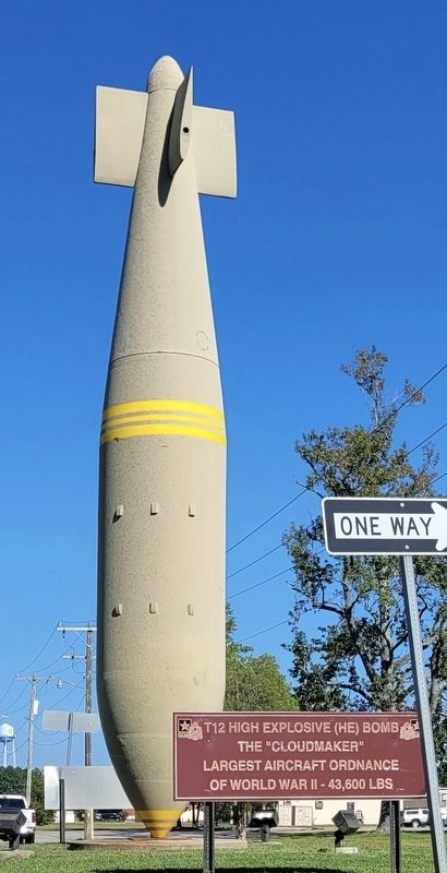
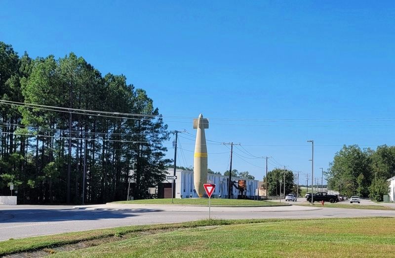
Photographed by James Hulse, October 4, 2023
3. The T12 High Explosive (HE) Bomb and Marker along the roundabout
Credits. This page was last revised on October 22, 2023. It was originally submitted on October 22, 2023, by James Hulse of Medina, Texas. This page has been viewed 589 times since then and 86 times this year. Photos: 1, 2, 3. submitted on October 22, 2023, by James Hulse of Medina, Texas.
