Circleville in Pendleton County, West Virginia — The American South (Appalachia)
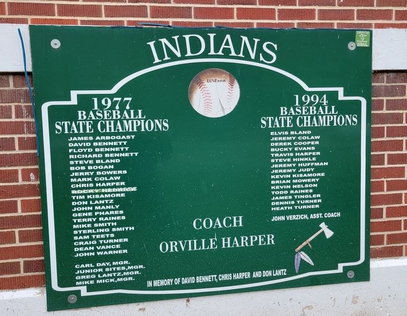
Indians
James Arbogast David Bennett Floyd Bennett Richard Bennett Steve Bland Bob Bogan Jerry Bowers Mark Colaw Chris Harper Rocky Hedrick Tim Kisamore Don Lantz John Manly Gene Phares Terry Raines Mike Smith Sterling Smith Sam Teets Craig Turner Dean Vance John Warner
Carl Day, Mgr. Junior Sites,Mgr. Greg Lantz,Mgr. Mike Mick,Mgr.
1994 Baseball State Champions
Elvis Bland Jeremy Colaw Derek Cooper Bucky Evans Travis Harper Steve Hinkle Jeremy Huffman Jeremy Judy Kevin Kisamore Brian Mowery Kevin Nelson Todd Raines James Tingler Dennis Turner Heath Turner
John Verzich, Asst. Coach
Coach Orville Harper
In memory of David Bennett, Chris Harper and Don Lantz
Topics. This historical marker is listed in this topic list: Sports. A significant historical year for this entry is 1977.
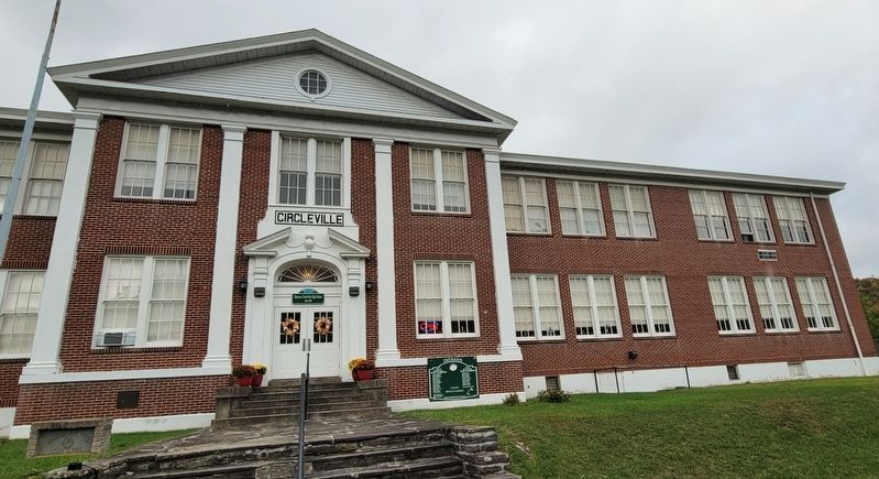
Location. 38° 40.359′ N, 79° 29.506′ W. Marker is in Circleville, West Virginia, in Pendleton County. Marker is on Price Way west of Mount Freedom Drive (West Virginia Route 28), on the left when traveling west. Marker is located to the right of the main entrance to the Historic Circleville High School. Touch for map. Marker is at or near this postal address: 153 Price Way, Circleville WV 26804, United States of America. Touch for directions.
Other nearby markers. At least 8 other markers are within 8 miles of this marker, measured as the crow flies. Spruce Knob (approx. 0.6 miles away); Germany Valley (approx. 5.4 miles away); Last Union Raid (approx. 5.4 miles away); The "Battle" of Riverton (approx. 5.7 miles away); Oriskany Sand (approx. 5.7 miles away); Gravesite of John Dolly (approx. 6 miles away); Destruction of Saltpeter Works (approx. 8.1 miles away); Trout Rock Fort (approx. 8.1 miles away).
Credits. This page was last revised on October 23, 2023. It was originally submitted on October 23, 2023, by Bradley Owen of Morgantown, West Virginia. This page has been viewed 80 times since then and 31 times this year. Photos: 1, 2. submitted on October 23, 2023, by Bradley Owen of Morgantown, West Virginia.

