Brentwood in Williamson County, Tennessee — The American South (East South Central)
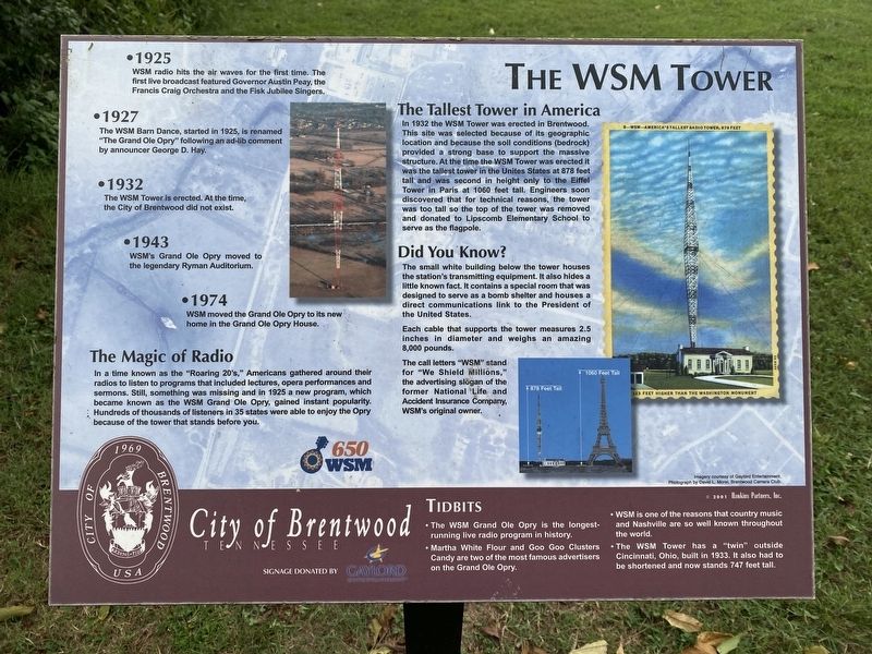
The WSM Tower
• 1925 - WSM radio hits the air waves for the first time. The first live broadcast featured Governor Austin Peay, the Francis Craig Orchestra and the Fisk Jubilee Singers.
• 1927 - The WSM Barn Dance, started in 1925, is renamed "The Grand Ole Opry" following an ad-lib comment by announcer George D. Hay.
• 1932 - The WSM Tower is erected. At the time, the City of Brentwood did not exist.
• 1943 - WSM's Grand Ole Opry moved to the legendary Ryman Auditorium.
• 1974 - WSM moved the Grand Ole Opry to its new home in the Grand Ole Opry House.
The Magic of Radio
In a time known as the "Roaring 20's," Americans gathered around their radios to listen to programs that included lectures, opera performances and sermons. Still, something was missing and in 1925 a new program, which became known as the WSM Grand Ole Opry, gained instant popularity. Hundreds of thousands of listeners in 35 states were able to enjoy the Opry because of the tower that stands before you.
The Tallest Tower in America
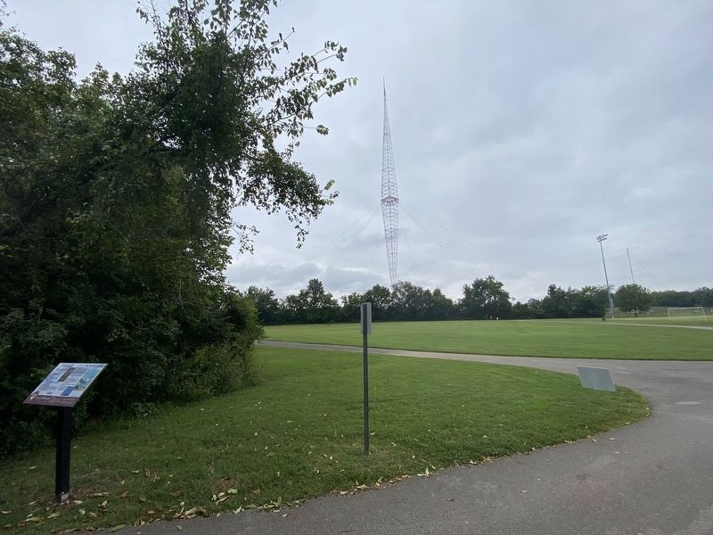
In 1932 the WSM Tower was erected in Brentwood. This site was selected because of its geographic location and because the soil conditions (bedrock) provided a strong base to support the massive structure. At the time the WSM Tower was erected it was the tallest tower in the Unites States at 878 feet tall and was second in height only to the Eiffel Tower in Paris at 1060 feet tall. Engineers soon discovered that for technical reasons, the tower was too tall so the top of the tower was removed and donated to Lipscomb Elementary School to serve as the flagpole.
Did You Know?
The small white building below the tower houses the station's transmitting equipment. It also hides a little known fact. It contains a special room that was designed to serve as a bomb shelter and houses a direct communications link to the President of the United States.
Each cable that supports the tower measures 2.5 Inches in diameter and weighs an amazing 8,000 pounds.
The call letters "WSM" stand for "We Shield Millions," the advertising slogan of the former National Life and Accident Insurance Company, WSM's original owner.
Tidbits
• The WSM Grand Ole Opry is the longest- running live radio program in history.
• Martha White Flour and Goo Goo Clusters Candy are two of the most famous advertisers on the Grand Ole Opry.
• WSM is one of the reasons that country music and Nashville are so well known throughout the world.
• The WSM Tower has a "twin" outside Cincinnati, Ohio, built in 1933. It also had to be shortened and now stands 747 feet tall.
Erected by City of Brentwood, Tennessee.
Topics. This historical marker is listed in this topic list: Notable Places.
Location. 36° 0.029′ N, 86° 47.425′ W. Marker is in Brentwood, Tennessee, in Williamson County. Marker can be reached from Heritage Way, ¼ mile north of Concord Road. Touch for map. Marker is in this post office area: Brentwood TN 37027, United States of America. Touch for directions.
Other nearby markers. At least 8 other markers are within 2 miles of this marker, measured as the crow flies. WSM Broadcasting Transmitter & Antenna (approx. ¼ mile away); Lipscomb Elementary School (approx. 0.3 miles away); Mountview (approx. 0.9 miles away); Owen Chapel (approx. one mile away); Alexander Smith House Twenty-Four Trees (approx. 1.2 miles away); Knox-Crockett House (approx. 1.2 miles away); Midway Plantation Slave Cemetery (approx. 1½ miles away); Sneed Acres (approx. 1.8 miles away). Touch for a list and map of all markers in Brentwood.
Credits. This page was last revised on October 29, 2023. It was originally submitted on October 24, 2023, by Darren Jefferson Clay of Duluth, Georgia. This page has been viewed 83 times since then and 36 times this year. Photos: 1, 2. submitted on October 27, 2023, by Darren Jefferson Clay of Duluth, Georgia. • James Hulse was the editor who published this page.

