Near Abó in Torrance County, New Mexico — The American Mountains (Southwest)
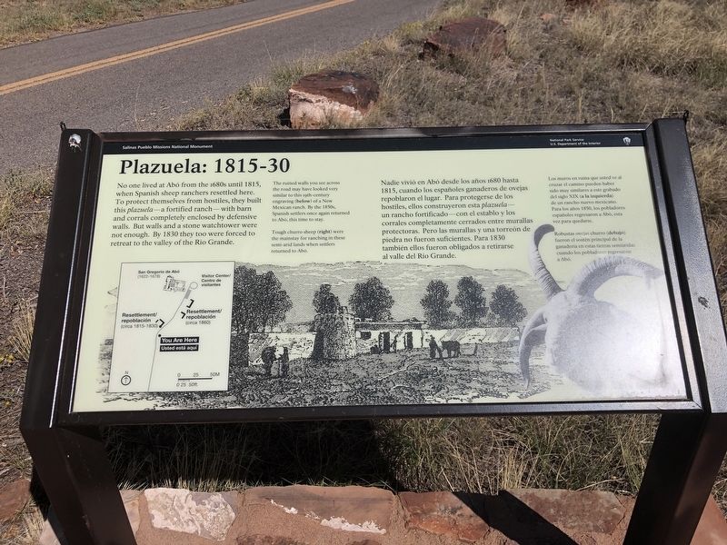
Plazuela: 1815-30
— Salinas Pueblo Missions National Monument —
[Captions]
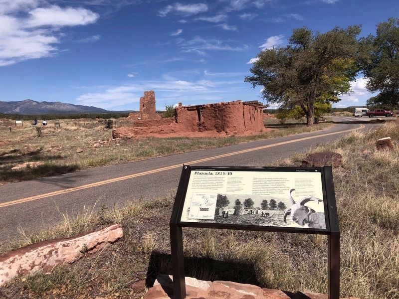
• The ruined walls you see across the road may have looked very similar to this 19th century engraving (below) of a New Mexican ranch. By the 1850s, Spanish settlers once again returned to Abó, this time to stay.
• Tough churro sheep (right) were the mainstay for ranching in these semi-arid lands when settlers returned to Abó.
[Español] Nadie vivió en Abó desde los años 1680 hasta 1815, cuando los españoles ganaderos de ovejas repoblaron el lugar. Para protegerse de los hostiles, ellos construyeron esta plazuela - un rancho fortificado – con el establo y los corrales completamente cerrados entre murallas protectoras. Pero las murallas y una torreón de piedra no fueron suficientes. Para 1830 también ellos fueron obligados a retirarse al valle del Rio Grande.
[Leyendas]
• Los muros en ruina que usted ve al cruzar el camino pueden haber sido muy similares a este grabado del siglo XIX (a la izquierda) de un rancho neuvo mexicano. Para los años 1850, los pobladores españoles regresaron a Abó, esta vez para quedarse.
• Robsutas ovejas churro (debajo) fueron el sostén principal de la ganaderia en esta tierras semiáridas cuando los pobladores regresaron a Abó.
Erected by National Park Service.
Topics and series. This historical marker is listed in these topic lists: Architecture • Settlements & Settlers. In addition, it is included in the National Historic Landmarks series list. A significant historical year for this entry is 1815.
Location. 34° 26.951′ N, 106° 22.525′ W. Marker is near Abó, New Mexico, in Torrance County. Marker is on Abó Ruins Road (State Road 513) 0.6 miles north of U.S. 60, on the right when traveling north. Marker is in Mission San Gregorio de Abó National Historic Landmark. Touch for map. Marker is at or near this postal address: 69 Abó Ruins Rd, Mountainair NM 87036, United States of America. Touch for directions.
Other nearby markers. At least 8 other markers are within walking distance of this marker. Village of Abó/Pueblo de Abó (within shouting distance of this marker); A Grander Church/Una iglesia más grande (about 300 feet away, measured in a direct line); People at Work/Manos a la obra (about 400 feet away); Prayers and Hymns/Rezos e himnos (about 400 feet away);
New Songs/Cantos Nuevos (about 400 feet away); A Kiva Here?/¿Una kiva aquí? (about 400 feet away); Abo Ruins (about 400 feet away); Crossroads/El cruce (about 500 feet away). Touch for a list and map of all markers in Abó.
Also see . . . Reoccupation Plazuela. Following the failure of the Abó Mission, resettlement was a slow process due to continued Apache raiding. By the 1800s, a few sheep herders were trying to return to the area due to the reliable spring water. The plazuela contained a number of rooms including a Torreon, or defensive tower, like the similar structure at Quarai. (National Park Service) (Submitted on November 4, 2023, by Duane and Tracy Marsteller of Murfreesboro, Tennessee.)
Credits. This page was last revised on November 4, 2023. It was originally submitted on November 2, 2023, by Duane and Tracy Marsteller of Murfreesboro, Tennessee. This page has been viewed 54 times since then and 15 times this year. Photos: 1, 2. submitted on November 2, 2023, by Duane and Tracy Marsteller of Murfreesboro, Tennessee.

