Nob Hill in Albuquerque in Bernalillo County, New Mexico — The American Mountains (Southwest)
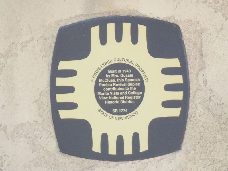
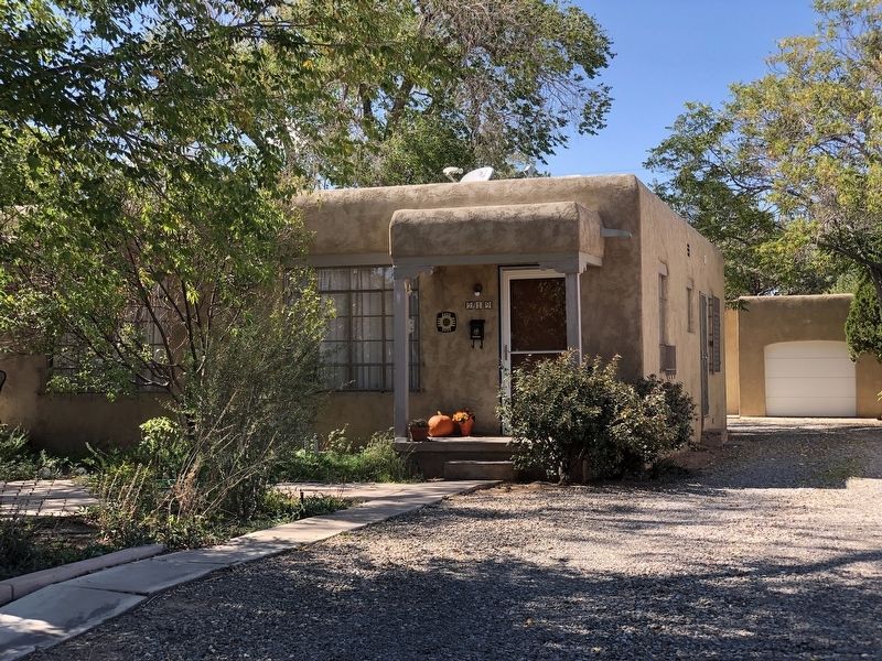
217-219 Solano Drive NE
A Registered Cultural Property
State of New Mexico
Topics and series. This historical marker is listed in this topic list: Architecture. In addition, it is included in the National Register of Historic Places series list. A significant historical year for this entry is 1940.
Location. 35° 4.853′ N, 106° 36.137′ W. Marker is in Albuquerque, New Mexico, in Bernalillo County. It is in Nob Hill. Marker is at the intersection of Solano Drive Northeast and Copper Avenue Northeast, on the left when traveling north on Solano Drive Northeast. Touch for map. Marker is at or near this postal address: 219 Solano Dr NE, Albuquerque NM 87108, United States of America. Touch for directions.
Other nearby markers. At least 8 other markers are within walking distance of this marker. 213-215 Solano Drive NE (a few steps from this marker); 204-206 Solano Drive NE (within shouting distance of this marker); 217 Hermosa Drive NE (about 300 feet away, measured in a direct line); 227-229 Aliso Dr NE (about 400 feet away); 310 Hermosa Drive NE (about 600 feet away); 242 Carlisle Boulevard NE (about 600 feet away); 305 Hermosa Dr. NE (about 600 feet away); 314 Hermosa Drive NE (about 600 feet away). Touch for a list and map of all markers in Albuquerque.
Regarding 217-219 Solano Drive NE. Excerpt from the National Register nomination:
The district consists of the Monte Vista and College View Additions both platted in 1926, the year following a major annexation to Albuquerque's east side in which the size of the city more than tripled. The first subdivisions on the East Mesa to be platted and then quickly developed, the Monte Vista and College View Additions, represented a significant step in determining the city's future growth eastward based upon the development of automobile-oriented suburbs. With its restrictions regarding minimum housing costs, its dedication of a parcel of land for construction of a school, and efforts to limit potential flooding damage through an innovative street plan, the Monte Vista Addition anticipated developers' efforts to develop land use plans in subsequent generations of subdivisions. With developer Charles McDuffie's precedent-setting efforts to make widespread use of Federal Housing Administration (FHA) loans in the mid-1930s, the College View Addition anticipated the means by which expanding suburban housing would lead to greater numbers of homeowners. Although both additions' developers, particularly McDuffie, played significant roles in constructing individual houses, independent builders continued to construct many of the district's houses. Their use of standard plans and materials and the range of regionally inspired stylistic elements applied to the houses imbued the district with the appearance of a distinctly southwestern suburb. The district's period of significance extends between 1926 and 1957, the period of which the two additions began to the point where they fulfilled their role as developed subdivisions.
Also see . . . Monte Vista and College View Historic District. National Register nomination (PDF) and photographs (separate PDF) submitted for the district, which includes this property and was listed in 2001. (Prepared by David Kammer and Edgar Boles, City of Albuquerque Planning Department; via National Park Service) (Submitted on November 4, 2023, by Duane and Tracy Marsteller of Murfreesboro, Tennessee.)
Credits. This page was last revised on November 6, 2023. It was originally submitted on November 4, 2023, by Duane and Tracy Marsteller of Murfreesboro, Tennessee. This page has been viewed 38 times since then and 5 times this year. Photos: 1, 2. submitted on November 4, 2023, by Duane and Tracy Marsteller of Murfreesboro, Tennessee.

