Northside in Houston in Harris County, Texas — The American South (West South Central)
Mount Pleasant Baptist Church
Photographed by James Hulse, November 3, 2023
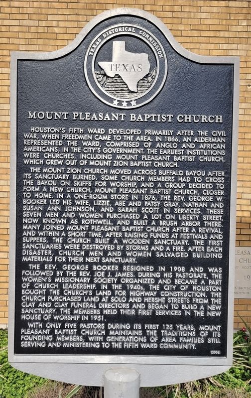
1. Mount Pleasant Baptist Church Marker
The Mount Zion Church moved across Buffalo Bayou after its sanctuary burned. Some church members had to cross the bayou on skiffs for worship, and a group decided to form a new church, Mount Pleasant Baptist Church, closer to home. In a one-room store in 1876, the Rev. George W. Booker led his wife, Lizzie, Abe and Patsy Gray, Nathan and Susan Ann Johnson, and Sarah Scott in services. These seven men and women purchased a lot on Liberty Street, now known as Rothwell, and built a brush arbor there. Many joined Mount Pleasant Baptist Church after a revival, and within a short time, after raising funds at festivals and suppers, the church built a wooden sanctuary. The first sanctuaries were destroyed by storms and a fire. After each disaster, church men and women salvaged building materials for their next sanctuary.
The Rev. George Booker resigned in 1908 and was followed by the Rev. Joe J. James. During his pastorate, the Women's Missionary Society organized and became a part of church leadership. In the 1940s, the City of Houston bought the church's land for highway construction. The church purchased land at Solo and Hershe Streets from the Clay and Clay funeral directors and began to build a new sanctuary. The members held their first services in the new house of worship in 1951.
With only five pastors during its first 125 years, Mount Pleasant Baptist Church maintains the traditions of its founding members, with generations of area families still serving and ministering
this page online
Incising on back: Pastors Rev. George W. Booker (1876-1908) Rev. Joe J. James (1909-1931) Rev. Howard O. Scott (1932-1959) Rev. Acy Doyal McCraw (1959-2000) Rev. Roy Lee Jackson (2000- )
Erected 2003 by Texas Historical Commission. (Marker Number 12923.)
Topics. This historical marker is listed in these topic lists: African Americans • Religion & Religious Structures. A significant historical year for this entry is 1866.
Location. 29° 46.668′ N, 95° 19.279′ W. Marker is in Houston, Texas, in Harris County. It is in Northside. It is at the intersection of Hershe Street and Solo Street, on the left when traveling east on Hershe Street. The marker is located in front of the church. Touch for map. Marker is at or near this postal address: 4819 Hershe Street, Houston TX 77020, United States of America. Touch for directions.

Regionally, this marker is in the American South and on the Gulf Coast. Globally, it is in North America, a Gulf of Mexico state, the Western Hemisphere, the Western World, and the Anglosphere. Historically, it finds itself in what was once New Spain, the Republic of
Photographed by James Hulse, November 3, 2023
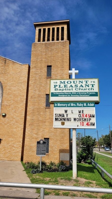
2. The front of Mount Pleasant Baptist Church and Marker
Other nearby markers. At least 8 other markers are within 2 miles of this marker, measured as the crow flies: First Shilo Missionary Baptist Church (approx. ¼ mile away); Peacock Records (approx. half a mile away); Phillis Wheatley High School (approx. half a mile away); The Frenchtown Community (approx. 1.2 miles away); Mount Vernon United Methodist Church (approx. 1.3 miles away); Payne Chapel A.M.E. Church (approx. 1.3 miles away); Zydeco Music in Frenchtown (approx. 1½ miles away); Safety Follows Wisdom (approx. 1.6 miles away). Touch for a list and map of all markers in Houston.
Also see . . . Freedman. Wikipedia
In the United States, the terms "freedmen" and "freedwomen" refer chiefly to former African slaves emancipated during and after the American Civil War by the Emancipation Proclamation and the 13th Amendment. African Slaves freed before the war (usually by individual manumissions, often in wills) were generally referred to as "free Negroes" or "free Blacks". In addition, there was a population of African Americans born free.(Submitted on November 6, 2023, by James Hulse of Medina, Texas.)
Photographed by James Hulse, November 3, 2023
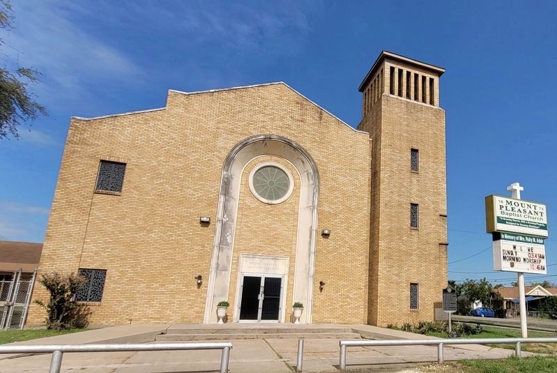
3. The view of the Mount Pleasant Baptist Church and Marker from across the street
Credits. This page was last revised on November 6, 2023. It was originally submitted on November 6, 2023, by James Hulse of Medina, Texas. This page has been viewed 395 times since then and 43 times this year. Photos: 1, 2, 3. submitted on November 6, 2023, by James Hulse of Medina, Texas.
