Congress in Yavapai County, Arizona — The American Mountains (Southwest)
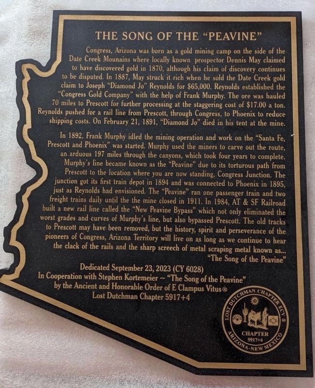
The Song of the “Peavine”
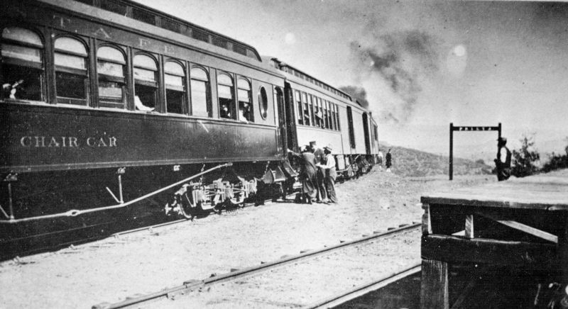
In 1892, Frank Murphy idled the mining operation and work on the “Santa Fe, Prescott and Phoenix” was started. Murphy used the miners to carve out the route, an arduous 197 miles through the canyons, which took four years to complete. Murphy’s line became known as the “Peavine” due to its torturous path from Prescott to the location where you are now standing, Congress Junction. The junction got its first train depot in 1894 and was connected to Phoenix in 1895, just as Reynolds had envisioned. The “Peavine” ran one passenger train and two freight trains daily until the the mine closed in 1911. In 1984, AT & SF Railroad built a new rail line called the “New Peavine Bypass” which not only eliminated the worst grades and curves of Murphy’s line, but also bypassed Prescott. The old tracks to Prescott may have been removed, but the history, spirit and perseverance of the pioneers of Congress, Arizona Territory will live on as long as we continue to hear the clack of the rails and the sharp screech of metal scraping metal known as... “The Song of the Peavine”
Erected 2023 by by the Ancient and Honorable Order of E Clampus Vitus® Lost Dutchman Chapter 5917+4 in cooperation with Stephen Kortmeier – “The Song of the Peavine.” Dedicated September 23, 2023. (Marker Number CY 6028.)
Topics and series. This historical marker is listed in these topic lists: Industry & Commerce • Natural Resources • Railroads & Streetcars. In addition, it is included in the E Clampus Vitus series list. A significant historical year for this entry is 1894.
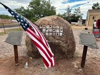
Location. 34° 9.673′ N, 112° 50.812′ W. Marker is in Congress, Arizona, in Yavapai County. Marker is on South Santa Fe Road. The marker is located at the entrance to the Congress Public Library, at the drilling rock (the large boulder). Touch for map. Marker is at or near this postal address: 26750 S Santa Fe Rd, Congress AZ 85332, United States of America. Touch for directions.
Other nearby markers. At least 8 other markers are within 15 miles of this marker, measured as the crow
flies. Congress, Arizona (here, next to this marker); In Memory of Charles Churchill Small (approx. 5.4 miles away); Peeples Valley Pioneer Cemetery (approx. 10.9 miles away); Wickenburg Massacre (approx. 14 miles away); Vulture Mine (approx. 14.4 miles away); Garcia School (approx. 14.7 miles away); Henry Wickenburg (approx. 14.8 miles away); Everett Bowman (approx. 14.8 miles away). Touch for a list and map of all markers in Congress.
Also see . . . Wikipedia entry for Santa Fe, Prescott and Phoenix Railway. Excerpt:
The Santa Fe, Prescott and Phoenix Railway (SFP&P) was a common carrier railroad that later became an operating subsidiary of the Atchison, Topeka and Santa Fe Railway in Arizona. At Ash Fork, Arizona, the SFP&P connected with Santa Fe’s operating subsidiary, the Atlantic & Pacific Railroad mainline, that ran from California to Chicago. The SFP&P's 195-mile line extended the Santa Fe Railway south into Phoenix. The SFP&P extended another 100 miles (160 km) to the east from Phoenix to Florence and Winkelman via the Phoenix and Eastern Railroad (which would become a Southern Pacific Railroad subsidiary in 1907). The SFP&P also served several mines in the Prescott area, including the Derby Mine by way of the Summit (flag) Station at ‘Prieta’ in the Sierra Prieta range, through its various subsidiary railroads.(Submitted on November 9, 2023.)
Additional commentary.
1. Stations on the Santa Fe, Prescott & Phoenix Railway
Ash Fork • Paulden • Prescott • Alto • Summit Station (Prieta) • Iron Springs • Skull Valley • Kirkland • Congress • Wickenburg • Phoenix
— Submitted November 9, 2023, by J. J. Prats of Powell, Ohio.
Credits. This page was last revised on November 10, 2023. It was originally submitted on November 9, 2023, by J. J. Prats of Powell, Ohio. This page has been viewed 68 times since then and 22 times this year. Photos: 1, 2, 3. submitted on November 9, 2023, by J. J. Prats of Powell, Ohio.


