Richmond Hill in York Region, Ontario — Central Canada (North America)
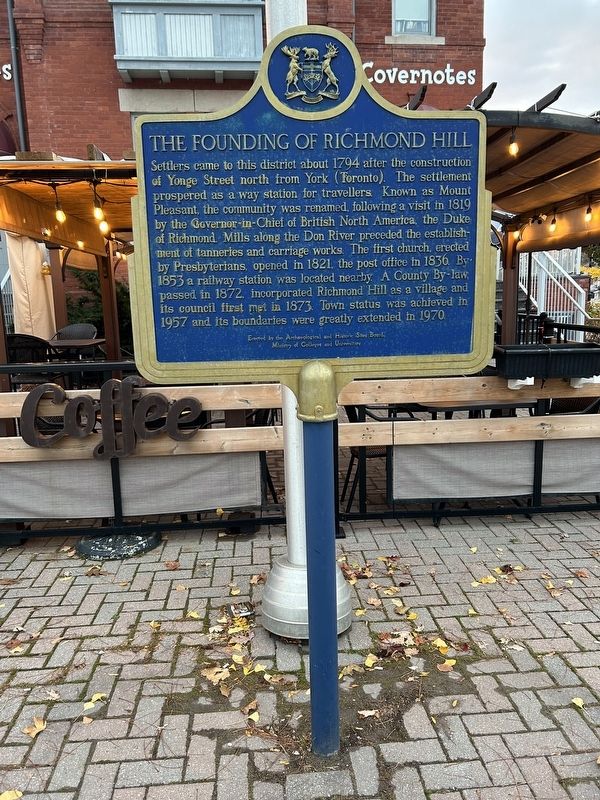
The Founding of Richmond Hill
Erected by Ontario Archaeological and Historic Sites Board.
Topics and series. This historical marker is listed in these topic lists: Churches & Religion • Industry & Commerce • Settlements & Settlers. In addition, it is included in the Canada, Ontario Heritage Foundation series list. A significant historical year for this entry is 1794.
Location. 43° 52.666′ N, 79° 26.336′ W. Marker is in Richmond Hill, Ontario, in York Region. Marker is on Yonge Street, on the right when traveling south. Right in front of "Covernotes", and a couple of meters north from the Richmond Hill Centre for the Performing Arts. Touch for map. Marker is at or near this postal address: 10268 Yonge Street, Richmond Hill ON L4C 3B7, Canada. Touch for directions.
Other nearby markers. At least 5 other markers are within 26 kilometers of this marker, measured as the crow flies. "The Old Post Office" (approx. 13.7 kilometers away); J. Tuzo Wilson (approx. 19.6 kilometers away); The Bluffs as Viewed by Elizabeth Simcoe c.1793 (approx. 24.2 kilometers away); Cliffside Golf Course (approx. 24.3 kilometers away); Scarborough Bluffs (approx. 25.3 kilometers away).
More about this marker. This marker sits at the Southwest corner of Yonge and Wright street. It's directly in front of a historical building that is currently a cafe called Covernotes. This building has had many different uses since its construction, including a government building, high school, and library. The current occupants, Covernotes, pay homage to the building's library days through their decor. The Richmond Hill high school eventually moved a short walk west down Wright Street, and that was eventually replaced by a larger and current Richmond Hill High School.
Credits. This page was last revised on November 11, 2023. It was originally submitted on November 10, 2023, by Aram Rajabpour of Richmond Hill, Ontario. This page has been viewed 52 times since then and 14 times this year. Photo 1. submitted on November 10, 2023, by Aram Rajabpour of Richmond Hill, Ontario. • Andrew Ruppenstein was the editor who published this page.
