Kerrytown in Ann Arbor in Washtenaw County, Michigan — The American Midwest (Great Lakes)
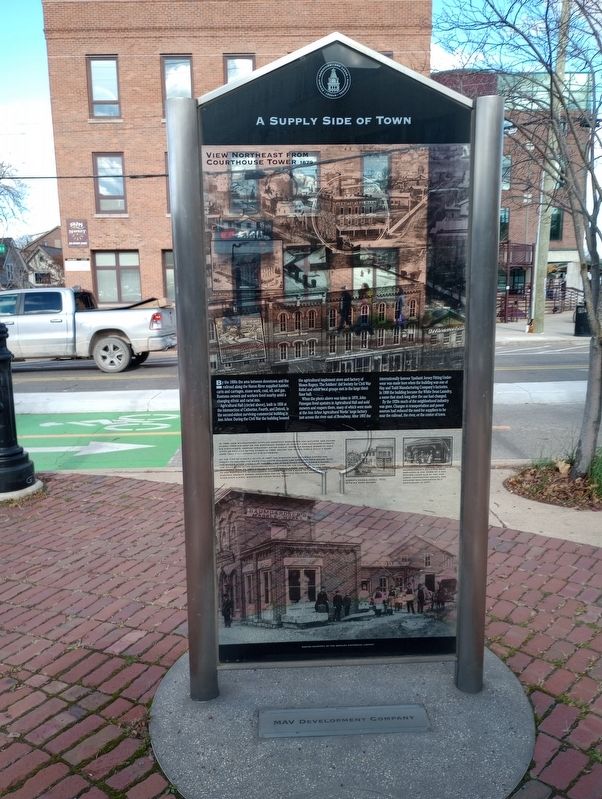
A Supply Side of Town
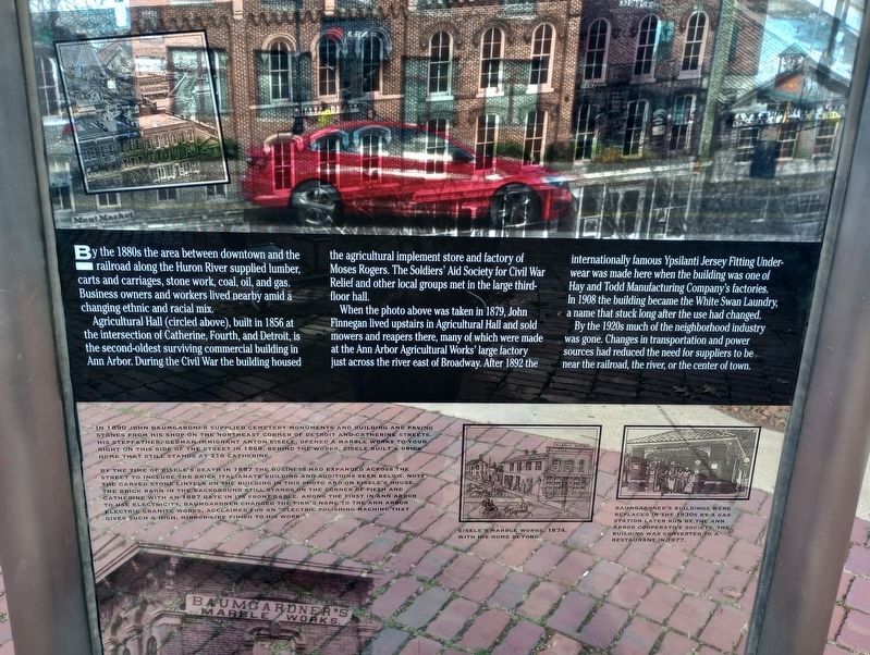
By the 1880s the area between downtown and the railroad along the Huron River supplied lumber, carts and carriages, stone work, coal, oil, and gas. Business owners and workers lived nearby amid a changing ethnic and racial mix.
Agricultural Hall (circled above), built in 1856 at the intersection of Catherine, Fourth, and Detroit, is the second-oldest surviving commercial building in Ann Arbor. During the Civil War the building housed the agricultural implement store and factory of Moses Rogers. The Soldiers' Aid Society for Civil War Relief and other local groups met in the large third floor hall.
When the photo above was taken in 1879, John Finnegan lived upstairs in Agricultural Hall and sold mowers and reapers there, many of which were made at the Ann Arbor Agricultural Works' large factory just across the river east of Broadway. After 1892 the internationally famous Ypsilanti Jersey Fitting Underwear was made here when the building was one of Hay and Todd Manufacturing Company's factories. In 1908 the building became the White Swan Laundry, a name that stuck long after the use had changed.
By the 1920s much of the neighborhood industry was gone. Changes in transportation and power sources had reduced the need for suppliers to be near the railroad, the river, or the center of town.
In 1890 John Baumgardner supplied cemetery monuments and building and paving stones from his shop on the northeast corner of Detroit and Catherine Streets. His stepfather, German immigrant Snton Eisele, opened a marble works to your right on this side of the street in 1868. Behind the works, Eisele built a brick home that still stands at 216 Catherine.
By the time of Eisele's death in 1887 the business had expanded across the street to include the brick italianate building and additions seen below. Note the carved stone lintels on the building in this photo and on Eisele's house. The brick barn in the background still stands on the corner of Fifth and Catherine with an 1887 date in its front gable. Among the first in Ann Arbor to use electricity, Baumgardner changed the firm's name to the Ann Arbor Electric Granite Works, acclaimed for an "electric polishing machine that gives such a high, mirror-like finish to his work."
Eisele's Marble Works, 1874, with his home beyond.
Baumgardner's buildings were replaced in the 1930s by a gas station later run by the Ann Arbor Cooperative Society. The building was converted to a restaurant in 1977.
Topics. This historical marker is listed in these topic lists: Architecture • Industry & Commerce. A significant historical year for this entry is 1856.
Location. 42° 16.987′ N, 83° 44.816′ W. Marker is in Ann Arbor, Michigan, in Washtenaw County. It is in Kerrytown. Marker is on North 4th Avenue, on the right when traveling east. Touch for map. Marker is at or near this postal address: 226 N 4th Ave, Ann Arbor MI 48104, United States of America. Touch for directions.
Other nearby markers. At least 8 other markers are within walking distance of this marker. A Corner Landmark on Huron and North Fourth (about 500 feet away, measured in a direct line); The Changing Face of North Fourth Avenue (about 500 feet away); A Meeting Place for Ann Arbor's Black Community (about 500 feet away); A Former Bank and Estate on Ann Street (about 500 feet away); Commerce on the "Ann Street Block" (about 500 feet away); The Streets Around Courthouse Square (about 500 feet away); Shopping on East Huron Street (about 500 feet away); Main Street in the 1890s (about 500 feet away). Touch for a list and map of all markers in Ann Arbor.
Credits. This page was last revised on November 30, 2023. It was originally submitted on November 14, 2023, by Craig Doda of Napoleon, Ohio. This page has been viewed 42 times since then and 9 times this year. Photos: 1, 2, 3. submitted on November 14, 2023, by Craig Doda of Napoleon, Ohio. • J. Makali Bruton was the editor who published this page.


