Ventura in Ventura County, California — The American West (Pacific Coastal)
Ventura Pier
Fun Facts
Dimensions
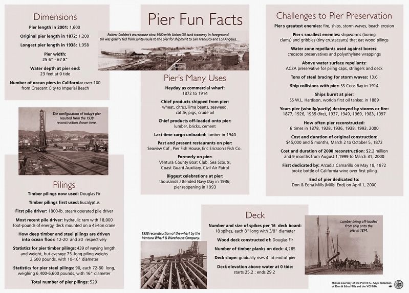
Pier length in 2001: 1,600
Original pier length in 1872: 1,200
Longest pier length in 1938: 1,958
Pier width: 256 - 678
Water depth at pier end: 23 feet at 0 tide
Number of ocean piers in California: over 100 from Crescent City to Imperial Beach
Pilings
Timber pilings now used: Douglas Fir
Timber pilings first used: Eucalyptus
First pile driver: 1800-lb. steam operated pile driver
Most recent pile driver: hydraulic ram with 18,000 foot-pounds of energy, deck mounted on a 45-ton crane
How deep timber and steel pilings are driven into ocean floor: 12-20 and 30 respectively
Statistics for pier timber pilings: 439 of varying length and weight, but average 75 long piling weighs 2,600 pounds, with 10-16 diameter
Statistics for pier steel pilings: 90, each 72-80 long, weighing 6,400-6,600 pounds, with 16 diameter
Total number of pier pilings: 529
Pier's Many Uses
Heyday as commercial wharf: 1872 to 1914
Chief products shipped from pier: wheat, citrus, lima beans, seaweed, cattle, pigs, crude oil
Chief products off-loaded onto pier: lumber, bricks, cement
Last time cargo unloaded: lumber in 1940
Past and present restaurants on pier: Seaview Caf, Pier Fish House, Eric Ericssons Fish Co.
Formerly on pier: Ventura County Boat Club, Sea Scouts, Coast Guard Auxiliary, Civil Air Patrol
Biggest celebrations at pier: thousands attended Navy Day in 1936, pier reopening in 1993
Deck
Number and size of spikes per 16 deck board: 18 spikes, each 8" long with 3/8" diameter
Wood deck constructed of: Douglas Fir
Number of timber planks on deck: 4,285
Deck slope: gradually rises 4 at end of pier
Deck elevation above water at 0 tide: starts 25.2; ends 29.2
Challenges to Pier Preservation
Piers greatest enemies: fire, ships, storm waves, beach erosion
Piers smallest enemies: shipworms (boring clams) and gribbles (tiny crustaceans) that eat wood pilings
Water zone repellants used against borers: creosote preservatives and polyethylene wrappings
Above water surface repellants: ACZA preservative for piling caps, stringers and deck
Tons of steel bracing for storm waves: 13.6
Ship collisions with pier: SS Coos Bay in 1914
Ships burnt at pier: SS W.L. Hardison, world's first oil tanker, in 1889
Years pier (wholly/partly) destroyed by storms or fire: 1877, 1926, 1935 (fire), 1937, 1949, 1969, 1983, 1997
How often pier reconstructed: 6
times in 1878, 1928, 1936, 1938, 1993, 2000
Cost and duration of original construction: $45,000 and 5 months, March 2 to October 5, 1872
Cost and duration of 2000 reconstruction: $2.2 million and 9 months from August 1, 1999 to March 31, 2000
First dedicated by: Arcadia Camarillo on May 18, 1872 broke bottle of California wine over first piling
End of pier dedicated to: Don & Edna Mills (Mills End) on April 1, 2000
Erected by City of Ventura. (Marker Number 20.)
Topics. This historical marker is listed in these topic lists: Architecture • Industry & Commerce. A significant historical year for this entry is 1872.
Location. 34° 16.515′ N, 119° 17.454′ W. Marker is in Ventura, California, in Ventura County. Marker can be reached from Harbor Boulevard near Ventura Pier. Touch for map. Marker is at or near this postal address: 750 E Harbor Blvd, Ventura CA 93001, United States of America. Touch for directions.
Other nearby markers. At least 8 other markers are within walking distance of this marker. The First Community (about 700 feet away, measured in a direct line); 632 E. Thompson Boulevard (approx. 0.2 miles away); 682 East Thompson Boulevard (approx. 0.2 miles away); Ventura Veterans Memorial (approx. Ό mile away); The Hobart/Barr/Lucking Initial Residence c. 1898 (approx. Ό mile away); The Hobart/Barr/Lucking Residence (approx. Ό mile away); Dacy Fazio House (approx. Ό mile away); The A.D. Briggs Residence (approx. Ό mile away). Touch for a list and map of all markers in Ventura.
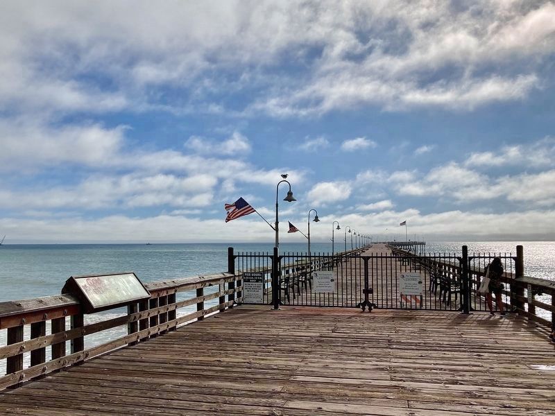
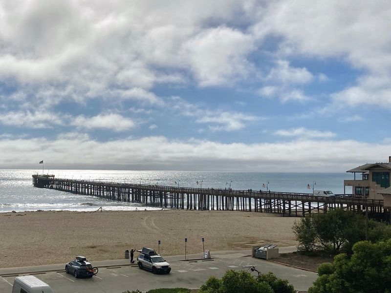
Regarding Ventura Pier. The Ventura Pier, formerly known as the Ventura Wharf and the San Buenaventura Wharf, is the oldest pier in California and is designated as Ventura Historic Landmark No. 20.
Since 1872, the Ventura Pier has stood as a symbol of the region's rich history and natural resources. Once the cornerstone of Ventura County's agricultural, construction, and oil trade, today the Ventura Pier is a favorite attraction for fishing, sunset strolls, and views of the coastline and the Channel Islands.
In January 2023 the pier was closed due to storm damage (again). Repairs and reopening are expected in 2024.
Credits. This page was last revised on November 16, 2023. It was originally submitted on November 16, 2023, by Craig Baker of Sylmar, California. This page has been viewed 71 times since then and 30 times this year. Photos: 1, 2, 3. submitted on November 16, 2023, by Craig Baker of Sylmar, California.


