Lincoln Township near Onawa in Monona County, Iowa — The American Midwest (Upper Plains)
Preparation Valley
— Loess Hills National Scenic Byway —
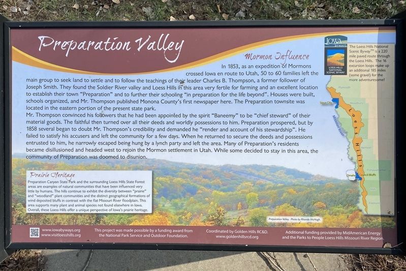
Mormon Influence
In 1853, as an expedition of Mormons crossed Iowa en route to Utah, 50 to 60 families left the main group to seek land to settle and to follow the teachings of their leader Charles B. Thompson, a former follower of Joseph Smith. They found the Soldier River valley and Loess Hills in this area very fertile for farming and an excellent location to establish their town "Preparation" and to further their schooling "in preparation for the life beyond". Houses were built, schools organized, and Mr. Thompson published Monona County's first newspaper here. The Preparation townsite was located in the eastern portion of the present state park.
Mr. Thompson convinced his followers that he had been appointed by the spirit "Baneemy" to be "chief steward" of their material goods. The faithful then turned over all their deeds and worldly possessions to him. Preparation prospered, but by 1858 several began to doubt Mr. Thompson's credibility and demanded he "render and account of his stewardship". He failed to satisfy his accusers and left the community for a few days. When he returned to secure the deeds and possessions entrusted to him, he narrowly escaped being hung by a lynch party and left the area. Many of Preparation's residents became disillusioned and headed west to rejoin the Mormon settlement in Utah. While some decided to stay in this area, the community of Preparation was doomed to disunion.
Prairie Heritage
Preparation Canyon State Park and the surrounding Loess Hills State Forest areas are examples of natural communities that have been influenced very little by humans. The hills continue to exhibit the diversity between "prairie" and "woodland" plant communities and the distinct geographical formations of wind deposited bluffs in contrast with the flat Missouri River floodplain. This area supports many plant and animal species not found elsewhere in Iowa. Overall, these Loess Hills offer a unique perspective of Iowa's prairie heritage.
Preparation Valley. Photo by Rhonda McHugh.
The Loess Hills National Scenic Byway™ is a 220 mile paved route through the Loess Hills. The 16 excursion loops make up an additional 185 miles (some gravel) for the more adventuresome!
Erected by the National Park Service and Outdoor Foundation, coordinated by Golden Hills RC&D; additional funding provided by MidAmerican Energy and the Parks to People Loess Hills Missouri River Region.
Topics. This historical marker is listed in these topic lists: Churches & Religion • Settlements & Settlers. A significant historical year for this entry is 1853.
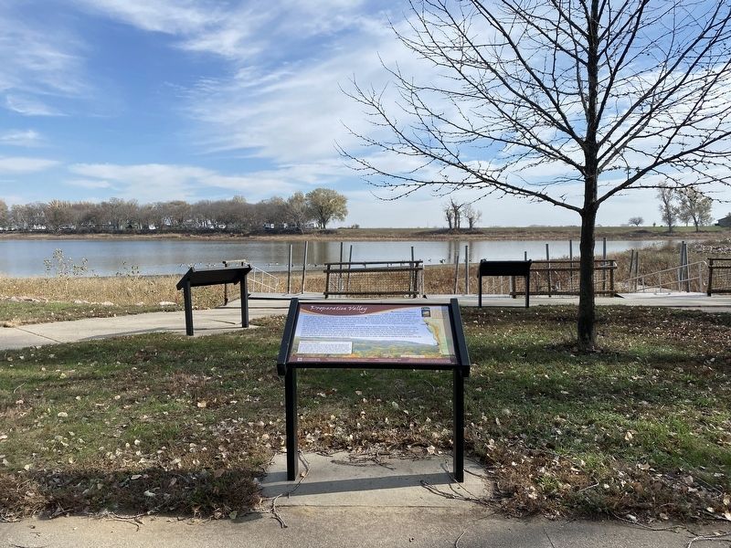
Location. 42° 2.587′ N, 96° 9.719′ W. Marker is near Onawa, Iowa, in Monona County. It is in Lincoln Township. Marker can be reached from Park Loop, ¾ mile north of 225th Street, on the right when traveling north. Located in Lewis and Clark State Park. Touch for map. Marker is at or near this postal address: 21914 Park Loop, Onawa IA 51040, United States of America. Touch for directions.
Other nearby markers. At least 8 other markers are within 4 miles of this marker, measured as the crow flies. Visiting Blackbird's Grave (here, next to this marker); Prairies in the Hills (here, next to this marker); The Lewis & Clark Expedition (a few steps from this marker); "Coupe A Jarcke" (a few steps from this marker); Open and Boundless Prairie (a few steps from this marker); A River Changed (about 700 feet away, measured in a direct line); Second Camping Ground in Monona County (about 800 feet away); Onawa Freedom Rock Veterans Memorial (approx. 3.3 miles away). Touch for a list and map of all markers in Onawa.
Credits. This page was last revised on November 16, 2023. It was originally submitted on November 16, 2023. This page has been viewed 54 times since then and 14 times this year. Photos: 1, 2. submitted on November 16, 2023.

