Charles City in Floyd County, Iowa — The American Midwest (Upper Plains)
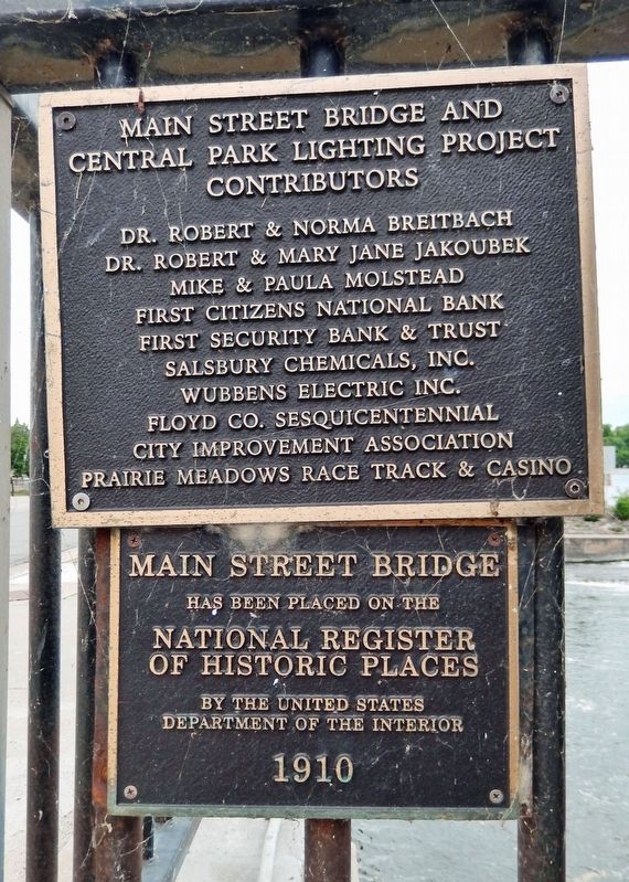
Main Street Bridge
1910
National Register
of Historic Places
by the United States
Department of the Interior
Main Street Bridge and
Central Park Lighting Project
Contributors
Dr. Robert & Norma Breitbach • Dr. Robert & Mary Jane Jakoubek • Mike & Paula Molstead • First Citizens National Bank • First Security Bank & Trust • Salsbury Chemicals, Inc. • Wubbens Electric, Inc. • Floyd Co. Sesquicentennial • City Improvement Association • Prairie Meadows Race Track & Casino
Topics and series. This historical marker is listed in this topic list: Bridges & Viaducts. In addition, it is included in the National Register of Historic Places series list. A significant historical year for this entry is 1910.
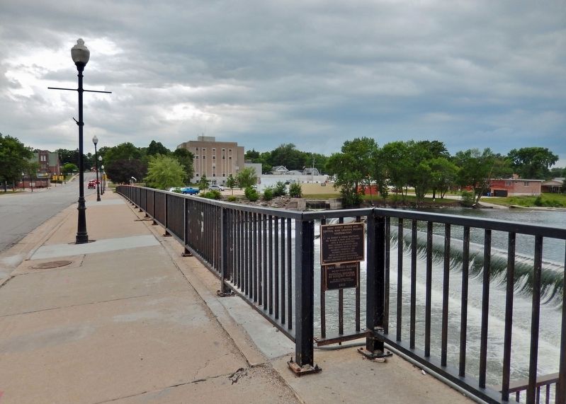
Location. 43° 3.988′ N, 92° 40.789′ W. Marker is in Charles City, Iowa, in Floyd County. Marker is on North Main Street just south of Riverside Drive, on the right when traveling south. The marker is mounted on the west bridge railing, near the north end of the bridge. Touch for map. Marker is in this post office area: Charles City IA 50616, United States of America. Touch for directions.
Other nearby markers. At least 8 other markers are within 14 miles of this marker, measured as the crow flies. Original Mill Wheel (a few steps from this marker); Farmer's Trust and Savings Bank (within shouting distance of this marker); Floyd County Veterans Memorial (about 600 feet away, measured in a direct line); 1968 Tornado Memorial (approx. 0.2 miles away); Charles City Veterans Monument (approx. 0.2 miles away); Andres Memorial Park (approx. 0.3 miles away); Dana Park (approx. 0.6 miles away); Greene Freedom Rock Veterans Memorial (approx. 13.4 miles away). Touch for a list and map of all markers in Charles City.
Regarding Main Street Bridge. National Register of Historic Places #99000311.
From the National Register Nomination:
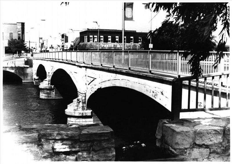
The Cedar River Bridge was completed by 1910 for approximately $40,000.00, of which more than $26,000.00 was provided by the county and at least $7,000.00 by the city. The concrete barrel arch style was popular during this period, particularly for major urban crossings. Other examples in Floyd County include the Bradford Street Bridge in Marble Rock, erected in 1915, and the First Street Bridge in Nora Springs, dating from 1916.Iowa's major urban bridges have followed a definite technological progression, reflective of the evolution and development of more durable bridge types. In the 1870s the bowstring arch-truss was
used for major river crossings in Iowa's cities. This was superseded by the pin-connected iron truss in the 1880s and, in the 1890s, by the steel truss. After 1905 a number of multiple-span concrete arches were built in the state. Although some were constructed in Des Moines, the majority of these monumental bridges were built in the northern and eastern counties — in cities such as Waterloo, Iowa City, Charles City and Mason City.via NPS, unknown2. Main Street BridgeNational Register of Historic Places Nomination Form
NPGallery Digital Asset Management System
Click for more information.
Also see . . . Main Street Bridge. Wikipedia entry:
Excerpt:
Before a bridge was built at this location local citizens would cross the river by way of a ferry, at a ford in summer, and across the ice in winter. The first bridge at this location was washed away in a flood while it was under construction in 1858. The second bridge was completed in 1864, and it was destroyed in a flood two years later. A temporary bridge was completed in 1867, and it was replaced by a truss bridge in 1870. It was used for 40 years despite an engineer's study in 1892 that suggested it be condemned. The Floyd County Board of Supervisors approved a replacement bridge in 1908. The old bridge was moved to a new spot five blocks downstream, but contract problems delayed construction of the new bridge.(Submitted on November 24, 2023, by Cosmos Mariner of Cape Canaveral, Florida.)
Credits. This page was last revised on November 25, 2023. It was originally submitted on November 23, 2023, by Cosmos Mariner of Cape Canaveral, Florida. This page has been viewed 53 times since then and 12 times this year. Photos: 1. submitted on November 24, 2023, by Cosmos Mariner of Cape Canaveral, Florida. 2. submitted on November 25, 2023, by Larry Gertner of New York, New York. 3. submitted on November 24, 2023, by Cosmos Mariner of Cape Canaveral, Florida.


