Fort York in Toronto, Ontario — Central Canada (North America)
Government House
1800 (destroyed 1813)
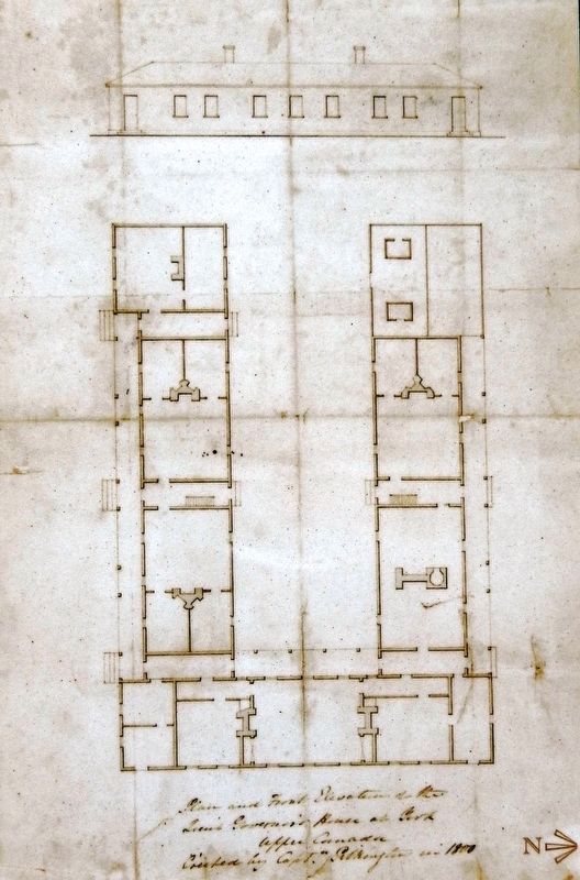
From 1800 to 1813, 'Government House' stood in the centre of today's Fort York. It was the home and office of Upper Canada's lieutenant-governor, head of the colony's civil government. In stressful times, the office was combined with that of the military commander. In 1811, as war with the United States loomed, Upper Canada came under the authority of Major-General Isaac Brock. He led the government as 'President' and lived here when in York.
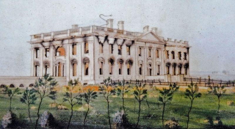
Government House was damaged during the Battle of York. It and the Parliament Buildings at the east end of town were then burned by the occupying US forces. In 1814, British forces retaliated when they captured Washington and torched the White House and the US Capitol.
Topics. This historical marker is listed in these topic lists: Architecture • Forts and Castles • War of 1812. A significant historical year for this entry is 1813.
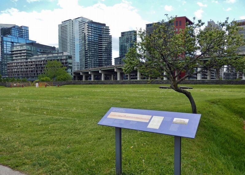
Location. 43° 38.33′ N, 79° 24.226′ W. Marker is in Toronto, Ontario. It is in Fort York. Marker can be reached from Fort York Boulevard, 0.2 kilometers north of Lake Shore Boulevard West. The marker is located along the interpretive walkway at Fort York National Historic Site. Touch for map. Marker is at or near this postal address: 250 Fort York Boulevard, Toronto ON M5V 3K9, Canada. Touch for directions.
Other nearby markers. At least 8 other markers are within walking distance of this marker. Stone Magazine (a few steps from this marker); Well and Well House (within shouting distance of this marker); North and South Soldiers' Barracks (within shouting distance of this marker); Fort York / Le Fort York (within shouting distance of this marker); Officers' Brick Barracks and Mess Establishment (within shouting distance of this marker); Officers' Blue Barracks (within shouting distance of this marker); Circular, or Government House, Battery (within shouting distance of this marker); No. 2 (Centre) Blockhouse (within shouting distance of this marker). Touch for a list and map of all markers in Toronto.
Related markers. Click here for a list of markers that are related to this marker. Fort York National Historic Site
Also see . . .
1. Battle of York (Wikipedia). Excerpt:
The Battle of York was a War of 1812 battle fought in York, Upper Canada (today's Toronto, Ontario, Canada) on April 27, 1813. An American force, supported by a naval flotilla, landed on the western lakeshore and captured the provincial capital after defeating an outnumbered force of regulars, militia and Ojibwe natives. Between April 28 and 30, American troops carried out many acts of plunder. Some of them set fire to the buildings of the Legislative Assembly, and Government House, home to the Lieutenant Governor of Upper Canada. Before they departed from York, the Americans razed most of the structures in the fort, except the barracks.(Submitted on December 11, 2023, by Cosmos Mariner of Cape Canaveral, Florida.)
2. British troops set fire to the White House (history.com). Excerpt:
On August 24, 1814, during the War of 1812 between the United States and England, British troops enter Washington, D.C. and burn the White House in retaliation for the American attack on the city of York in Ontario, Canada, in 1813. When the British arrived at the White House, they found that President James Madison and his first lady Dolley had already fled to safety in Maryland. Soldiers reportedly sat down to eat a meal made of leftover food from the White House scullery using White House dishes and silver before ransacking the presidential mansion and setting it ablaze.(Submitted on December 11, 2023, by Cosmos Mariner of Cape Canaveral, Florida.)
3. Fort York National Historic Site. Excerpt:
The Fort York National Historic Site was built in 1793 and is the birthplace of urban Toronto. The Fort served as the city’s primary harbour defence between the 1790s and the 1880s and was the home of a military garrison until the 1930s. Fort York is where British soldiers, First Nations warriors and Upper Canadian militiamen stood together against the United States and its mission to capture Toronto in the War of 1812. The bloody Battle of York that ensued was a dark and dramatic moment in the history of the city.(Submitted on December 11, 2023, by Cosmos Mariner of Cape Canaveral, Florida.)

The White House Historical Association, 2001.1800.1
4. Marker detail: The White House, c.1814
The US President's House after being burned by British troops in 1814 in retaliation for the destruction of Government House at York. The term 'White House' predates the War of 1812 and referred to the building's whitewashed Aquia sandstone. The name became popular after the restored mansion received a coat of oil-based white paint in 1817. (Watercolour by George Munger, c.1814-15.)
Credits. This page was last revised on December 11, 2023. It was originally submitted on December 10, 2023, by Cosmos Mariner of Cape Canaveral, Florida. This page has been viewed 57 times since then and 14 times this year. Photos: 1, 2, 3, 4, 5. submitted on December 11, 2023, by Cosmos Mariner of Cape Canaveral, Florida.


