Near Laurel Springs in Ashe County, North Carolina — The American South (South Atlantic)
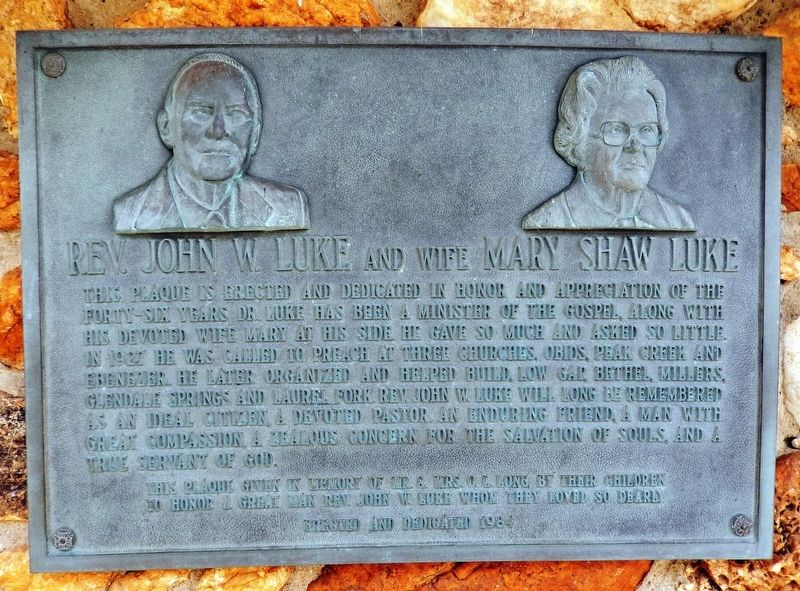
Rev. John W. Luke and Wife Mary Shaw Luke
This plaque is erected and dedicated in honor and appreciation of the forty-six years Dr. Luke has been a minister of the gospel, along with his devoted wife Mary at his side he gave so much and asked so little. In 1927 he was called to preach at three churches, Obids, Peak Creek and Ebenezer. He later organized and helped build, Low Gap, Bethel, Millers, Glendale Springs and Laurel Fork. Rev. John W. Luke will long be remembered as an ideal citizen, a devoted pastor, and enduring friend, a man with great compassion, a zealous concern for the salvation of souls, and a true servant of God.
to honor a great man Rev. John W. Luke whom they loved so dearly
Erected and dedicated 1984
Erected 1984.
Topics. This historical marker is listed in these topic lists: Charity & Public Work • Churches & Religion. A significant historical year for this entry is 1927.
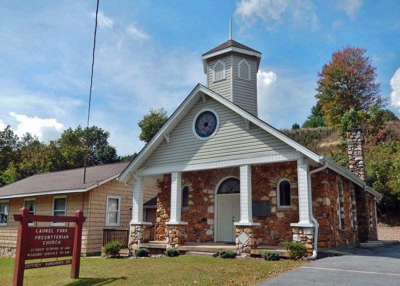
Location. 36° 22.852′ N, 81° 14.69′ W. Marker is near Laurel Springs, North Carolina, in Ashe County. Marker is on State Highway 18 S, one mile south of Blue Ridge Parkway, on the right when traveling south. The marker is mounted at eye-level on the Laurel Fork Presbyterian Church, just to the right of the front entrance. Touch for map. Marker is at or near this postal address: 15232 North Carolina Hwy 18 South, Laurel Springs NC 28644, United States of America. Touch for directions.
Other nearby markers. At least 8 other markers are within 7 miles of this marker, measured as the crow flies. Robert L. Doughton (approx. 2.4 miles away); Tobaccoville Barn (approx. 4.6 miles away); Ore Knob Mine (approx. 4.7 miles away); Robert Lee Doughton (approx. 5.2 miles away); The Brinegar Family (approx. 6.1 miles away); An Outdoor Pantry (approx. 6.1 miles away); Making Linsey-Woolsey (approx. 6.1 miles away); Making Shoes (approx. 6.1 miles away). Touch for a list and map of all markers in Laurel Springs.
Credits. This page was last revised on December 16, 2023. It was originally submitted on December 14, 2023, by Cosmos Mariner of Cape Canaveral, Florida. This page has been viewed 49 times since then and 11 times this year. Photos: 1, 2. submitted on December 16, 2023, by Cosmos Mariner of Cape Canaveral, Florida.

