East Side in Chicago in Cook County, Illinois — The American Midwest (Great Lakes)
Illinois-Indiana Boundary Marker
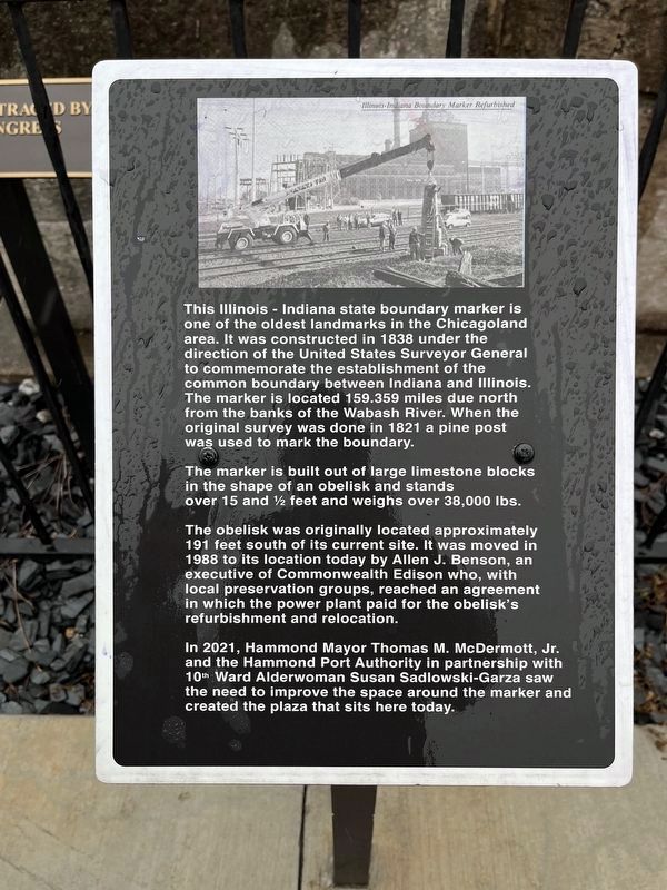
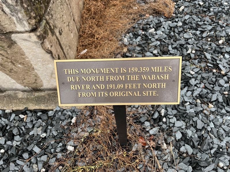
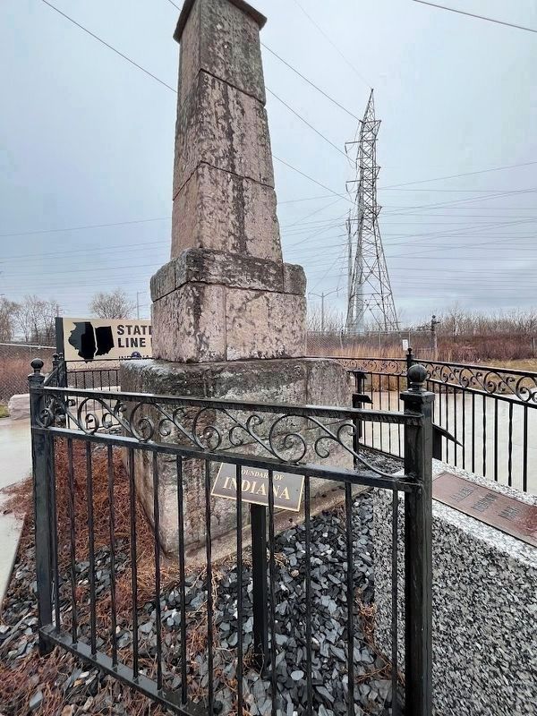
This Illinois - Indiana state boundary marker is one of the oldest landmarks in the Chicagoland area. It was constructed in 1838 under the direction of the United States Surveyor General to commemorate the establishment of the common boundary between Indiana and Illinois. The marker is located 159.359 miles due north from the banks of the Wabash River. When the original survey was done in 1821 a pine post was used to mark the boundary.
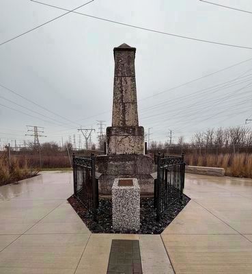
The marker is built out of large limestone blocks in the shape of an obelisk and stands over 15 and ½ feet and weighs over 38,000 lbs.
The obelisk was originally located approximately 191 feet south of its current site. It was moved in 1988 to its location today by Allen J. Benson, an executive of Commonwealth Edison who, with local preservation groups, reached an agreement in which the power plant paid for the obelisk's refurbishment and relocation.
In 2021, Hammond Mayor Thomas M. McDermott, Jr. and the Hammond Port Authority in partnership with 10th Ward Alderwoman Susan Sadlowski-Garza saw the need to improve the space around the marker and created the plaza that sits here today.
Erected 2021.
Topics. This historical marker is listed in these topic lists: Landmarks • Political Subdivisions. A significant historical year for this entry is 1838.
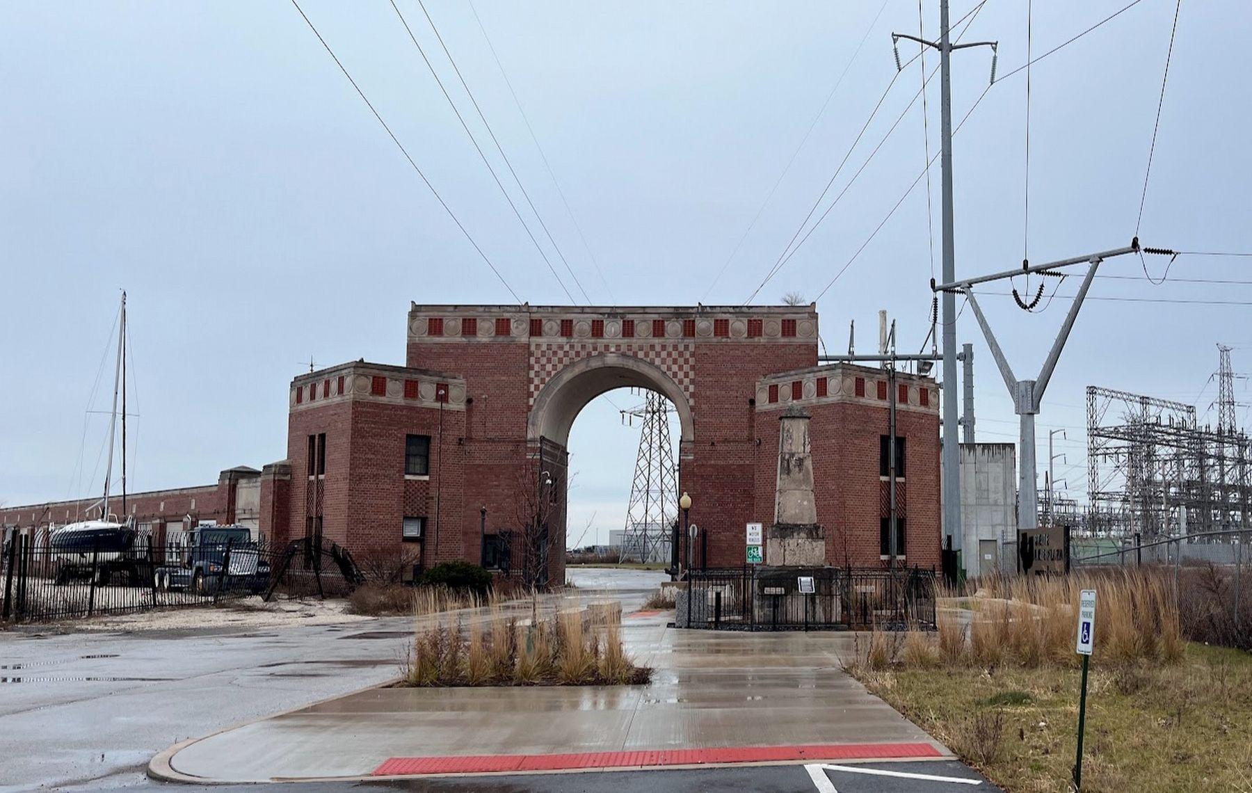
Location. 41° 42.47′ N, 87° 31.47′ W. Marker is in Chicago, Illinois, in Cook County. It is in the East Side. Marker is on Avenue G, 0.6 miles east of East 100th Street. The marker straddles the border between Chicago, Illinois, and Hammond, Indiana, about 20 yards from a building that was originally a guardhouse and entryway for the State Line Generating Plant, which was torn down in 2014. Touch for map. Marker is in this post office area: Chicago IL 60617, United States of America. Touch for directions.
Other nearby markers. At least 8 other markers are within 7 miles of this marker, measured as the crow flies. East Side Veterans Memorial (approx. 0.7 miles away); The Arcade (approx. 4½ miles away); Mahalia Jackson (approx. 5½ miles away); Thomas A. Dorsey (approx. 5.7 miles away); Confederate Mound Monument (approx. 5.7 miles away); Confederate Mound (approx. 5.7 miles away); Origins of Calumet City and Abraham Lincoln Funeral Train (approx. 5.9 miles away); John Dewey (approx. 6.2 miles away). Touch for a list and map of all markers in Chicago.
More about this marker. This limestone obelisk, dedicated in 1838 by the U.S. Surveyor's Office and straddling the border between Illinois and Indiana, is one of the oldest (if not the oldest) surviving historical marker in either Illinois or Indiana. It is also believed to be the third-oldest man-made structure still standing in Chicago, behind only the Noble–Seymour–Crippen
House (circa 1833, in the Norwood Park neighborhood) and the Henry B. Clarke House (circa 1836, in the South Loop neighborhood).
As of December 2023, the obelisk is surrounded by a wrought-iron fence, with brick pavers outlining the Indiana-Illinois marker for a few yards north and south of it; the south pavers lead to a sign describing the small park as State Line Plaza. The obelisk is believed to have originally been engraved with an inscription when erected in 1838, but those engravings are completely worn away. Today it is flanked by several smaller markers, which were installed in 2021, replacing identical markers that had been affixed to its sides when it moved to this location in 1988. Two say "Boundary of Illinois" and "Boundary of Indiana." Another describes the marker's 191-foot move north in 1988. And one more notes that the state line was retraced by act of Congress in 1833. A newer marker describes the obelisk, its 1988 move and its 2021 refurbishment (the text is in the Inscription section above). On the north side of the marker, in the middle of the state border, is a plaque dedicating the area as Allen Benson Plaza, in honor of the Commonwealth Edison executive who helped save the marker in the 1980s.
The small park was created in 1988, when preservationists from Chicago's East Side neighborhood worked with Commonwealth Edison, the utility company
that owned the land at the time, to restore the obelisk. They moved the obelisk from its original location, which was remote and wooded, north approximately 191 feet to a new spot still straddling the border but very close to the entrance of the State Line Generating Plant in Hammond, and a short distance from Chicago's Calumet Park.
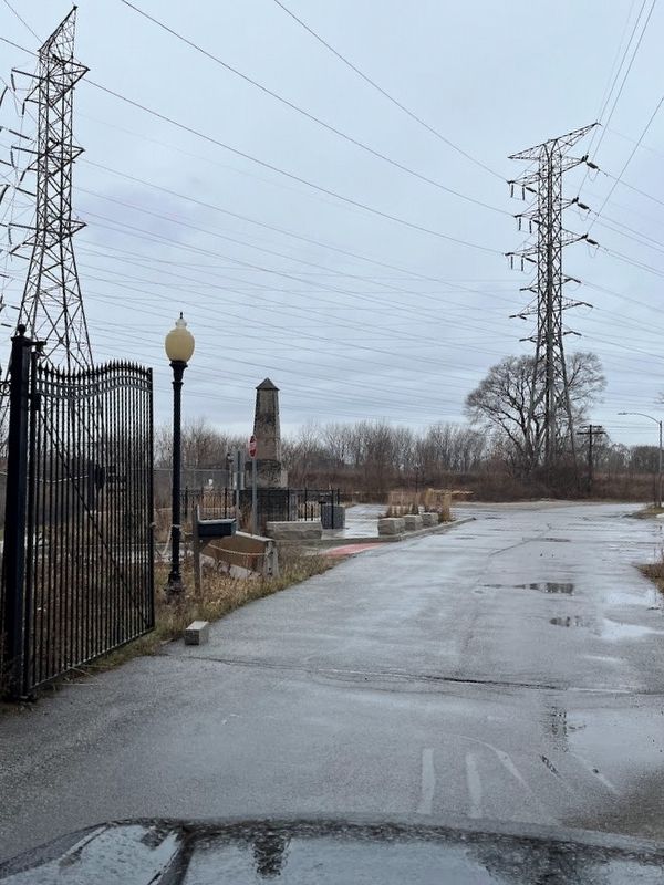
Although the directions on Google Maps suggested otherwise, when this site was visited in December 2023 there appeared to be no way for the general public to access the site by automobile from Indiana. A data center occupies some of the land that once housed the State Line Generating Plant, and while it was possible to go through the plant's guardhouse, the site of that data center was closed to public traffic and a road that leads east and purportedly offered a way into Indiana was blocked by a chain. That said, the marker is accessible from Indiana by bike or foot via a paved bike trail that begins near the marker.
Regarding Illinois-Indiana Boundary Marker. After the Northwest Territory was established in 1787, it was over the next decades subdivided into the state borders we know today as Ohio, Michigan, Indiana, Illinois, Wisconsin and part of Minnesota. When Illinois was awarded its own territorial government in 1809, its border with Indiana was established as a north-south line that connected
the Wabash River with Lake Michigan.
Indiana was admitted as a state in 1816 and Illinois was admitted in 1818, and the border was surveyed. In 1833, Congress ordered a new survey to firmly confirm this border, located at 87 degrees 30 minutes west longitude. The boundary used the Wabash River for the southern portion of the states' border until a point about 10 miles southwest of Terre Haute, Indiana, from where it went due north for 159.359 miles to Lake Michigan.
In 1838, to commemorate this firmly defined border, this marker was erected at a spot that was then just feet from the shore of Lake Michigan, where a pine post had originally been placed. However, over time, that original site, approximately 191 feet south of here, had over time grown farther and farther from the lake, due to landfill for the industrial development across the region, according to a 2003 article in the Chicago Tribune. By the 1980s, the marker was in a wooded area, almost completely forgotten, accessible only by parking off a gravel road near the generating plant and then taking a footpath over train tracks. A few of the rare visitors to this monument had covered it with graffiti.
A local historical group from Chicago's East Side neighborhood worked with Commonwealth Edison, which owned the land, to fund a restoration of the damaged obelisk and to move the marker
to a safer, more easily accessible spot off the roadway to the coal-fired State Line Generating Plant in Hammond, whose nearby guardhouse could better secure the obelisk. However, when that power plant closed in 2012 and was demolished in 2014, the boundary marker once again faced an uncertain future. For one thing, straddling two state jurisdictions and sitting on private property, it wasn't entirely clear who was in charge of it. And with the guardhouse no longer providing security for it, three of the four plaques were nabbed by scavengers within a year. However, efforts to redevelop the power plant site had some success, bringing activity back to that area. And then in 2021, the cities of Chicago and Hammond agreed to add signage to the area around the obelisk, to bring it to its current state.
The State of Illinois also erected a border marker for the southernmost point of the straight-line border, where it meets the Wabash River, in the 1830s. A news article by the Tribune-Star of Terre Haute, Indiana, from 2008 described a recent rediscovery of that marker (about 10 miles southwest of Terre Haute, as the crow flies), but noted that much of it had been covered in silt from the Wabash River, making it increasingly hard to find—not that many people had seen it during its nearly two centuries of existence. That southern marker, the article said, is engraved with
these words: “159 miles and 46 chains to Lake Michigan.”
Also see . . .
1. Chicago Tribune obituary: Allen J. Benson, East Side Advocate. Allen Benson, after whom the border marker plaza is named, died in 1987, just prior to the relocation of this marker. His grandfather and father worked in East Side factories and he was president of that neighborhood's Chamber of Commerce. (Submitted on December 17, 2023, by Sean Flynn of Oak Park, Illinois.)
2. Chicago Landmarks: Illinois-Indiana State Line Boundary Marker. The City of Chicago website page for this Chicago landmark, including some circa 2001 photos of the current marker location as it appeared before the State Line power plant was demolished. (Submitted on December 18, 2023, by Sean Flynn of Oak Park, Illinois.)
3. Illinois History Primer: A Note on the Boundaries of Illinois. (Submitted on December 19, 2023, by Sean Flynn of Oak Park, Illinois.)
Additional commentary.
1. About the boundary marker
The obelisk itself reportedly was engraved with an inscription, but that inscription has completely eroded after 185 years. The text is from a small plaque that was posted in 2021, facing west from the Illinois side of the border.
— Submitted December 24, 2023, by Sean Flynn of Oak Park, Illinois.
Credits. This page was last revised on December 24, 2023. It was originally submitted on December 16, 2023, by Sean Flynn of Oak Park, Illinois. This page has been viewed 181 times since then and 150 times this year. Photos: 1, 2, 3. submitted on December 16, 2023, by Sean Flynn of Oak Park, Illinois. 4. submitted on December 17, 2023, by Sean Flynn of Oak Park, Illinois. 5. submitted on December 16, 2023, by Sean Flynn of Oak Park, Illinois. 6. submitted on December 17, 2023, by Sean Flynn of Oak Park, Illinois. • Devry Becker Jones was the editor who published this page.
