Davis in Tucker County, West Virginia — The American South (Appalachia)
A Growing And Evolving Industry On The Riverbanks
A Sprawling Sawmill Turned Forest Resources Into A Wide Variety Of Products From Lumber To PaperPulp
Inscription.
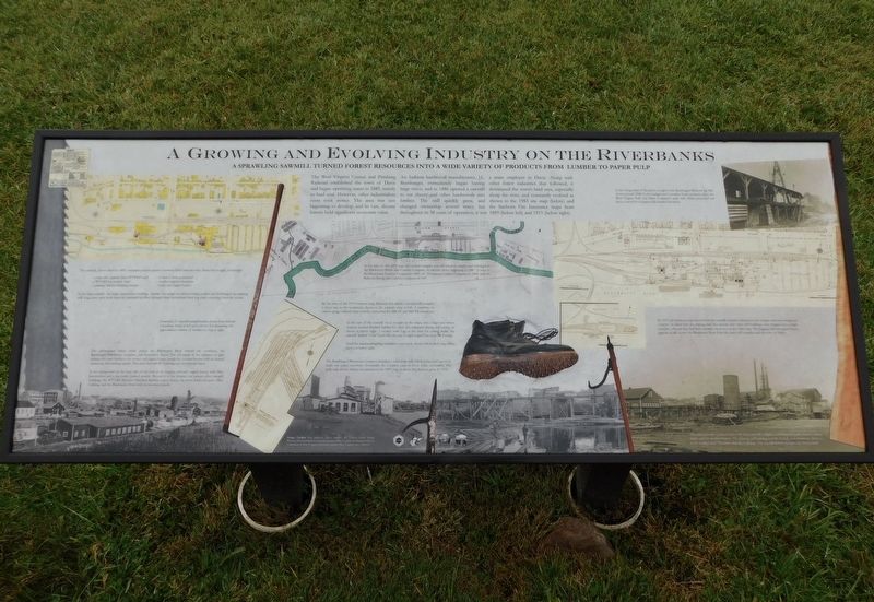
The West Virginia Central and Pittsburg Railroad established the town of Davis and began operating trains in 1885, mainly to haul coal. However, other industrialists soon took notice. The area was just beginning to develop, and its vast, diverse forests held significant economic value. An Indiana hardwood manufacturer, J.L. Rumbarger, immediately began buying large tracts, and in 1886 opened a sawmill to cut cherry and other hardwoods into lumber. The mill quickly grew, and changed ownership several times, but throughout its 38 years of operation, it was a main employer in Davis. Along with other forest industries that followed, it dominated the town's land area, especially along the river, and constantly evolved as shown in the 1983 site map (below) and the Sanborn Fire Insurance maps from 1899 (below left) and 1915 (below right).
(Captions):
The sawmill, shown above in 1899, occupied a major position between Davis and the river. From left to right, it included:
- a pulp mill, separate from WVP&P's mill
- a WVC&P locomotive shed
- a planing mill for finishing lumber
- a shed to store pulpwood
- smaller support structures
- boiler and engine houses
In the main sawmill - the large, easternmost building - lumber was rough-cut before curing in kilns and finishing in the planing mill. Logs were sawn fresh from the dammed-up river, dumped there beforehand from log trains returning from the woods.
Examples of sawmill paraphernalia shown here include a bandsaw blade at left and a device for measuring the approximate volume of lumber in a log at right.
The photograph below looks across the Blackwater River toward the northeast, the Rumbarger/Blackwater complex, and downtown Davis. The tall stacks in the distance at right exhaust the main boilers at the power and engine house, beside the sawdust burner with its domed screen top for catching sparks. The main Sawmill #1 buildings are just beyond them.
In the foreground on the near side of the river is the logging railroad's engine house, with Shay locomotives and a log loader parked outside. Beyond it in the distance are various other sawmill buildings, the WVC&P/Western Maryland Railway engine house, the stone bank and post office building, and the Blackwater Hotel with its two-story porch.
At the time of this 1893 map, the sawmill complex was still relatively simple, and belonged to the Blackwater Boom and Lumber Company, its second owner beginning in 1887. It went to the Blackwater Lumber Companyin 1893, the Thompson Lumber Company in 1905, and the Babcock Boom and Lumber Company in 1907.
By the time of the 1915 Sanborn map,
Babcock had added a second mill complex a short way to the southwest, shown in the separate map at left. A tramway, or narrow guage railroad atop a trestle, connected the Mill #1 and Mill #2 complexes.
To the east of the sawmill. or to its right in the maps, was a large area where workers stacked finished lumber for final, pre-shipment drying and curing, as shown at below right. A worker sorts logs in the river for cutting inside the sawmill. Spiked "cork" boots like the one at right helped him keep his footing.
Tools for maneuvering logs included a cant hook, shown below, and a log roller, shown at below right.
The Rumbarger/Blackwater complex included a small pulp mill, which processed logs to be made into paper elsewhere. Evenutally, the complex came to focus solely on lumber. The pulp mill, shown below, was present in the 1899 map at above left, but was gone by 1915.
In the foreground of the photo at right is the Rumbarger/Babcock Jig Mill, shown around 1908. In the background is another forest products plant, the West Virginia Pulp and Paper Company's pulp mill, which processed red spruce wood for its paper mills located elsewhere.
By 1915, the Sanborn map showed that the sawmill complex had grown into a larger and more integrated complex At above left, the planing mill, box factory, and other mill buildings were merged into a single complex, whereas they had been separate structures on the older map. The logging railroad engine house appears at left, across the Blackwater River from the main mill complex and the town of Davis.
This view provides a closer look at the main sawmill complex, including the boiler house's smoke stacks and the sawdust burner. The planing mill building is at the far left, and downtown Davis is in the background. Tramways link the buildings. The log-filled river occupies the foreground.
Image Credits: Pete Johnson, David Strahin, the Tekavec-Zadell Family, Western Maryland Railway Historical Society, West Virginia and Regional History Collections at West Virginia University, and the West Virginia State Archives.
Layouts and text by David A. Vago Historic Resource Planning & Design
Erected 2023 by Tucker Culture, The West Virginia Humanities Council, Friends of Blackwater and Davis West Virginia.
Topics. This historical marker is listed in this topic list: Industry & Commerce. A significant historical year for this entry is 1885.
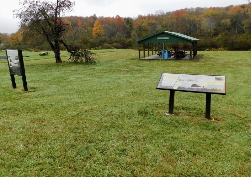
Location. 39° 7.697′ N, 79° 27.86′ W. Marker is in Davis, West Virginia, in Tucker County. Marker can be reached from Appalachian Highway (West Virginia Route 32) south of William Avenue, on the right when traveling south. Marker is located in the Town of Davis Riverfront Park. Touch for map. Marker is in this post office area: Davis WV 26260, United States of America. Touch for directions.
Other nearby markers. At least 8 other markers are within walking distance of this marker. A Prosperous Sawmill Town (here, next to this marker); From Forest To Sawmill (here, next to this marker); Shipping By Rail (a few steps from this marker); Inside The Sawmill (a few steps from this marker); Verzi's Saloon (about 300 feet away, measured in a direct line); The Pennsylvania House (about 300 feet away); Myrtle Mae (Hockman) Shrader (about 300 feet away); The Blackwater Hotel (about 300 feet away). Touch for a list and map of all markers in Davis.
Regarding A Growing And Evolving Industry On The Riverbanks. Transcription includes a handful of spelling and punctuation errors that were made on the marker.
Credits. This page was last revised on January 6, 2024. It was originally submitted on January 5, 2024, by Bradley Owen of Morgantown, West Virginia. This page has been viewed 37 times since then. Photos: 1, 2. submitted on January 6, 2024, by Bradley Owen of Morgantown, West Virginia.

