Emeryville in Alameda County, California — The American West (Pacific Coastal)
Emeryville’s Horse Racetrack
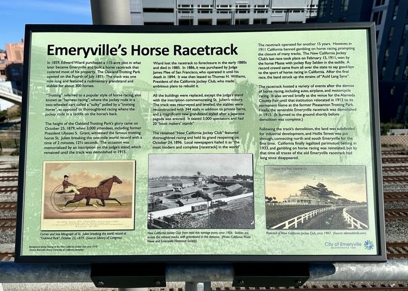
In 1859, Edward Wiard purchased a 115-acre plot in what later became Emeryville and built a horse racetrack that covered most of his property. The Oakland Trotting Park opened on the Fourth of July 1871. The track was one mile long and featured a rudimentary grandstand and stables for about 300 horses.
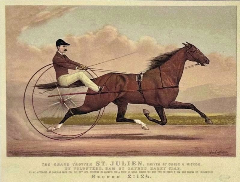
"Trotting" referred to a popular style of horse racing, also known as "harness racing", where the jockey rode in a two-wheeled cart called a "sulky" pulled by a "trotting horse", as opposed to thoroughbred racing where the jockey rode in a saddle on the horse's back.
The height of the Oakland Trotting Park's glory came on October 25, 1879, when 3,000 attendees, including former President Ulysses S. Grant, witnessed the famous trotting horse St. Julien breaking the one-mile world record with a time of 2 minutes, 123/4 seconds. The occasion was memorialized by an inscription on the judge's stand, which remained until the track was demolished in 1915.
Wiard lost the racetrack to foreclosure in the early 1880s and died in 1885. In 1886, it was purchased by Judge James Mee of San Francisco, who operated it until his death in 1894. It was then leased to Thomas H. Williams, President of the California Jockey Club, who made ambitious plans to rebuild it.
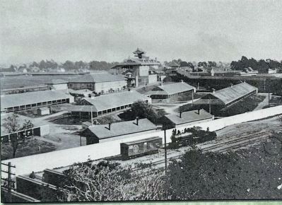
All the buildings were replaced, except the judge's stand with the inscription commemorating St. Julien's victory. The track was resurveyed and levelled, the stables were reconstructed with 344 stalls in addition to private barns, and a magnificent new grandstand styled after a Japanese pagoda was erected. It seated 3,000 spectators and had 20 "book makers' stands".
The renamed "New California Jockey Club" featured thoroughbred racing and held its grand reopening on October 24, 1896. Local newspapers hailed it as "the most modern and complete [racetrack] in the world".
The racetrack operated for another 15 years. However, in 1911 California banned gambling on horse racing, prompting the closure of many tracks. The New California Jockey Club's last race took place on February 15, 1911, won by the horse Massa with jockey Roy Selden in the saddle. A record crowd came from all over the state to say good-bye to the sport of horse racing in California. After the final race, the band struck up the strains of "Auld Lang Syne".
The racetrack hosted a variety of events after the demise of horse racing, including auto, airplane, and motorcycle racing. It also served briefly as the venue for the Alameda County Fair until that institution relocated in 1912 to its permanent home at the former Pleasanton Trotting Park. Finally, the venerable Emeryville
racetrack was demolished
in 1915. (It burned to the ground shortly before
demolition was complete.)
Following the track's demolition, the land was subdivided for industrial development, and Hollis Street was put through, connecting north and south Emeryville for the first time. California finally legalized parimutuel betting in 1933, and gambling on horse racing was reinstated, but by that time all traces of the old Emeryville racetrack had long since disappeared.
Erected 2023 by City of Emeryville.
Topics. This historical marker is listed in these topic lists: Animals • Sports. A significant historical month for this entry is July 1871.
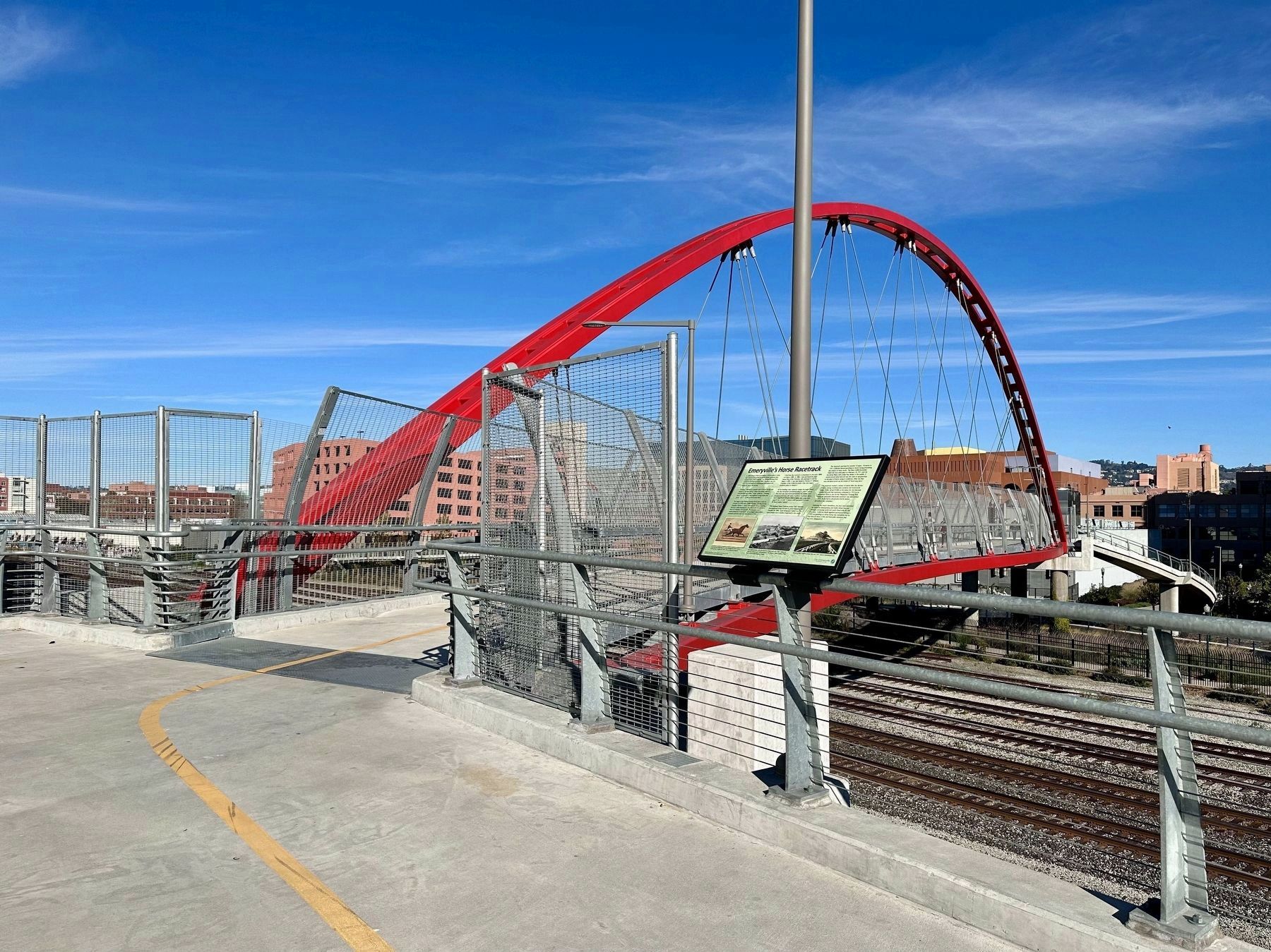
Location. 37° 50.077′ N, 122° 17.484′ W. Marker is in Emeryville, California, in Alameda County. Marker can be reached from Bay Street. Touch for map. Marker is in this post office area: Emeryville CA 94608, United States of America. Touch for directions.
Other nearby markers. At least 8 other markers are within walking distance of this marker. Northern Railway (within shouting distance of this marker); Emeryville’s Mexican Heritage (about 400 feet away, measured in a direct line); Two Emeryville Pioneers (about 700 feet away); Shell Mound Park (about 800 feet away); PCR Park (approx. 0.2 miles away); Judson Manufacturing (approx. 0.2 miles away); Xučyun Park (Huchiun Park)
(approx. 0.2 miles away); Welcome to the Emeryville Greenway (approx. 0.2 miles away). Touch for a list and map of all markers in Emeryville.
Also see . . . Horse Racing in Emeryville (Emeryville Historical Society).
Excerpt: The Emeryville horse race track, originally known as the Oakland Trotting Park and later as the California Jockey Club, was built by Edward Wiard. Wiard was born in New Haven, Connecticut in 1815, and as a young man worked as a steam engineer in Georgia. He later joined the Gold Rush, and arrived in San Francisco in 1850. After working for several years in the gold mines of the Mother Lode, Wiard settled in the East Bay. In 1859 he purchased a 115-acre tract of land in what later became part of the town of Emeryville.(Submitted on January 6, 2024.)
Located north of Oakland and next to San Francisco Bay, the Wiard tract was soon bisected by the Northern Railway tracks, which connected Oakland with Martinez. The area west of the tracks became Shell Mound Park, a resort and picnic area-that featured a shooting gallery, merry-go-round. foot race track, and dance pavilions. Shell Mound Park was leased to Captain L. Siebe, and it remained in operation until 1924. Wiard built Oakland Trotting Park on the land east of the railroad tracks on the property bounded by San Pablo, Park, and Stanford Avenues.
Credits. This page was last revised on January 6, 2024. It was originally submitted on January 6, 2024, by Andrew Ruppenstein of Lamorinda, California. This page has been viewed 63 times since then. Photos: 1, 2, 3, 4. submitted on January 6, 2024, by Andrew Ruppenstein of Lamorinda, California.


